• Welcome to TalkWeather!
    We see you lurking around TalkWeather! Take the extra step and join us today to view attachments, see less ads and maybe even join the discussion.
    CLICK TO JOIN TALKWEATHER
Logo 468x120

Severe WX March 27-30th, 2018 - Localized Flooding/Slight Severe Potential

South AL Wx

Member
Meteorologist
Messages
309
Reaction score
311
Location
Wetumpka, AL
Special Affiliations
  1. SKYWARN® Volunteer
The latest Day 4 Outlook from SPC has a severe risk for portions of LA/MS/AL:

swody4_severeprob.png


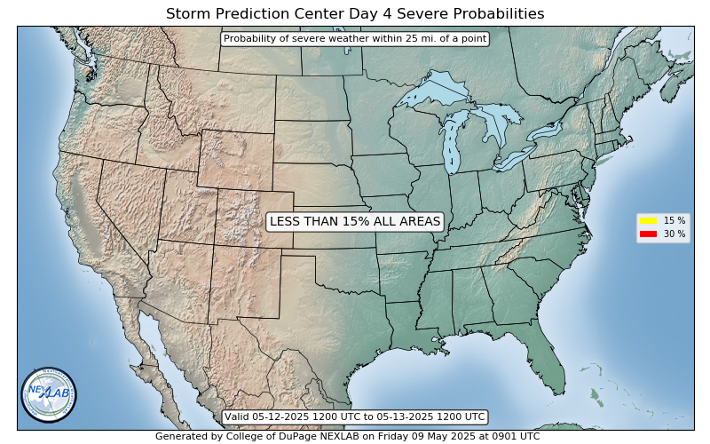
MODEL CONSENSUS IS THAT A BROAD SYNOPTIC UPPER TROUGH WILL DOMINATE
MUCH OF THE U.S. ON THURSDAY (DAY 4). A SHORTWAVE TROUGH EMBEDDED
WITHIN THIS FEATURE WILL DEAMPLIFY AS IT MOVES RAPIDLY FROM THE
LOWER MS VALLEY EARLY DAY 4 TO THE NORTHEAST U.S. BY DAY 5. STORMS
WILL BE ONGOING ALONG COLD FRONT FROM THE TN VALLEY TO LA EARLY IN
THE DAY. WIND AND VERTICAL SHEAR PROFILES ENHANCED BY THE EJECTING
SHORTWAVE TROUGH WILL BE SUPPORTIVE OF SEVERE STORMS. WHILE LAPSE
RATES WILL REMAIN POOR, INFLUX OF LOW-LEVEL MOISTURE WILL RESULT IN
AT LEAST MARGINAL INSTABILITY, AND STORMS MAY ORGANIZE ALONG THE
COLD FRONT POSING A RISK FOR MAINLY DAMAGING WIND ALONG WITH A
CONDITIONAL THREAT OF A COUPLE OF TORNADOES OVER A PORTION OF THE
GULF COAST STATES.
 
Messages
2,752
Reaction score
4,288
Location
Madison, WI
I think the Firefox cache on my work computer is being weird. I'm still seeing yesterday's Day 4-8 graphic on the SPC site and it doesn't change when I hit refresh, but the Day 1 outlook updated to show the 13Z graphics just fine.
 

South AL Wx

Member
Meteorologist
Messages
309
Reaction score
311
Location
Wetumpka, AL
Special Affiliations
  1. SKYWARN® Volunteer
I think the Firefox cache on my work computer is being weird. I'm still seeing yesterday's Day 4-8 graphic on the SPC site and it doesn't change when I hit refresh, but the Day 1 outlook updated to show the 13Z graphics just fine.

Yeah, the old outlook from yesterday is still up on the SPC website. It is updated on College of DuPage's site:

http://kamala.cod.edu/spc/

EDIT: It has now been updated on the SPC site.
 
Last edited:

rolltide_130

Member
Messages
828
Reaction score
378
Location
Harvest, Alabama
Special Affiliations
SPC has a Day 4 out and he's still being insistent..

If the NAM is off by just 1 or 2 degrees T/TD (which it most likely is), this will completely change that output..

upload_2018-3-26_10-0-47.png
 
  • Thread starter
  • Moderator
  • #26

KoD

Moderator
Staff member
Moderator
PerryW Project Supporter
Messages
1,380
Reaction score
697
Location
Huntsville, AL
I think the Firefox cache on my work computer is being weird. I'm still seeing yesterday's Day 4-8 graphic on the SPC site and it doesn't change when I hit refresh, but the Day 1 outlook updated to show the 13Z graphics just fine.
A helpful tip:
Hitting F5 will refresh the page, but hitting Ctrl+F5 will clear the page cache and refresh it. Comes in handy with a few weather sites.
SPC was having some issues this morning though, I saw the same thing.
 

warneagle

Member
Messages
3,729
Reaction score
3,208
Location
Arlington, VA
Special Affiliations
  1. SKYWARN® Volunteer
I understand wanting to combat the #HYPETRAIN and various other social media nonsense, but I'm not sure why he's expressing such high confidence that the threat for Thursday is minimal when that confidence isn't necessarily there. Obviously overstating confidence that an event will occur is bad and can damage credibility with the public, but reflexively downplaying every threat isn't good messaging either. Maintaining transparency about what we do or don't know, especially when it's still a few days out, should be the main focus, not minimizing the public's concern.
 

Kory

Member
Messages
4,928
Reaction score
2,119
Location
Tuscaloosa, Alabama
Spann did change his tone. Went from no to low severe chances. I don't think this will be anything of the caliber of last week, but to downplay anything as "just a damaging wind threat" in the core of our severe wx season is foolish.
 
Messages
585
Reaction score
403
Location
St. Catharines, Ontario
I understand wanting to combat the #HYPETRAIN and various other social media nonsense, but I'm not sure why he's expressing such high confidence that the threat for Thursday is minimal when that confidence isn't necessarily there. Obviously overstating confidence that an event will occur is bad and can damage credibility with the public, but reflexively downplaying every threat isn't good messaging either. Maintaining transparency about what we do or don't know, especially when it's still a few days out, should be the main focus, not minimizing the public's concern.
Apparently everything is either April 27 All Over Again™, or just a couple of showers. Is anyone saying there will be 100+ tornadoes on Thursday? No. That doesn't mean rain is the only or even the primary threat. Thursday definitely has the potential to be a decent severe weather event.
 

rolltide_130

Member
Messages
828
Reaction score
378
Location
Harvest, Alabama
Special Affiliations
Spann did change his tone. Went from no to low severe chances. I don't think this will be anything of the caliber of last week, but to downplay anything as "just a damaging wind threat" in the core of our severe wx season is foolish.

Probably because he saw how much he was out on an island with that forecast.. and this is at least a low-end tornado threat where we currently stand as well..
 
Messages
2,752
Reaction score
4,288
Location
Madison, WI
Spann did change his tone. Went from no to low severe chances. I don't think this will be anything of the caliber of last week, but to downplay anything as "just a damaging wind threat" in the core of our severe wx season is foolish.

Apparently everything is either April 27 All Over Again™, or just a couple of showers. Is anyone saying there will be 100+ tornadoes on Thursday? No. That doesn't mean rain is the only or even the primary threat. Thursday definitely has the potential to be a decent severe weather event.

...and he knows that better than anyone. I've lost count of the number of times he's said during live coverage in the ensuing years, "all it takes is one tornado coming down your street, and that's your April 27." You're slipping, James.
 

JP Dice

Member
Meteorologist
Messages
5
Reaction score
28
Location
Birmingham, AL

I got beaten up on social media for posting this last Thursday and Friday. Not exactly sure why. I like to show the next system we're watching. I didn't specify tornadoes and emphasized I didn't have details at this point, but there were indications we could see some stronger storms. While I do think this is mainly a heavy rain threat, I cannot give it a zero tornado or strong storm threat. There is a good bit of shear and some instability. Certainly not an outbreak, but worth nothing.
 

jmills

Member
Messages
134
Reaction score
99
Location
Troy, AL/Montevallo, AL
I got beaten up on social media for posting this last Thursday and Friday. Not exactly sure why. I like to show the next system we're watching. I didn't specify tornadoes and emphasized I didn't have details at this point, but there were indications we could see some stronger storms. While I do think this is mainly a heavy rain threat, I cannot give it a zero tornado or strong storm threat. There is a good bit of shear and some instability. Certainly not an outbreak, but worth nothing.

Great to have you on here!
 

rolltide_130

Member
Messages
828
Reaction score
378
Location
Harvest, Alabama
Special Affiliations
I got beaten up on social media for posting this last Thursday and Friday. Not exactly sure why. I like to show the next system we're watching. I didn't specify tornadoes and emphasized I didn't have details at this point, but there were indications we could see some stronger storms. While I do think this is mainly a heavy rain threat, I cannot give it a zero tornado or strong storm threat. There is a good bit of shear and some instability. Certainly not an outbreak, but worth nothing.

Welcome to TW!
 

JP Dice

Member
Meteorologist
Messages
5
Reaction score
28
Location
Birmingham, AL
Personally, I think Thursday is one to watch. It might be mainly just a bunch of rain for most folks. But, the thermodynamic profiles in these models have not been the greatest. Some damaging winds and a possible tornado is not out of the question. I think it is worth watching closely. Not an outbreak, but not a zero threat kind of day either especially west of I-65 and south of I-20/59.

Plus, anyone who knows me knows I'm not a hype kind of guy. I'm pretty much just the facts.
 

Mike S

Administrator
Staff member
Administrator
Moderator
PerryW Project Supporter
Messages
1,991
Reaction score
1,115
Location
Meridianville, Al
Special Affiliations
  1. SKYWARN® Volunteer
Personally, I think Thursday is one to watch. It might be mainly just a bunch of rain for most folks. But, the thermodynamic profiles in these models have not been the greatest. Some damaging winds and a possible tornado is not out of the question. I think it is worth watching closely. Not an outbreak, but not a zero threat kind of day either especially west of I-65 and south of I-20/59.

Plus, anyone who knows me knows I'm not a hype kind of guy. I'm pretty much just the facts.

Great to have you back around, JP. Fox 6 is my go to station to stream up here in Huntsville when I am watching Birmingham weather.

Social media seems to be a necessary evil for on camera meteorologists. It is expected of you and is a great way to communicate information but there is always going to be some who are going to have something negative to say.
 

Daryl

Member
Messages
316
Reaction score
99
Location
Boaz,AL
day3otlk_0730.gif

Strong deep-layer/low-level shear will support at least some
possibility of organized storm modes capable of damaging winds
and/or a tornado risk particularly early in the day
 

Bama Ravens

Member
Messages
1,207
Reaction score
648
Location
Morris, AL (Northern Jefferson County)
AREA FORECAST DISCUSSION
NATIONAL WEATHER SERVICE BIRMINGHAM AL
635 AM CDT TUE MAR 27 2018

WEDNESDAY THROUGH MONDAY.

A STRONG DEEP-LAYER RIDGE CENTERED NEAR THE BAHAMAS WILL KEEP THE
BEST MOISTURE AND LIFT TO OUR NORTHWEST ON WEDNESDAY. DRY AND WARM
CONDITIONS ARE EXPECTED WITH THE EXCEPTION BEING ACROSS OUR FAR
NORTHWEST, WHERE THE EASTERN FRINGE OF THE MOIST AXIS COULD LEAD TO
AFTERNOON SHOWERS. A FAIRLY STRONG UPPER-LEVEL TROUGH WILL EJECT
EASTWARD WEDNESDAY NIGHT INTO THURSDAY, LEADING INCREASING LIFT AND
AN INTENSIFYING LOW-LEVEL JET. THIS SHOULD CAUSE CONVECTION TO
BECOME MORE ORGANIZED AS IT MOVES ACROSS ALABAMA DURING THE DAY ON
THURSDAY, AND THERE IS A NON-ZERO THREAT FOR SEVERE STORMS. WITH
INDICATIONS OF 500MB FLOW BECOMING MORE SOUTHERLY AND INCREASING
TEMPERATURES IN THIS LAYER, SBCAPE WILL PROBABLY REMAIN IN THE RANGE
OF 500-1000 J/KG EVEN WITH DEWPOINTS IN THE MID TO UPPER 60S.
UPDRAFT SPEEDS IN THE MID TO UPPER LEVEL SHOULD BE TEMPERED BY
MEDIOCRE LAPSE RATES, WHICH WILL LIMIT THE THREAT. HOWEVER, ISOLATED
DAMAGING WINDS AND A TORNADO OR TWO CANNOT BE RULED OUT IF 850MB OF
40-45KT FLOW CAN OVERLAP WITH THE AXIS OF INSTABILITY. THE BEST
CHANCE OF THIS OCCURRING IS PROBABLY AS FAR NORTH AS I-22 AND AS FAR
EAST AS I-65.
FORECAST RAINFALL AMOUNTS ACROSS THE NORTHWEST HAVE
DECREASED COMPARED TO PREVIOUS FORECAST CYCLES, AND THE THREAT FOR
FLOODING WILL BE REMOVED FROM THE HWO.
 
Back
Top