Equus
Member
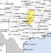
NW AL has been included in the SPC Day 5 risk on the Days 4-8 outlook, for Saturday.
Follow along with the video below to see how to install our site as a web app on your home screen.
Note: This feature may not be available in some browsers.
0z model runs are coming in further south with the upper and surface low bringing better dynamic support and lift to support a severe weather risk.NWS Huntsville mentions maybe a couple strong storms Saturday night but BMX is clearly unimpressed at the moment. A case of the better dynamic support staying too far north to raise too many eyebrows.
It looks like the main dynamics begin pulling north and west of Alabama by Saturday. Although it may clip the NW corner. But the system will be weakening by then.NWS Huntsville mentions maybe a couple strong storms Saturday night but BMX is clearly unimpressed at the moment. A case of the better dynamic support staying too far north to raise too many eyebrows.
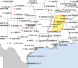
Saturday at least looks like some good hailers West Tennessee and damaging wind threat . But Tuesday has higher ceilingIt looks like the main dynamics begin pulling north and west of Alabama by Saturday. Although it may clip the NW corner. But the system will be weakening by then.
My eye is on next Tuesday...
From Matt Grantham at BMX.The usual hype-man Broyles seems kind of subdued on the 4-8 for Tuesday.
The suppressed jet stream will affect
the track of a shortwave moving eastward from the Southwest CONUS
on Tuesday. There is quite a difference between models regarding
the evolution of this system due to a split jet stream, but the
trend of ECMWF/UKMET has become quite concerning from a severe
weather standpoint. These models, along with the ECMWF ensemble,
favor strong pressure falls over the Lower/Mid Mississippi Valley
on Tuesday as a warm front and 70 degree dewpoints advance inland
across southern MS/AL. If these trends continue, a tornado threat,
perhaps significant, will need to be added to our HWO. For now we
will wait for more confirmation from other models and future model
runs.
On Tuesday, an upper-level trough is forecast to move quickly into
the Mississippi Valley as a cold front advances eastward across the
Gulf Coast States. Thunderstorms will be possible along and ahead of
the cold front. A few marginally severe wind gusts may occur in
areas that heat up ahead of the front. However, uncertainty is
substantial concerning the timing of the shortwave trough and cold
front.
Yeah...like did Broyles even look at the models? Holy cow that was a bad forecast discussion. Zero analysis.The favoritism is more in the EURO/UK camp. The GFS is and probably will continue to trend its way.
To me this is the best shot we have seen for a tornado threat all year. Of course the last system was an over performer from earlier model forecasts. This has a high celing if youre in the Euro camp. Even when the gfs had the low over central al and the euro on the coast i knew they would shift n. Its 50/50 right now but like Matt said this is one to watch.Yeah...like did Broyles even look at the models? Holy cow that was a bad forecast discussion. Zero analysis.
BMX, JAN, and LIX all hit in possibly severe weather (BMX the strongest tornado wording which would be appropriate if looking at the euro and UKMET). They also all talk about discrepancies as the GFS is doing GFS things.
The SPC and BMX have been at odds for years now. I’ll go with BMX.
Well, if I had to pick a Matt to trust, I’d pick Grantham.Can we trust that Matt guy?
Can we trust that Matt guy?
Yep, he's the real deal. I've been on the forum for many many years (primarily as a reader) and I remember folks like Matt, Fred & Brett before they became meteorologists. Now Matt is with NWS, Fred working the wx enterprise in the TV business and Brett is a paid chaser. Anything that crew shares get's my attention. Years ago I was part of a chase convoy that linked up with Brett.....funny thing as we were positioning for a storm we ended up passing another chaser in the same area (guess who...Matt). Small worldHe's a longtime poster on here albeit he has not been very active since the reboot a couple years ago and he's one of BMX's finest. He's very good.
")
I'm 99.99999% sure he was joking.He's a longtime poster on here albeit he has not been very active since the reboot a couple years ago and he's one of BMX's finest. He's very good.
I'm 99.99999% sure he was joking.
I’m still uneasy about going all in especially since we have guidance that isn’t a severe wx threat at all. Granted, it’s the less reliable American guidance, but being within 5 days now and have such drastic differences doesn’t lend a whole lot of confidence. Latest 12z UKMET is a bit of a backpedal from last night’s. We’ll see what the Euro shows in a bit.To me this is the best shot we have seen for a tornado threat all year. Of course the last system was an over performer from earlier model forecasts. This has a high celing if youre in the Euro camp. Even when the gfs had the low over central al and the euro on the coast i knew they would shift n. Its 50/50 right now but like Matt said this is one to watch.