
warneagle
Member
Looks like there are some breaks in the clouds over at least parts of the warm sector. Should be enough to allow for some heating, right?
Follow along with the video below to see how to install our site as a web app on your home screen.
Note: This feature may not be available in some browsers.
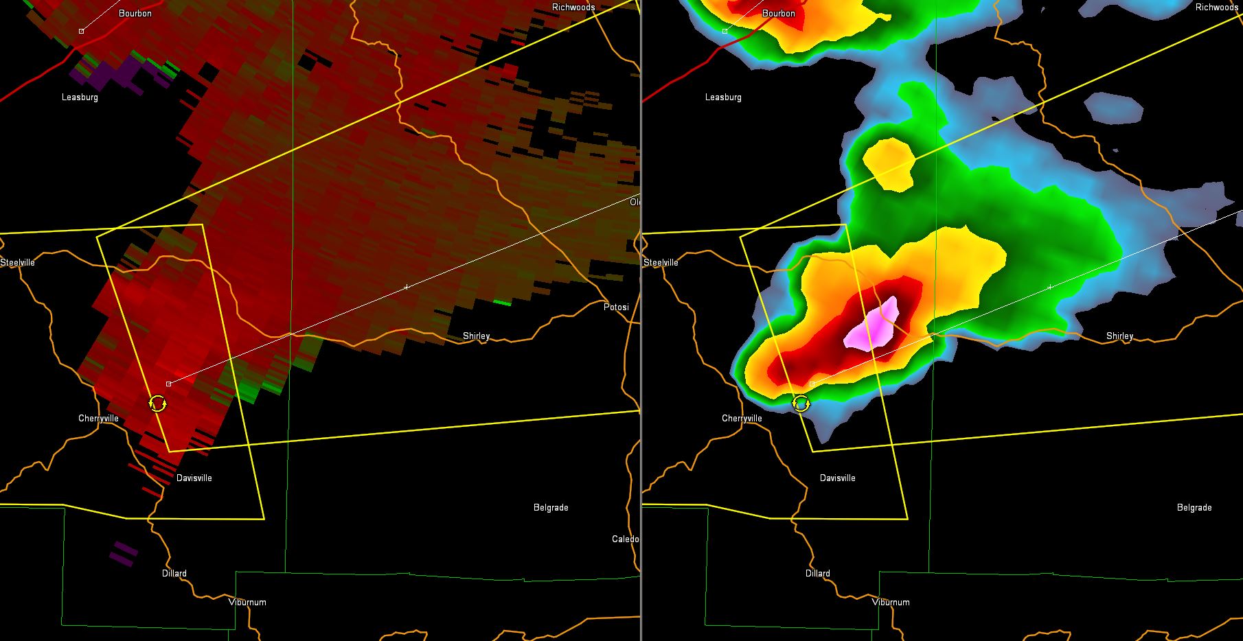
Large tornado in progress around Ottawa, IL. Watch out SW suburbs of Chicago....
Large tornado in progress around Ottawa, IL. Watch out SW suburbs of Chicago....
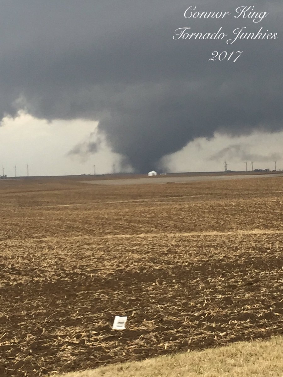
Following on twitter. NWS Chicago has reported a large and violent tornado in Ottawa.Anyone have a link to a livestream from that area?
Is it just me, or are radars down too frequently, especially where severe weather has happened this year?
Yeah it definitely seems that way. KHTX in Huntsville is also currently down, with a round of severe weather expected here tomorrow.
