
BayouWeatherGeek
Member
Tornado warned storm with a decent hook near Mayflower and Maumelle, Arkansas
Follow along with the video below to see how to install our site as a web app on your home screen.
Note: This feature may not be available in some browsers.
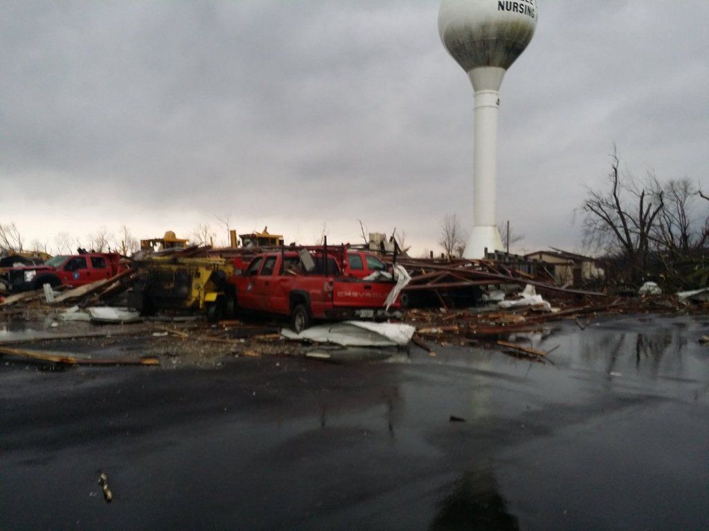
Looking like low-end/mid range EF3 damage to me.I'm seeing some damage pictures out of Illinois
That's what I was afraid ofOne confirmed fatality in the tornado near Ottawa, Ill.


Yeah it definitely seems that way. KHTX in Huntsville is also currently down, with a round of severe weather expected here tomorrow.
Multiple fatalities on I-55. This looks like it was very violent as it went NE of Perryville and into Rockwood and Ava.Dozen cars flipped over on Interstate 55.
They had it working for a very short amount of time today then it began overheating so it is back down. I've been using WAFF's radar for this area.
This is awful...both of these are likely EF3+. At this rate today looks to outperform the late January outbreak...and tragically it seems to be taking a lot of lives.This one in Illinois is hitting town after town. Massive debris signature. I hate to think of the fatalities that are gonna come from this. PAH needs to issue the tornado emergency NOW.
Link to a live feed?Yeah that thing is a monster, no doubt. Wow. That debris signature. No words.
