
warneagle
Member
Tornado warning on the cell in SE MO about to move into IL.
Follow along with the video below to see how to install our site as a web app on your home screen.
Note: This feature may not be available in some browsers.
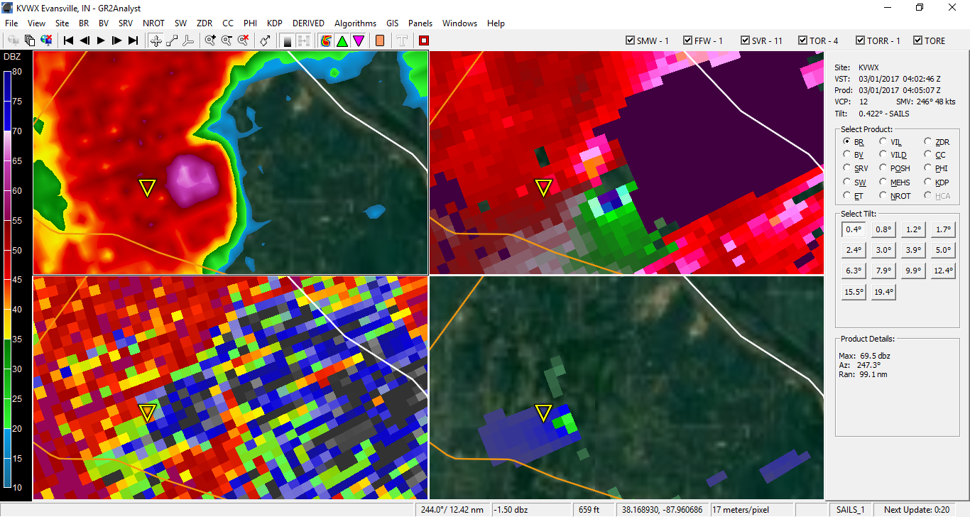
Agreed...tornadoes tend to draw all of the attention but they're obviously not the only dangerous or impressive features of a severe thunderstorm.I bet these storms are dropping some serious hail too based on that reflectivity.
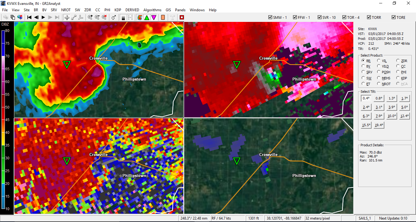
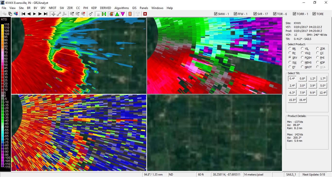
Just watched a very strong tornado develop in the last 5 minutes, went from nothing to 172 kt gate-to-gate shear and a big debris ball near Crossville, IL getting close to the Indiana border.

000
WFUS53 KICT 010405
TORICT
KSC133-010445-
/O.NEW.KICT.TO.W.0002.170301T0405Z-170301T0445Z/
BULLETIN - EAS ACTIVATION REQUESTED
Tornado Warning
National Weather Service Wichita KS
1005 PM CST TUE FEB 28 2017
The National Weather Service in Wichita has issued a
* Tornado Warning for...
Northern Neosho County in southeastern Kansas...
* Until 1045 PM CST
* At 1005 PM CST, a severe thunderstorm capable of producing a
tornado was located near Chanute, moving east at 65 mph.
HAZARD...Tornado.
SOURCE...Radar indicated rotation.
IMPACT...Flying debris will be dangerous to those caught without
shelter. Mobile homes will be damaged or destroyed.
Damage to roofs, windows, and vehicles will occur. Tree
damage is likely.
* This dangerous storm will be near...
Erie around 1015 PM CST.
Other locations impacted by this tornadic thunderstorm include
Earlton, Stark and Chanute Airport.
PRECAUTIONARY/PREPAREDNESS ACTIONS...
TAKE COVER NOW! Move to a basement or an interior room on the lowest
floor of a sturdy building. Avoid windows. If you are outdoors, in a
mobile home, or in a vehicle, move to the closest substantial shelter
and protect yourself from flying debris.
&&
LAT...LON 3754 9553 3773 9552 3773 9509 3759 9509
TIME...MOT...LOC 0405Z 255DEG 57KT 3761 9549
TORNADO...RADAR INDICATED
HAIL...<.75IN
$$
METZGER

Just saw on Twitter that a debris ball showed up near Perryville, MO. Debris lofted up as high as 20,000 feet.