• Welcome to TalkWeather!
    We see you lurking around TalkWeather! Take the extra step and join us today to view attachments, see less ads and maybe even join the discussion.
    CLICK TO JOIN TALKWEATHER
  • April 2024 Weather Video of the Month
    Post your nominations now!
Logo 468x120

Severe WX Severe Weather Threat 2/27/17-3/2/17

stormcentral

Member
Messages
143
Reaction score
16
Location
Chattanooga, TN
Special Affiliations
  1. SKYWARN® Volunteer
I can't really see that sounding well, but surface wins looks veered out of this world and flow is unidirectional. I still think tomorrow/tomorrow night into very early Wednesday will be the primary tornado threat (and it will be further West from AR/SE MO/W TN/NW MS). It will then quickly transition into a damaging wind/hail threat later Wednesday. You can never rule out a conditional tornado threat further east, but its very conditional as of now. But that DOESN'T mean you should heed warnings because this is "only a damaging wind threat." Take that just as seriously.
Thank you for that valued insight. Sorry it was a screen shot. Lol. Always looking for your post on here. Favorite weather guy.

Sent from my LGLS770 using TalkWeather mobile app
 

KoD

Moderator
Staff member
Moderator
Sustaining Member
PerryW Project Supporter
Messages
1,380
Reaction score
697
Location
Huntsville, AL
Some notes from my run-to-run consistency review

NAM trends over the past 2 days for the N AL region on Wednesday 12z-21z:
Upper level winds (500 & 700mb) have backed slightly more west to east, primarily 700mb ; 700mb jet weakened slightly. 500mb jet maintains orientation and strength, although placement has trended consistently northward.
Lower level winds (850 & 925mb) have backed more west, however lowest level jet still backs predominantly south ; 850mb jet placement trended eastward but maintains consistent strength ~60+ knots for N AL -- 925mb jet maintains strength but exits region quicker each successive run.
Dew points have trended up ~3-5+ degrees throughout the TN valley warm sector.
Mid level lapse rates are on an increasing trend
Low level lapse rates have maintained consistency
SB/MU/MLCAPE have trended stronger
Best helicity values have extended eastward away from the area with respect to timing of precipitation.

Precipitation/storm mode:
12/15z minimal changes
18z precipitation depicted as linear 48hrs ago and progressively becomes less linear each successive run, now indicating less organized structures east of the previously depicted line echo - also shows line segment west of this activity. Convective activity in the N AL region at this time begin to appear in the last 4 runs.
21z precipitation depicted as linear 48hrs ago and maintains somewhat linear appearance throughout most successive runs ; less organized structure noted in N AL, however a linear feature is apparent and also a more south/eastward placement is evident
00z precipitation depicted as linear throughout run, and general location of this line has remained in the same area for the previous 4-5 runs ; prior to these runs, the line was further west ~30-50miles
 

GTWXAlum

Member
Messages
125
Reaction score
67
Location
Nashville, Tennessee
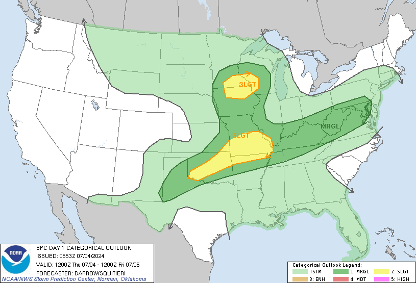
day1otlk_1200.gif


Much larger ENH risk on the new Day 1 outlook, now including most of the state of Indiana
 

Kory

Member
Messages
4,928
Reaction score
2,119
Location
Tuscaloosa, Alabama
To be honest, some of the latest runs of convective allowing models (now that were in their range) are not very impressive for AL tomorrow. Not even a squall line but just some scattered showers and storms.
 

warneagle

Member
Messages
3,884
Reaction score
3,576
Location
Arlington, VA
Special Affiliations
  1. SKYWARN® Volunteer
The 12z 4km NAM really only initiates a couple of pre-frontal storms in Ark./Mo. where the best ingredients are. Obviously, with moderate instability and decent shear, one or two storms might be enough to produce something significant, but it doesn't look like there will be a whole bunch of supercells during the late afternoon/evening and the margin between a significant event and a bust (well, not really a bust, but a lack of anything interesting before the front) might be small...

If there is something before the front, it's going to be fast moving in rough terrain and at/near dusk, so I hope nobody is stupid enough to try to go chase that.
 

Kory

Member
Messages
4,928
Reaction score
2,119
Location
Tuscaloosa, Alabama
The 12z 4km NAM really only initiates a couple of pre-frontal storms in Ark./Mo. where the best ingredients are. Obviously, with moderate instability and decent shear, one or two storms might be enough to produce something significant, but it doesn't look like there will be a whole bunch of supercells during the late afternoon/evening and the margin between a significant event and a bust (well, not really a bust, but a lack of anything interesting before the front) might be small...

If there is something before the front, it's going to be fast moving in rough terrain and at/near dusk, so I hope nobody is stupid enough to try to go chase that.
I really think the main tornado threat is shifting up into Eastern MO and IL. Surface winds begin to veer in Southern MO and AR with the surface low deepening in Northern MO and scooting northeast. Overall, the tor threat doesn't look as high there but more so into IL and eastern MO.
 

warneagle

Member
Messages
3,884
Reaction score
3,576
Location
Arlington, VA
Special Affiliations
  1. SKYWARN® Volunteer
I really think the main tornado threat is shifting up into Eastern MO and IL. Surface winds begin to veer in Southern MO and AR with the surface low deepening in Northern MO and scooting northeast. Overall, the tor threat doesn't look as high there but more so into IL and eastern MO.

Yeah, the latest runs of the HRRR and 4km NAM agree with you for sure. The HRRR generates a storm back in SE Kan. early on, before dusk, in an area that's barely in the slight risk, which I found interesting. The 12z 4km NAM tracks a supercell across most of Ark. from the SW to north-central part of the state in the 21-0z time frame, but doesn't generate much else down there. Obviously if a storm like that could get going down there it might still be trouble.
 
Messages
489
Reaction score
492
Location
Canton, GA
12z 4km NAM continues to look favorable for North Georgia. Squall line enters NW GA around 21Z, with modest instability and strong deep layer shear to maintain organized convection. There is still enough curvature in the lowest 1-2km to not rule out circulations within the line.
 

warneagle

Member
Messages
3,884
Reaction score
3,576
Location
Arlington, VA
Special Affiliations
  1. SKYWARN® Volunteer
Yeah, there's no doubt the ingredients are there. If the storms can fire, there's going to be plenty to work with. St. Louis is at 70/62, Cape Girardeau is at 65/64. Mid-level lapse rates are 7-7.5 across the board in the MDT area. Some pockets of SRH >200. Time to wait and see if/when storms start to fire I guess?

EDIT: Looks like there's one storm already between Springfield and Rolla. Here we go?
 

Kory

Member
Messages
4,928
Reaction score
2,119
Location
Tuscaloosa, Alabama
Keep in mind, HRRR is overestimating moisture depth quality. That's a stout cap off the LZK sounding. Some sunshine would greatly help in that regard.
 
Back
Top