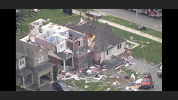
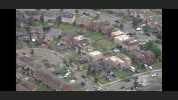
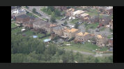
Tornado in Barrie, ON from earlier.
Twitter is showing what looks like widespread EF2 damage in a subdivision as a result of this tornado. Lots of two story homes with roof loss, and some loss of upper exterior walls too.
Follow along with the video below to see how to install our site as a web app on your home screen.
Note: This feature may not be available in some browsers.
Tornado in Barrie, ON from earlier.


 www.facebook.com
 www.facebook.com