• Welcome to TalkWeather!
    We see you lurking around TalkWeather! Take the extra step and join us today to view attachments, see less ads and maybe even join the discussion.
    CLICK TO JOIN TALKWEATHER
Logo 468x120

Archive Severe Potential 4/3-4/4

rolltide_130

Member
Messages
828
Reaction score
378
Location
Harvest, Alabama
Special Affiliations
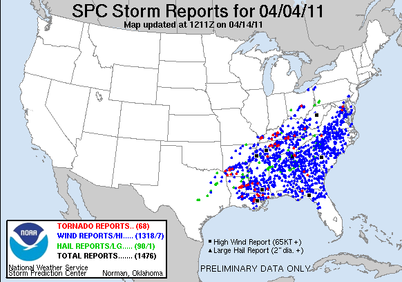
Looking at that large MDT driven by wind, you gotta wonder if we’re about to see another April 4-5, 2011.

That day had a perfect little Madison county sized bubble where no significant severe weather occurred yet everywhere around us got lambasted. I have an exam tomorrow so I wouldn't exactly complain if some wind gusts conveniently knocked out power to UAH until around 10 or so tomorrow morning.

110404_rpts.gif
 

KoD

Moderator
Staff member
Moderator
PerryW Project Supporter
Messages
1,380
Reaction score
697
Location
Huntsville, AL
That's a pretty large moderate outlook, and given models underdoing of several important severe parameters I think it's a pretty good call. Looks like this April is shaping up to be more active than the previous few years.
 

warneagle

Member
Messages
3,729
Reaction score
3,208
Location
Arlington, VA
Special Affiliations
  1. SKYWARN® Volunteer
Tornado watch is up for most of southern Indiana and southwestern Ohio along the warm front. 60/40.

Most of the recent model runs have shown decent sigtor values (>2) up there after about 20z, so even though it's not the main event, it bears watching.
 
Last edited:

Austin Dawg

Member
Sustaining Member
Messages
852
Reaction score
1,299
Location
Leander, Texas
Screen Shot 2018-04-03 at 1.15.39 PM.png 
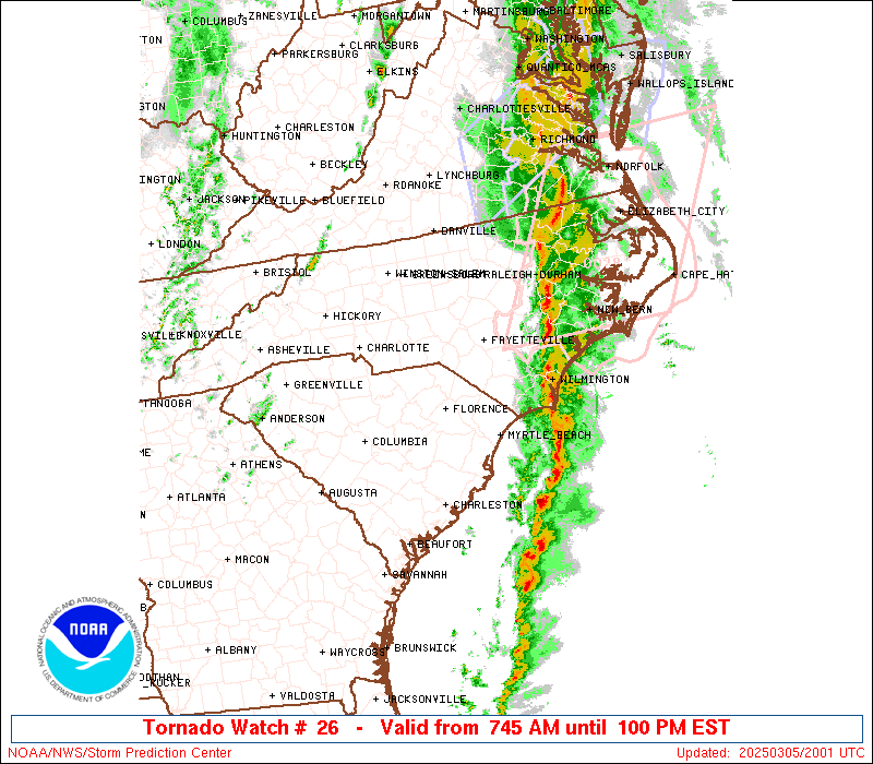
Severe storms firing just north of my location before the dryline even gets here. I'd watch out east of here folks.
 
Messages
2,753
Reaction score
4,291
Location
Madison, WI
That's a pretty large moderate outlook, and given models underdoing of several important severe parameters I think it's a pretty good call. Looks like this April is shaping up to be more active than the previous few years.

It's certainly getting interesting sooner than I'd anticipated given the pattern. I'll armchair chase while my apartment heater is going full blast. My side mirrors were iced over when I left work today.

Probs on that new watch for the western/southern portion of the risk area are impressive. Just shy of PDS territory.
 

Equus

Member
Messages
3,290
Reaction score
3,368
Location
Jasper, AL
Special Affiliations
  1. SKYWARN® Volunteer
Will be an interesting day. I had the choice to fly back from the west coast to Nashville either yesterday or today, and suffice to say yesterday was a much better plan in retrospect hah
 

HazardousWx

Member
Messages
91
Reaction score
87
Location
Huntsville, AL
HAM Callsign
W4SSW
Special Affiliations
  1. SKYWARN® Volunteer
There has been a fair amount of sunshine up here in North AL. However, I'm noticing the dewpoint still around 58F in Huntsville.
 

StormStalker

Moderator
Staff member
Moderator
Messages
564
Reaction score
430
Location
Tuscumbia, AL
Special Affiliations
  1. SKYWARN® Volunteer
There has been a fair amount of sunshine up here in North AL. However, I'm noticing the dewpoint still around 58F in Huntsville.


Its the same here in the Shoals. Temp at 80 but dewpoint 56. The wind is crazy though.
 

The Nino

Member
Messages
164
Reaction score
229
Location
JV Hsv
There has been a fair amount of sunshine up here in North AL. However, I'm noticing the dewpoint still around 58F in Huntsville.

Speaking of Huntsville, what is this system looking like over here? I have been out of pocket for this system.
 

HazardousWx

Member
Messages
91
Reaction score
87
Location
Huntsville, AL
HAM Callsign
W4SSW
Special Affiliations
  1. SKYWARN® Volunteer
Speaking of Huntsville, what is this system looking like over here? I have been out of pocket for this system.
As an aside, an outdoor warning siren was just put in up on Keel. Depending on where you live up there will determine if you will hear it or not due to all the trees.
 

The Nino

Member
Messages
164
Reaction score
229
Location
JV Hsv
As an aside, an outdoor warning siren was just put in up on Keel. Depending on where you live up there will determine if you will hear it or not due to all the trees.

yep saw that. I'm on the less populated side of the mountain so might not be able to hear it. No prob though, I don't rely on them anyways...I like to think I'm pretty weather aware ;)
 

rolltide_130

Member
Messages
828
Reaction score
378
Location
Harvest, Alabama
Special Affiliations
I need to stress that potentially significant straight line winds in excess of 70mph are the main threat tonight. That will NOT trigger the sirens, but it can be just as damaging (sometimes even moreso) than a small tornado. There could even be some isolated gusts over 80mph. Relying on the sirens alone isn't a good idea in general, but a particularly bad idea tonight.
 
Back
Top