• Welcome to TalkWeather!
    We see you lurking around TalkWeather! Take the extra step and join us today to view attachments, see less ads and maybe even join the discussion.
    CLICK TO JOIN TALKWEATHER
  • April 2024 Weather Video of the Month
    Post your nominations now!

Severe WX Severe Wx Outbreak March 1st- 3rd, 2023 - Southern States, MS/OH/TN Valley

Messages
1,123
Reaction score
1,433
Location
jackson tennessee
Special Affiliations
  1. SKYWARN® Volunteer
What makes you say that?
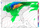
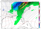
Slp seems to be getting squashed deep further south on these runs , going hinder the warm sector , not going be as large open … like see better instability … going say areas down toward gulf still have shot at a respectable eevebt suppose … let’s see how the 12z suits are today .
 

Clancy

Member
Messages
3,158
Reaction score
5,924
Location
Macland, Georgia
CIPS analog maps for D7 and D8, respectively.
1677251255235.png1677251270881.png
Edit: Also, probability map of 1+ and 5+ SVR reports from 3/1 to 3/4, respectively.
PRALLC01_gefsF168.png
1677251379177.png
 

UncleJuJu98

Member
100,000th Post
Messages
4,078
Reaction score
5,351
Location
Birmingham
What the heck is driving these analogs a more robust instability pool ahead of the high shear for Monday?

Wrong thread. This comment was intended for Monday lol
 
Last edited:

UncleJuJu98

Member
100,000th Post
Messages
4,078
Reaction score
5,351
Location
Birmingham
Honestly it's been quite a while 12 years since such a deep low traveled a identical path? Correct me if I'm wrong the last time a deep low traveled near that path and brought severe weather for Alabama was April 27th 2011 I think. And again I will say this every time lol, this will not be as bad as that day. But it's a very rare occurrence to have a 980s mb low traverse the favorable place for tornado events in Alabama.
 

keithGA

Member
Messages
211
Reaction score
379
Location
GA
Special Affiliations
  1. SKYWARN® Volunteer
Backside snow.
 

Attachments

  • gfs_mslp_pcpn_frzn_seus_29.png
    gfs_mslp_pcpn_frzn_seus_29.png
    185.1 KB · Views: 0
  • gfs_mslp_pcpn_frzn_seus_30.png
    gfs_mslp_pcpn_frzn_seus_30.png
    179.2 KB · Views: 0

Taylor Campbell

Moderator
Moderator
PerryW Project Supporter
Messages
2,140
Reaction score
2,247
Location
Wedowee, AL
Special Affiliations
  1. SKYWARN® Volunteer
What're you talking about? For the Tennessee area ? It actually set it up for a very volatile day for atleast Alabama in the 12z may miss out on the Tennessee area some View attachment 18131

Yeah, that’s a nasty look and continues to uptick the severe potential for Thursday.
 

UncleJuJu98

Member
100,000th Post
Messages
4,078
Reaction score
5,351
Location
Birmingham
Yeah, that’s a nasty look and continues to uptick the severe potential for Thursday.
Ludicrous height falls with a favorable broad trough.
Although not as broad as it was a day ago I don't think , and it's semi neutral semi negative tilt trough; not sure that it'll be a major hindrance though gfs_z500a_us_30 (1).png
 
Messages
1,123
Reaction score
1,433
Location
jackson tennessee
Special Affiliations
  1. SKYWARN® Volunteer
GFS also seems to be getting more progressive with the system. Front now races through most of AL before peak heating 3/3. However in the past it's been known to do this and then slow the system down again inside of 72 hours or so.
Exactly , think this a trend that needs be watched . Going be soon the Florida panhandle se. Georgia and south Alabama towards gulf going be the trouble spot
 

UncleJuJu98

Member
100,000th Post
Messages
4,078
Reaction score
5,351
Location
Birmingham
Prefrontal trough showed on the 12z GFS ahead of the main cold front. Oof especially if there is a unstable warm sector ahead of it.
 

UncleJuJu98

Member
100,000th Post
Messages
4,078
Reaction score
5,351
Location
Birmingham
To be fair, the 12z GFS moved north compared to the 00z. The 12z GEFS is also north with most members in the Missouri Bootheel, but there is a lot of spread. The fun of D7/8 trends.
The GEFS is on board with that path? Oof haven't checked the ensembles recently. How much you wanna bet a SPC outline comes out by tommorow morning if the rest of the runs are very similar to the Memphis /bootheel area?
 
Messages
1,123
Reaction score
1,433
Location
jackson tennessee
Special Affiliations
  1. SKYWARN® Volunteer
The GEFS is on board with that path? Oof haven't checked the ensembles recently. How much you wanna bet a SPC outline comes out by tommorow morning if the rest of the runs are very similar to the Memphis /bootheel area?
A lot depends for sure tonight’s 0z runs … imo.
 
Logo 468x120
Top