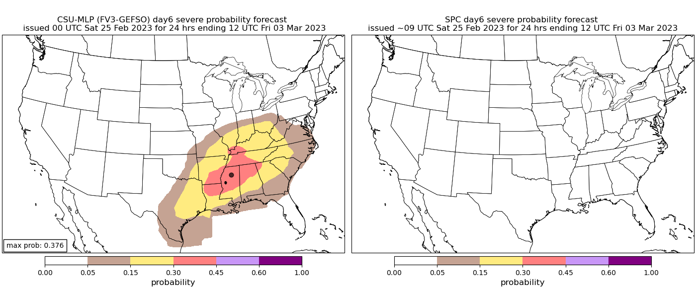
From the FFC AFD this morning. I like the technical description used …..”YIKES”. [emoji846]
“Finally, an active pattern resumes towards the back end of next week. Models are in decent agreement of the Gulf opening back up Wednesday night with good rain coverage along a lifting warm front. Of particular interest, models are resolving a sharp, digging shortwave trough across the Southeast on Friday, although models differ on timing with some indicating an early Friday morning
passage, and others showing a late Friday overnight passage. Either way, with the proximity to the upper-level system/support, deep moisture profiles, and abundant low- and mid-level shear (0-1km shear near 50kts, and 0-1km SRH values over 500+ m2/s2! Yikes) could
support strong to severe thunderstorms with this system in a high-shear/low-CAPE environment.”
Sent from my iPhone using Tapatalk