
Navigation
Install the app
How to install the app on iOS
Follow along with the video below to see how to install our site as a web app on your home screen.
Note: This feature may not be available in some browsers.
More options
-
Welcome to TalkWeather! We see you lurking around TalkWeather! Take the extra step and join us today to view attachments, see less ads and maybe even join the discussion. CLICK TO JOIN TALKWEATHER
You are using an out of date browser. It may not display this or other websites correctly.
You should upgrade or use an alternative browser.
You should upgrade or use an alternative browser.
Significant Tornado Events
- Thread starter locomusic01
- Start date
- Thread starter
- #9,422
locomusic01
Member
Found another interesting little tidbit from New Richmond recently, but I dunno how reliable it is since it's one man's personal anecdote. I probably won't put it in my article unless I can confirm it w/another source, so I figured I'd post it here.
So, this man was driving his buggy from New Richmond to Boardman when he saw and heard the tornado rumbling across the prairie, seemingly heading in his direction. He pulled his buggy off the road near a culvert (I can't help imagining him signaling and putting on his hazard lights btw) and was going to jump in, but then he saw a large house in the distance with a cellar door in the yard. Though no one was home, he was able to get into the cellar in time and take shelter there.
When he came out, the house was heavily damaged but not totally destroyed. He couldn't see his buggy anywhere, and as he ran closer to where he'd stopped, he saw that the culvert had apparently been ripped partly out of the ground and was sort of jutting upward at an angle. After much searching, he found his team of horses in the field (didn't say how far away but presumably a fair distance) with the smashed-up buggy a bit beyond them. One horse was dead and badly mangled while the other was barely alive and died soon after.
Not sure exactly what culverts looked like back then or how they were constructed, but it sounds pretty impressive. I wish he'd given more details on his location, but there were only a couple of roads he could've taken and I think probably somewhere around the little settlement of "Gloverdale" is the most likely area. That's ~2.5 miles NE of Boardman and would've been not long after the tornado first maxed out.
I also found an account from someone whose family lived about 40 miles NNE of New Richmond in Cumberland, WI. They said that debris rained from the sky that night and the next morning people found clothes, papers and bits of books from New Richmond bobbing along the shore of the lake that partially surrounds the town.
Btw, I mentioned a while back how tricky it is to pin down the real death toll. Well, it's actually even worse because it turns out there are multiple sets of victims with the same damn names. In fact, there were somehow apparently three different victims named John Wells (two adults and one child), all killed within like a block and a half of each other. And what's more bizarre is they don't even seem to be related, though each of the adults also had a child who was killed. What the hell are the odds?
Edit: Sorry for the novel, hopped up on lots of coffee and didn't realize how much I'd rambled lol. TLDR is New Richmond (maybe?) partially ripped up a culvert south of town and also they apparently hadn't invented very many names yet in 1899.
- Thread starter
- #9,423
locomusic01
Member
Okay, one last thing because it's dumb and I'm easily amused. One woman said that her grandpa had suffered from terrible headaches all his life. When the tornado came, he was huddled in the basement with the rest of the family and some piece of debris struck him in the head, knocking him out and slicing his forehead open along his hairline. Sounds pretty bad, right? Au contraire! Apparently this was just what he needed, because once he came to he never had a headache again in his life.
(As someone who deals with migraines occasionally, I'm down for trying this novel treatment. Surely a 2x4 to the head can't be much worse.)
(As someone who deals with migraines occasionally, I'm down for trying this novel treatment. Surely a 2x4 to the head can't be much worse.)
TH2002
Member
- Messages
- 4,973
- Reaction score
- 11,113
- Location
- California, United States
- Special Affiliations
- SKYWARN® Volunteer
Some seriously impressive rotation here, particularly in the second video. Whatever the case, this thing absolutely should have been rated EF4 - the debarking alone could have put it in the EF4 category IMO, but there were also some well-anchored homes reduced to basements.
The surveyors “addressed” this in a video presentation by showing pictures of some unanchored sliders that were hit, and essentially said “They were sliders, all there is to it. Anyway moving on…” while completely ignoring the well-anchored homes that were obliterated and reduced to basements. I 100% agree that this tornado was absolutely an EF4, and should have been rated as such. Ridiculous…Some seriously impressive rotation here, particularly in the second video. Whatever the case, this thing absolutely should have been rated EF4 - the debarking alone could have put it in the EF4 category IMO, but there were also some well-anchored homes reduced to basements.
The presentation is probably on YouTube still btw
Tanner
Member
This was the tornado that got me into weather. Formed just west of me and passed within a couple of miles of where I sheltered at an American Legion, before I heard the news Springfield had been hit.
On another note, surveying the damage with my dad days after, I’ll always remember the devastation that had been inflicted on downtown Monson. It makes it even more difficult knowing that nobody in the northeast is really prepared with how to deal with a tornado disaster.
Sent from my iPhone using Tapatalk
AngelAndHisWx
Member
Off topic, but the March 2022 one was almost my first tornado, which would’ve been some kind of irony considering just two months prior was when I got the DVD copy of the Texas A&M video of the F5 and stood in the same spot both tornadoes impacted. Instead we saw the Round Rock EF2 (which was not the same one that passed near Granger, Round Rock occluded and never even crossed 135).Everybody probably already knows this, but I didn't know that Double Creek estates had an extremely close call with another tornado last March? I knew Jarrell had some tornadoes near it last year, but apparently the neighborhood barely dodged an EF1. A MUCH weaker tornado, but still. View attachment 18620View attachment 18621

Not sure if this has been posted before, but this is apparently a video of the Primrose NE F4 (likely F5) from 5/8/1965. Can certainly tell this was a high end tornado.
Lake Martin EF4
Member
Not sure if this has been posted before, but this is apparently a video of the Primrose NE F4 (likely F5) from 5/8/1965. Can certainly tell this was a high end tornado.
Wait, video? I thought there were only photos LOL
Not sure if this has been posted before, but this is apparently a video of the Primrose NE F4 (likely F5) from 5/8/1965. Can certainly tell this was a high end tornado.
Wow! That’s an incredible find. Truly a historic piece of video.
Lake Martin EF4
Member
I could have done something productive. I did this instead.
.png (PNG Image 1920 × 1080 pixels).png")
Lake Martin EF4
Member
Not sure exactly what culverts looked like back then or how they were constructed

Smithville tier stuff.
- Thread starter
- #9,433
locomusic01
Member
Nice! Old-timey witness accounts are always a bit.. let's say open to interpretation, but I think that's probably about right. It's such a shame not to have any photos of a tornado that was highly visible through much of its path and probably seen by a couple thousand people altogether.I could have done something productive. I did this instead.
View attachment 18686
(Might need to update the date though lol)
Lake Martin EF4
Member
NOOOOOOOOOOOOOOO I JUST NOTICED THATNice! Old-timey witness accounts are always a bit.. let's say open to interpretation, but I think that's probably about right. It's such a shame not to have any photos of a tornado that was highly visible through much of its path and probably seen by a couple thousand people altogether.
(Might need to update the date though lol)
FFFFFFF-
Lake Martin EF4
Member
Also, do you have an updated sequence map?Nice! Old-timey witness accounts are always a bit.. let's say open to interpretation, but I think that's probably about right. It's such a shame not to have any photos of a tornado that was highly visible through much of its path and probably seen by a couple thousand people altogether.
(Might need to update the date though lol)
- Thread starter
- #9,436
locomusic01
Member
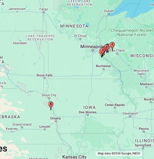
I need to add more/corrected deaths + a few small path tweaks I've made, but otherwise this is mostly up to date:Also, do you have an updated sequence map?
June 12, 1899 — The New Richmond, WI F5 - Google My Maps
June 12, 1899 — The New Richmond, WI F5
 www.google.com
Or if you wanted the kmz I can post it tomorrow after I update that stuff.
Edit: I just realized that I never got around to updating the Clear Lake-Arland tornado. Nothing huge, but I need to adjust it a bit further north in the area east of Clayton, and the section between Clear Lake and Richardson (where the deaths occurred) needs to be a little wider. It's like 400-500 yards right now but should probably be more like 600-800 there based on where some of the farms were actually located within the affected plots.
Last edited:
Ivanthetornadoenthusiast
Member
Do you have any newspaper account for the other unlisted tornadoes prior to Salix June 11 and New Richmond June 12?I need to add more/corrected deaths + a few small path tweaks I've made, but otherwise this is mostly up to date:
June 12, 1899 — The New Richmond, WI F5 - Google My Maps
June 12, 1899 — The New Richmond, WI F5
Or if you wanted the kmz I can post it tomorrow after I update that stuff.
Edit: I just realized that I never got around to updating the Clear Lake-Arland tornado. Nothing huge, but I need to adjust it a bit further north in the area east of Clayton, and the section between Clear Lake and Richardson (where the deaths occurred) needs to be a little wider. It's like 400-500 yards right now but should probably be more like 600-800 there based on where some of the farms were actually located within the affected plots.
MNTornadoGuy
Member
Do you have any information about that tornado near Hastings?I need to add more/corrected deaths + a few small path tweaks I've made, but otherwise this is mostly up to date:
June 12, 1899 — The New Richmond, WI F5 - Google My Maps
June 12, 1899 — The New Richmond, WI F5
Or if you wanted the kmz I can post it tomorrow after I update that stuff.
Edit: I just realized that I never got around to updating the Clear Lake-Arland tornado. Nothing huge, but I need to adjust it a bit further north in the area east of Clayton, and the section between Clear Lake and Richardson (where the deaths occurred) needs to be a little wider. It's like 400-500 yards right now but should probably be more like 600-800 there based on where some of the farms were actually located within the affected plots.
- Thread starter
- #9,439
locomusic01
Member
I'm not sure how many clippings I still have saved but I'll gather up and post what I have later.Do you have any newspaper account for the other unlisted tornadoes prior to Salix June 11 and New Richmond June 12?
That's the one I'm least confident in and I've gone back and forth on whether I'll keep it in my final map. Several people reported seeing a funnel cloud, and there was damage throughout that area, but I've yet to find anything 100% definitive that it was a tornado. Here's what I have on it in my article:Do you have any information about that tornado near Hastings?
Some 15 miles away, near where the St. Croix River flows into the mighty Mississippi, the people of Hastings, Minnesota could see what Dr. Thomas could not. Just beyond the patch of clearing sky, a dark and threatening shape hung from the clouds like a “great, pendulous mass.” The whirling protuberance sagged steadily lower, reaching out from the base of the storm as if grasping for the earth below.
Strong, damaging winds — perhaps a small tornado, intermittent downbursts or some combination of the two — raked the countryside south of Hastings. The storm toppled trees, blew over outbuildings and prostrated long stretches of telegraph lines. While some in town made for their root cellars and storm caves, others continued looking on in fascination.
A little before 5:30 pm, the storm slipped between Hastings and neighboring Prescott, located just across the river in Wisconsin. A “most terrible cloud” passed directly over Point Douglas, where residents recounted a brief but intense downpour followed by powerful, shifting winds. Hurrying north-northeastward, the low-hanging cloud paralleled the course of the St. Croix River for several miles.
atrainguy
Member
Man, New Richmond was so close to the end of the tornado's life, if only it lifted just a mile or two earlier. I seem to recall it being the same thing with Pomeroy 1893. On the ground for dozens of miles, avoiding Storm Lake and some other towns, only to smack into Pomeroy at the last minute.
Question - I've seen people refer to it's destruction and fatalities as Jarrell-like a few times, was this tornado reported as a particularly slow mover? Just wondering if it took its time chewing on the town like Jarrell, and if that contributed to how extreme the effects of it were.
Question - I've seen people refer to it's destruction and fatalities as Jarrell-like a few times, was this tornado reported as a particularly slow mover? Just wondering if it took its time chewing on the town like Jarrell, and if that contributed to how extreme the effects of it were.