Day 2 Convective Outlook
NWS Storm Prediction Center Norman OK
0100 AM CST Tue Dec 13 2022
Valid 141200Z - 151200Z
...THERE IS AN ENHANCED RISK OF SEVERE THUNDERSTORMS ACROSS MUCH OF
SOUTHERN LOUISIANA...MISSISSIPPI...WESTERN AND SOUTHERN ALABAMA AND
THE WESTERN FLORIDA PANHANDLE...
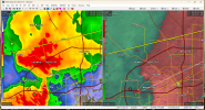
...SUMMARY...
Tornadoes and damaging winds are expected Wednesday over parts of
southern Louisiana, Mississippi, southwest Alabama and the western
Florida Panhandle. A few strong tornadoes may occur.
...Synopsis...
An upper low will drift eastward across SD/NE/IA with a large upper
trough pivoting from the Plains into the MS Valley. A leading speed
max will extend roughly from the middle MS Valley southwestward into
southern TX by 00Z with 500 mb speeds over 100 kt. Strong midlevel
southwesterlies of 50-70 kt will extend over a large part of the
Southeast ahead of this trough, with 850 mb winds around 50 kt out
of the south aiding moisture advection.
At the surface, the main low will be near the SD/NE/IA area for much
of the day, with a trough/cold front crossing the MS River.
Meanwhile, a warm front will extend roughly from western TN/northern
MS to the FL Panhandle at 12Z Wed, lifting northward across much of
MS and AL through 00Z. Dewpoints in the upper 60s F will be common
across the warm sector, resulting in favorable MLCAPE for severe
storms given strong shear and increasing large-scale ascent.
...Southern LA into MS, AL and the western FL Panhandle...
Several models indicate scattered storms may be ongoing Wednesday
morning along an outflow boundary across parts of MS and LA. These
storms will approach a plume of mid 60s F dewpoints, aided by a 40+
kt low-level jet. Instability will be sufficient to support
supercells with a tornado risk as the outflow should decelerate. A
warm front will exist roughly from northern MS into southwest AL,
providing a limit to SBCAPE early in the day. These storms may tend
to wane by midday as low-level winds diurnally adjust.
It appears the primary severe risk will develop during the afternoon
and evening as large-scale lift increases along and ahead of the
cold front. Predictability for outflow-boundary position is low at
this time. However, southern parts of LA, MS, and AL have a high
probability of destabilization ahead of the cold front which will
approach from the west. At the very least, a broken line of
supercells is expected along this front, with a substantial
cross-boundary component to the deep-layer shear. Effective SRH
averaging 200-300 m2/s2, mid to upper 60s F dewpoints and MLCAPE
over 1000 J/kg will favor a risk of tornadoes. Models also indicate
possible mesolows along the line, with locally strong storm-relative
inflow/backed surface winds likely as the convection matures late in
the day.
Should a southwest-northeast oriented outflow boundary remain in
place during the afternoon ahead of the cold front, it could provide
a favored corridor for strong tornadoes, enhancing low-level ascent
and shear. While coverage of severe storms may decrease somewhat
overnight, additional activity may develop toward 09-12Z Thursday
across the FL Panhandle and southwest GA, where both instability and
shear (of similar magnitude to western areas) will remain favorable
for tornadic supercells.
..Jewell.. 12/13/2022