Mesoscale Discussion 0758
NWS Storm Prediction Center Norman OK
0200 PM CDT Thu May 18 2017
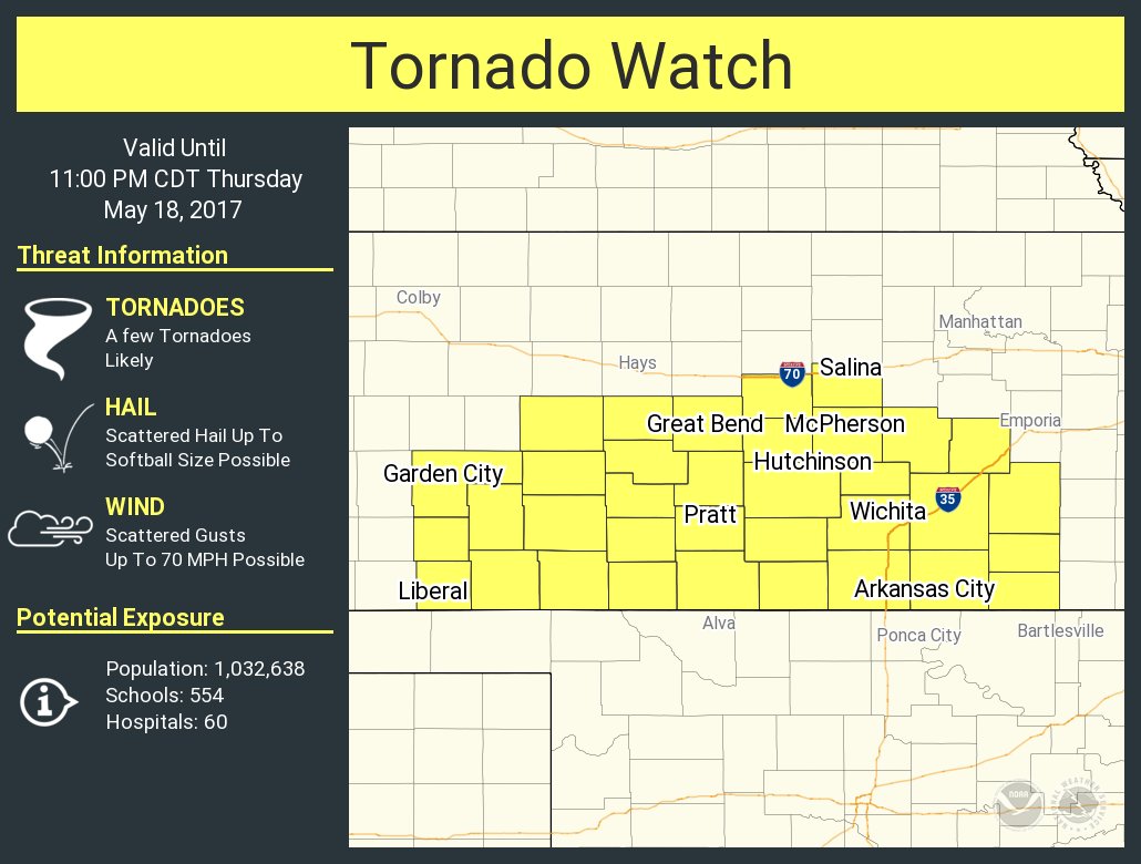
Areas affected...Portions of southern/central Kansas
Concerning...Severe potential...Tornado Watch likely
Valid 181900Z - 182030Z
Probability of Watch Issuance...95 percent
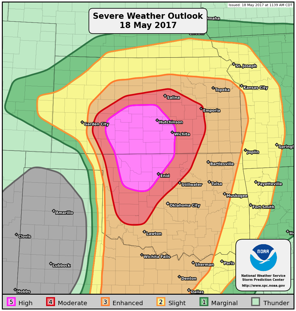
SUMMARY...Severe thunderstorms will develop across parts of southern
and central Kansas this afternoon and evening, with an attendant
threat of tornadoes (some of which may be strong), very large hail,
and damaging winds. A PDS Tornado Watch will likely be issued within
the next hour or two.
DISCUSSION...Surface analyses indicate a warm front is slowly
advancing northward across southern Kansas this afternoon. To the
south of this front, ample boundary-layer heating has resulted in
considerable mixed-layer buoyancy, with CAPE values upwards of
2500-3000 J/kg. As forcing for ascent continues to increase over the
region, low-level moisture will continue to stream north/northwest,
promoting a further increase in buoyancy over southern Kansas. With
850-700mb southerly flow strengthening during the late
afternoon/evening, warm advection near/south of the warm front will
lead to a blossoming of convection over the region. Indeed, current
visible satellite data show a developing cumulus field beneath a
higher-level canopy. Severe thunderstorms will likely develop out of
this cumulus field as it continues to advance north/northwest ahead
of the dry line and south of the warm front.
Cells near the warm front will interact with more backed low-level
flow, enhancing storm-relative helicity. In turn, with continued
north/northwestward transport of rich boundary-layer moisture, the
potential exists for a few discrete cells with organized/strong
low-level mesocyclones. A tornado threat would likely evolve, with
the potential for a few stronger tornadoes, considering the ample
low-level helicity. Steep mid-level lapse rates and considerable
effective shear will encourage a threat of very large hail.
Moreover, somewhat straight mid-level hodographs could yield upscale
growth through the evening. While this would reduce the tornado
threat some, merging cold pools (aided by dry air aloft) would offer
the potential for a few significant severe gusts. In turn, with the
potential for all higher-end severe hazards, a PDS Tornado Watch
will likely be issued within the next hour or two.