• Welcome to TalkWeather!
    We see you lurking around TalkWeather! Take the extra step and join us today to view attachments, see less ads and maybe even join the discussion.
    CLICK TO JOIN TALKWEATHER

Severe Weather 2026

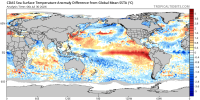
TNI values are currently at almost +3. You can even see the extreme temperature gradient across the equatorial pacific. Hard to imagine this won't lead to significant severe weather in the coming weeks/months.

View attachment 54398

GFS has been moderately consistent with a shortwave or three moving through the Midwest around the 8/7-11 timeframe; exact timing, placement and ceiling varies from run to run as to be expected at this range.
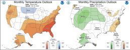
 
GFS has been moderately consistent with a shortwave or three moving through the Midwest around the 8/7-11 timeframe; exact timing, placement and ceiling varies from run to run as to be expected at this range.
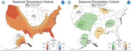
It also looks like a favorable pattern could set up about a month from now and severe weather will impact the Northern Plains and Midwest before shifting south towards the Tennessee valley.

THis NOAA study Found that the frequency of F3 to F5 tornadoes doubles during strongly positive TNI phases. Fun stuff.

1785441031661.png
1785441054827.png
 
A abundance of dry air will cause mini supercells tomorrow acros E MO. With storm relative wind around 30 kts, you would be thinking a few solid nudgers. However, these "mini" cases don't require nudgers. Nudgers may blow up a storm in this instance since they're smallish in nature, and plus dry air wouldn't allow many storms to interact. Should morning convection of sorts leave a remnant boundary around for vorticity to sprinkle onto, this would be your best chance at seeing some of these mini spinning supercells tomorrow drop a tornado. Vorticity and 3CAPE is the play tomorrow.
 
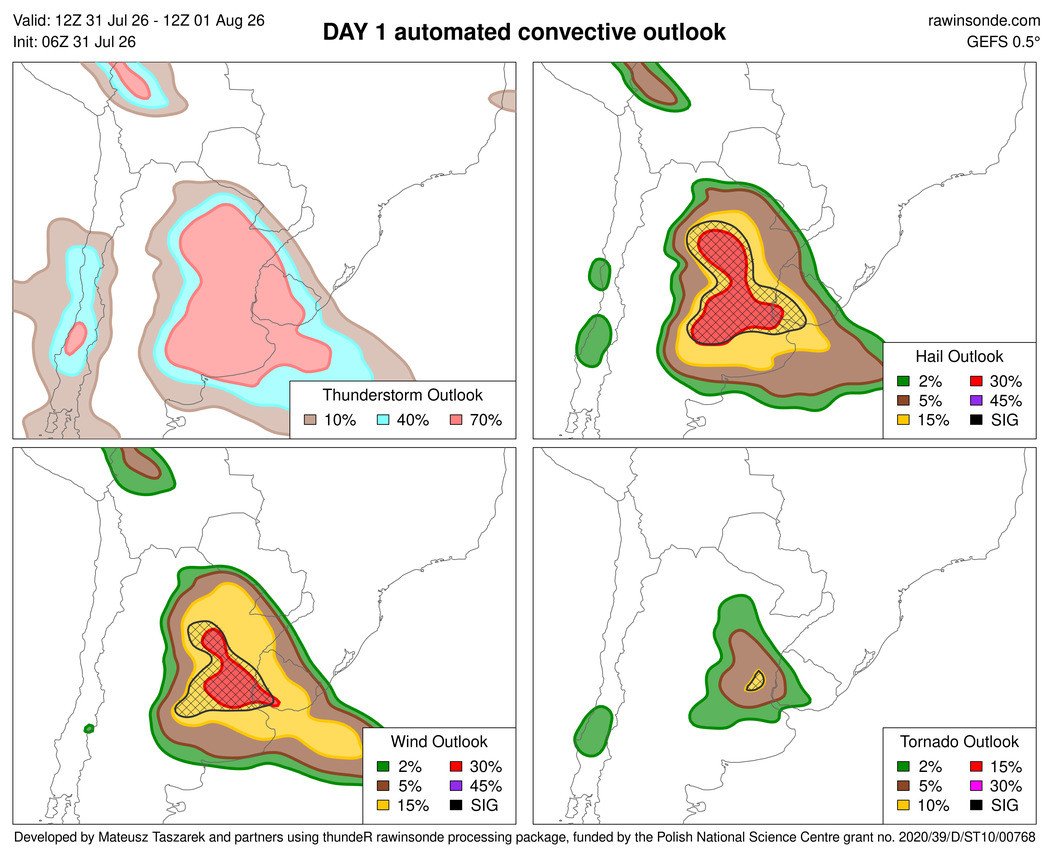
12Z 7/31 – 12Z 8/1

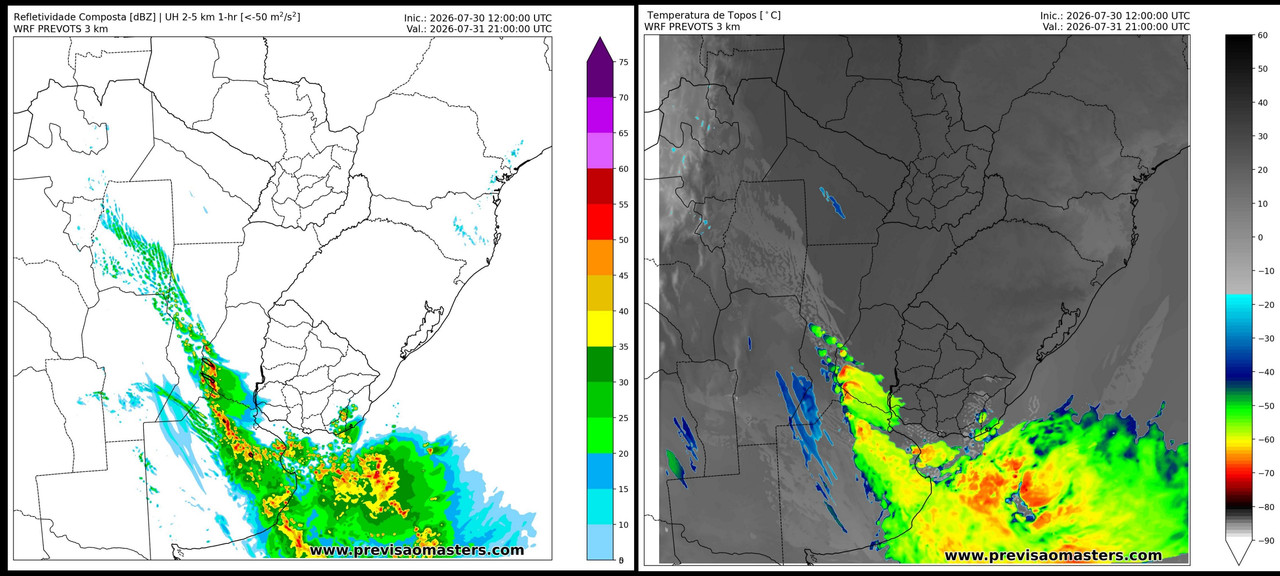
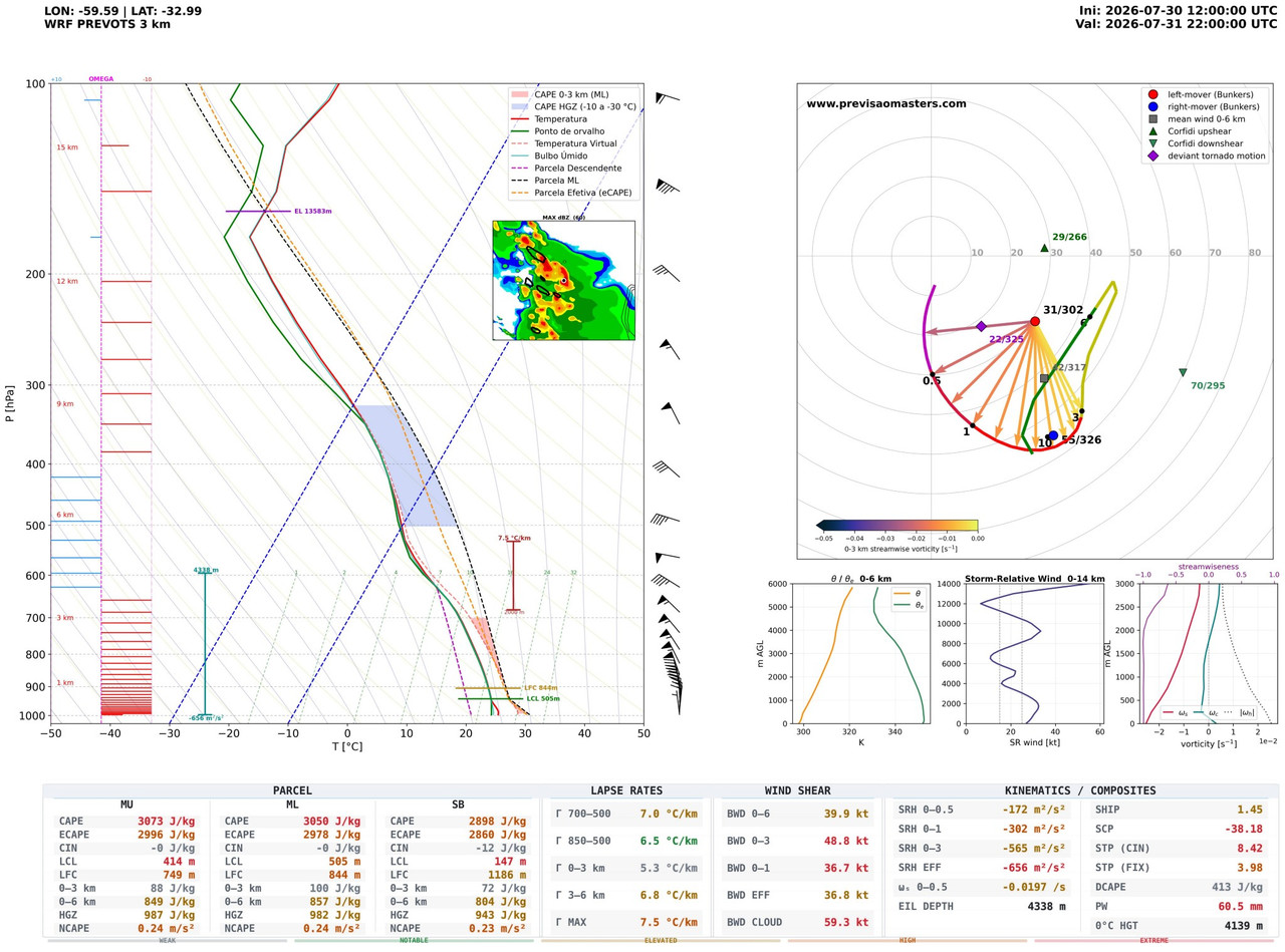
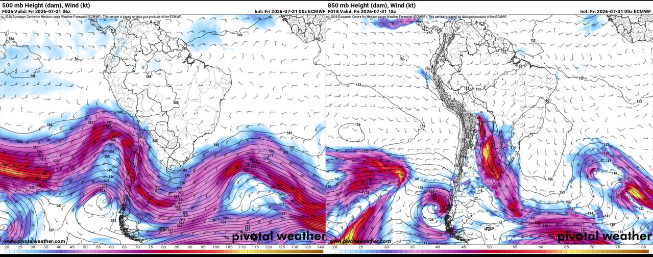
Severe and tornadic conditions (for the Southern Hemisphere) are expected to develop today in the central part of the SESA plains (Southeastern South America plains), with severe thunderstorms initially occurring sporadically this afternoon (when the risk of tornadoes will be highest) and then shifting to a linear pattern that will sweep across all of central-eastern Argentina and Uruguay overnight and into the early morning hours of tomorrow.


This region is now completely immersed in the right flank of an unusually northerly long-wave trough extending to the Bolivian Andes, which is activating a powerful SALLJ (South American Low-Level Jet) of 60 kt at 850 hPa, which is pushing warm, humid tropical air directly from the Amazon basin with dew points of 21°C (70°F) into the heart of the Pampas plains.


This has placed the region under tornado prone conditions, even Mateusz Taszarek’s GEFS-based model has raised the risk to a 10% probability of tornadoes with CIG3 intensity under SPC criteria (even with the GEFS model tends to underestimate severe weather events in South America), though the greatest risk remains hail and destructive winds.


Last edited:
Just want to warn that if we happen to see any major tornadoes in question the next few months, please be wary of Google Earth. Yes, i said Google Earth. Google released a feature that allows you to generate images based off Nano Banana in any location. This means you can generate anything. Disasters like tornadoes and flooding, and bombs + missile craters. This post is for the tornado aspect of that, but i decided to test my own hometown on satellite and i was able to generate all of these which is concerning. Anyways, back on topic. If Google doesn't change much about this, disaster aftermaths will become riddled with misinformation. Here's proof regarding tornadoes.


To the untrained eye who isn't trained about tornadoes and major flooding, this is EXACTLY the type of stuff you could be seeing in a while with any significant flooding events or tornadoes. I hope guidelines are put on this.

apologies regarding the tweet below which I will not mention but I couldn't find any way to deattach that tweet given its nature that it involves but it is true regarding that side of things too.
 
Just want to warn that if we happen to see any major tornadoes in question the next few months, please be wary of Google Earth. Yes, i said Google Earth. Google released a feature that allows you to generate images based off Nano Banana in any location. This means you can generate anything. Disasters like tornadoes and flooding, and bombs + missile craters. This post is for the tornado aspect of that, but i decided to test my own hometown on satellite and i was able to generate all of these which is concerning. Anyways, back on topic. If Google doesn't change much about this, disaster aftermaths will become riddled with misinformation. Here's proof regarding tornadoes.
Absolutely baffling that there's zero thought behind these changes, like what are we even doing? What even is the point of this? Despite AI being capable of doing great things, it's incredibly difficult to be pro-AI right now when the only motives behind implementing these features is money and generating slop. Thanks for the heads-up on this, didn't even hear about it.
 
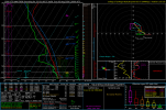
Sounding from Coosa County, AL off the NAM Saturday evening. Obviously, not a classic tornado sounding for this area, but not what you'd expect for early August in the South, either. Straight-line winds will still probably be the primary hazard, but could certainly see some spin-ups supported by our synoptic forcing. Instability Sunday actually looks to be a good bit higher across parts of Alabama and Georgia, so could pose another round of severe storms if sufficient initiation occurs. Wind profiles a lot more unidirectional at that point, as the low moves off to the north and east throughout the day into early Monday.
1785528219502.png
 
Back
Top