I absolutely agree. Regarding Thursday, I've seen a few eying this threat elsewhere and there is clear failure modes to a sleeper tor threat in Oklahoma.
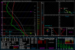
I mean, thermos are pretty poor and several models do show issues with the mid levels. Moisture return isn't exactly bad for October though. I still don't see Thursday being much.
Regarding the threats AFTER? The 24th honestly seems pretty poor, and plenty of models downtrended on that potential it had for at least a minor all hazards threat which is great.
25th in Eastern TX, damaging wind and large hail moreso.
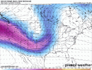
Now... The 27th. The latest GFS run really isn't that bullish but that's to be expected at this range a nd ensembles still do say watch out. Admittedly, around 21z in NW AR, GFS hints at some low level shear to make it work and perhaps a locally higher tornado threat. I will note, this is me explaining what the models are intending to show and are not really my personal thoughts but the 24th/25th i do agree on with a damaging wind/large hail aspect.
I'm not really thinking much about the 27th in depth at the minute, but even then the latest GFS still shows strong low level shear in some vicinity. The 27th needs a very close watch and even the SPC is showing strong language for their standards mentioning potential all hazards this far out.


