• Welcome to TalkWeather!
    We see you lurking around TalkWeather! Take the extra step and join us today to view attachments, see less ads and maybe even join the discussion.
    CLICK TO JOIN TALKWEATHER

Severe Weather 2025

I honestly can't recall the last time we had a severe weather threat around Halloween
 
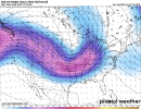
Very weirdly shaped trough on the latest GFS. Willing to throw it out at this point
It’s better to look at the ensembles for a general shape at this range, rather than the operationals anyways. GEFS has a bit of a weaker signal for the trough (still there though) but EPS has a very strong signal for a big longwave.
 
It’s better to look at the ensembles for a general shape at this range, rather than the operationals anyways. GEFS has a bit of a weaker signal for the trough (still there though) but EPS has a very strong signal for a big longwave.
I think all we can conclude at this point is that we're looking at veryyyyy active troughing towards the end of the month
 
Given the consistent showing of an intense severe weather signature from multiple models, I think that now is the time to keep a close eye on how the models progress with it. Remember that it can change at any time.

Though the area is uncertain to me. Is it OK? TX? AR? it kind of shifts to one of those three with each run.
 
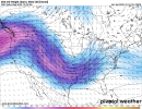
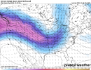
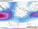
EPS has the strongest signal here, CMCE and GEFS are weaker and not quite as optimal placement-wise. Additionally, it's very possible this feature continues to evolve and ends up looking sloppy by Day 1. However, the overall signal is fairly consistent, and if this system were to keep that EPS presentation, it would definitely be cause for concern.
1760832256875.png1760832259147.png1760832261472.png
 
EPS has the strongest signal here, CMCE and GEFS are weaker and not quite as optimal placement-wise. Additionally, it's very possible this feature continues to evolve and ends up looking sloppy by Day 1. However, the overall signal is fairly consistent, and if this system were to keep that EPS presentation, it would definitely be cause for concern.
View attachment 47528View attachment 47529View attachment 47530
like you said, it’s way out in La La land, but that is a nasty looking trough presentation. Those troughs that dive bomb southeast from around the Pacific Northwest/California can be significant.
 
EPS has the strongest signal here, CMCE and GEFS are weaker and not quite as optimal placement-wise. Additionally, it's very possible this feature continues to evolve and ends up looking sloppy by Day 1. However, the overall signal is fairly consistent, and if this system were to keep that EPS presentation, it would definitely be cause for concern.
View attachment 47528
View attachment 47529View attachment 47530
Ahhh yes… If I am reading this right that looks like Dixie’s first threat of the latter half of the year (LA, MS, AL the usual suspects) ANNND this winter is supposed to warm in the Deep South?! mmmmmmk

damnit @Clancy oh how I have missed your posts lol
 
Back
Top