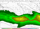
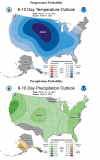
Agreed. We may get a “lull” for a few weeks. Late March to Early May is always in play.Looks too amplified for a significant tornado event. Another wind threat, possibly.
Navigation
Install the app
How to install the app on iOS
Follow along with the video below to see how to install our site as a web app on your home screen.
Note: This feature may not be available in some browsers.
More options
-
Welcome to TalkWeather! We see you lurking around TalkWeather! Take the extra step and join us today to view attachments, see less ads and maybe even join the discussion. CLICK TO JOIN TALKWEATHER -
Current Tropical Systems Melissa
You are using an out of date browser. It may not display this or other websites correctly.
You should upgrade or use an alternative browser.
You should upgrade or use an alternative browser.
Severe Weather 2023
- Thread starter KevinH
- Start date
- Moderator
- #402
A very uncertain weather setup the later half of next week is what I’ve seen modeled. The 12z/18z runs of the GFS are new to this idea of a possible severe threat over the weekend. There have been wild swings on the GFS/EURO. The UM and GEM hold better two day consistency with a northwest flow still over the eastern US next weekend.
MattPetrulli
Member
A very uncertain weather setup the later half of next week is what I’ve seen modeled. The 12z/18z runs of the GFS are new to this idea of a possible severe threat over the weekend. There have been wild swings on the GFS/EURO. The UM and GEM hold better two day consistency with a northwest flow still over the eastern US next weekend.

- Moderator
- #405
- Moderator
- #406
- Moderator
- #407
The MJO report seems to signal for severe weather to return in the extended. The ensemble lines project movement into Phase 8 (Figure A). In addition, the forecast (unfilled contours) on the reconstruction chart (Figure B) shows similarities to the periods that led to the large/significant tornado episodes on Nov 4th last year and Jan 12th this year.
Figure A

Figure B

Source: https://www.cpc.ncep.noaa.gov/products/precip/CWlink/MJO/mjo.shtml#discussion
Figure A

Figure B

Source: https://www.cpc.ncep.noaa.gov/products/precip/CWlink/MJO/mjo.shtml#discussion
Last edited:
JBishopwx
Member
Austin Dawg
Member
CheeselandSkies
Member
Hold the phone...12Z GFS just came in with a rather more potent look for next Saturday (3/11).
Verbatim looks like it could run into a similar issue that was (part) of the problem for yesterday's setup...namely the low is occluding by peak heating.
Verbatim looks like it could run into a similar issue that was (part) of the problem for yesterday's setup...namely the low is occluding by peak heating.
Lake Martin EF4
Member
I predict a Forecasted Convective Amplification Deficiency!SPC hinting at increased risk for strong to severe storm potential mid/late next week. Y'all know the drill by now as well as the areas that will be at risk. LOL!
CheeselandSkies
Member
Fantasy range of course, but 06Z GFS would be another threat for Gulf Coastal regions on the 19th of March. Again, fantasy range, but the implication is annoying - that these threats still can't get north of about I-20 even as we approach the equinox. Remember, last year we had the Winterset, IA EF4 on March 5th.
I would expect a Marginal to Slight Risk at the very least going into Wednesday thru Friday timeframe (8th to 10th) across portions of the Mid-South region. Nothing stands out for a significant outbreak, but then again, these things have tended to escalate closer in.
tennessee storm chaser
Member
- Messages
- 1,623
- Reaction score
- 3,058
- Location
- jackson tennessee
- Special Affiliations
- SKYWARN® Volunteer
You can thank the negative nao for thatFantasy range of course, but 06Z GFS would be another threat for Gulf Coastal regions on the 19th of March. Again, fantasy range, but the implication is annoying - that these threats still can't get north of about I-20 even as we approach the equinox. Remember, last year we had the Winterset, IA EF4 on March 5th.
Last edited:
Weatherphreak
Member
I'm hoping the weekend of the 19th can stay rain free for the Atlanta area so I can go to the Nascar race.
Austin Dawg
Member
A lot of cold air in the forecast.Fantasy range of course, but 06Z GFS would be another threat for Gulf Coastal regions on the 19th of March. Again, fantasy range, but the implication is annoying - that these threats still can't get north of about I-20 even as we approach the equinox. Remember, last year we had the Winterset, IA EF4 on March 5th.
David in SW Blount
Member
Took me a second to remember that severe weather season is just getting started. Feels like it's been happening for weeks!
Can we just not with more severe. @TheSuckZone suck the severe weather possiblity up on models and give us sunshine and mild temps


