
Equus
Member
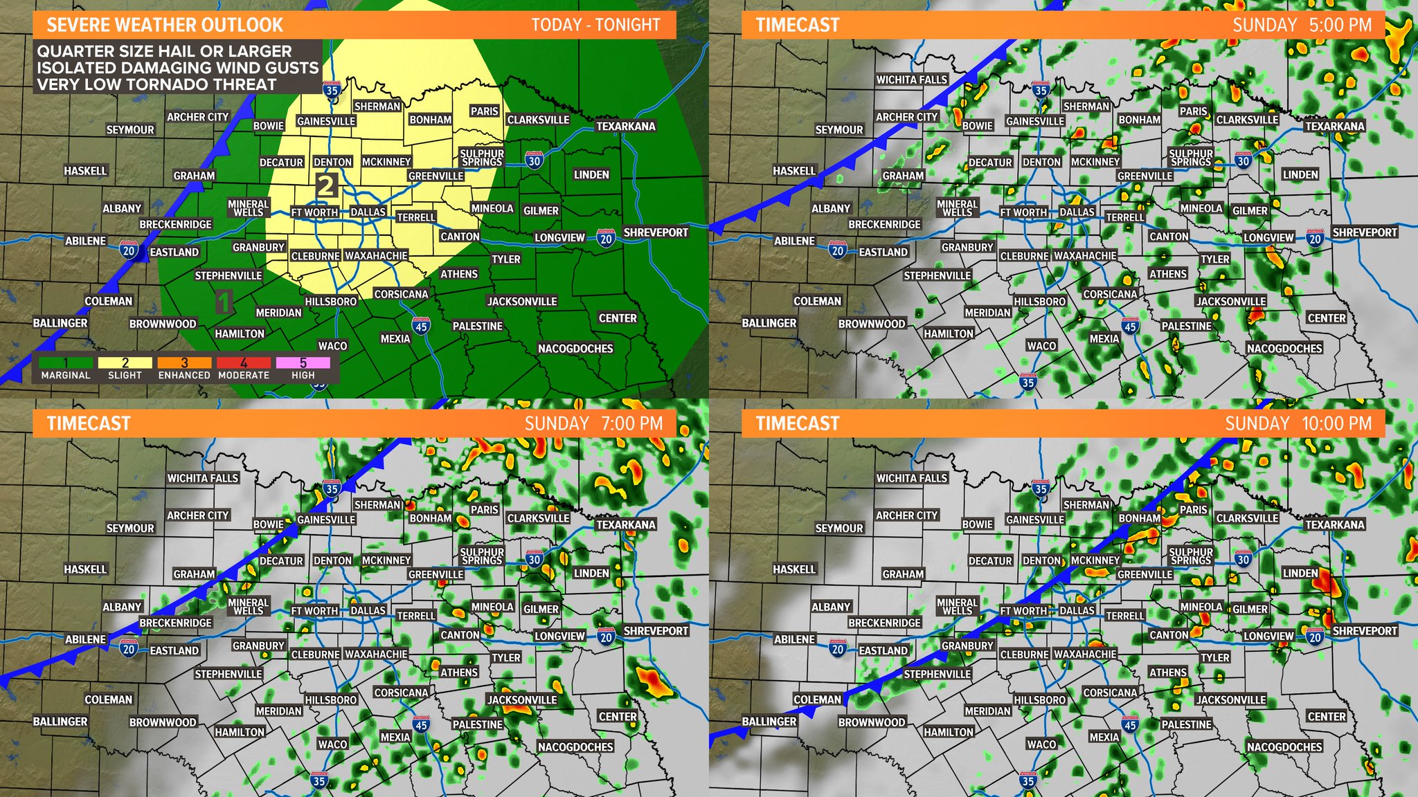
Well if north DFW is gonna be under the gun I'll be sure to send pictures, lol
Follow along with the video below to see how to install our site as a web app on your home screen.
Note: This feature may not be available in some browsers.
Well if north DFW is gonna be under the gun I'll be sure to send pictures, lol
 I want my sleep!
I think that's exactly what's going on. I like to drive over the bridge between Madison and Morgan county just to see how high the Tennessee River is. I definitely think flooding will be the big story of next week if trends hold. Someone is going to get a lot of rain.The Tennessee River here in South Huntsville is already very high. This may be TVA trying to get ahead of the next system but 5-10 inches will cause major problems over the next week if the river doesn’t drop before then.
We've seen significant shifts in the model runs this afternoon/evening that would favor a more substantial severe weather threat.I think that's exactly what's going on. I like to drive over the bridge between Madison and Morgan county just to see how high the Tennessee River is. I definitely think flooding will be the big story of next week if trends hold. Someone is going to get a lot of rain.
Kory, what day/days are they saying? I keep hearing about a severe weather possibility, but the mets in Huntsville have only talked about the flooding.We've seen significant shifts in the model runs this afternoon/evening that would favor a more substantial severe weather threat.
Looks like Wednesday yet again for potential severe weather. Flooding issues will begin Monday as the lead portion of the rain moves in and then were the heavy band gets hung up in AL/MS/TN. That to be determined as well.Kory, what day/days are they saying? I keep hearing about a severe weather possibility, but the mets in Huntsville have only talked about the flooding.
Looks like Wednesday yet again for potential severe weather. Flooding issues will begin Monday as the lead portion of the rain moves in and then were the heavy band gets hung up in AL/MS/TN. That to be determined as well.
SPC has been slow to get on board with next week's potential event due to model inconsistency.

I know. Enhanced risk already.Well, they are (on board) now. First thing I did was check and see if Broyles did the 4-8 outloook. Nope.
Oh you're right. Looks like the lower level wind fields have amped up quite a bit from a couple days ago and the surface low deepens and tracks further NW. Is the Euro on board with this?We've seen significant shifts in the model runs this afternoon/evening that would favor a more substantial severe weather threat.
Yes. Seasonal trend starting with the December 16th event have seen these things have been to trend NW and trend upward. I'd say nearly every event since then has been this way. GFS is woefully awful in the medium range.Oh you're right. Looks like the lower level wind fields have amped up quite a bit from a couple days ago and the surface low deepens and tracks further NW. Is the Euro on board with this?
Thank you.Looks like Wednesday yet again for potential severe weather. Flooding issues will begin Monday as the lead portion of the rain moves in and then were the heavy band gets hung up in AL/MS/TN. That to be determined as well.