• Welcome to TalkWeather!
    We see you lurking around TalkWeather! Take the extra step and join us today to view attachments, see less ads and maybe even join the discussion.
    CLICK TO JOIN TALKWEATHER

Severe Weather 2018

This severe weather season will be?

  • Above Average

    Votes: 7 31.8%
  • Average

    Votes: 13 59.1%
  • Below Average

    Votes: 2 9.1%

  • Total voters
    22
  • Poll closed .
45% sig wind and hail. First time we've had that this year I think?

We've also got a slight risk here since we're getting (yay!) even more rain. A lot of the area has had 8-12" in the past week already.
 
Well, that was interesting. For only the second time since I moved to Georgia 12 years ago, I actually had to go through my tornado plan. I never imagined it would be on August 1.

Moderators, can we merge this into the new thread I started?

Thanks
 
Last edited:
Sounds like the dam held up but they really got dumped on yesterday. Even worse than we have been up here (I say as it just started raining again).

There was also a brief tornado EF-0 in Charlottesville yesterday with those storms. And one in Queens of all places.
 
1v40yz.jpg
 
We've got a heck of a lightning show going on and had some good hail going for a few minutes. Pretty good for a non-severe storm.
 
The Alonsa, MB tornado last Friday was upgraded to low-end EF-4 (270-280 km/h, so about 168-173 mph) by Environment Canada. First EF-4 of the year...in August.
 
Any thoughts on the storm chances for today? I’m a football coach in Huntsville trying to decide what to do about practice after school.


Sent from my iPhone using Tapatalk
There will likely be a line later tonight with scattered storms throughout the day. Practice general lightning safety precautions (if you can see or hear it cancel practice, wait 30 minutes after he last rumble of thunder to resume) and you should be fine.
 
Tornadic supercell tracking across northern MS, just your regular August day.

That bow moving into Memphis looks rough too.
 
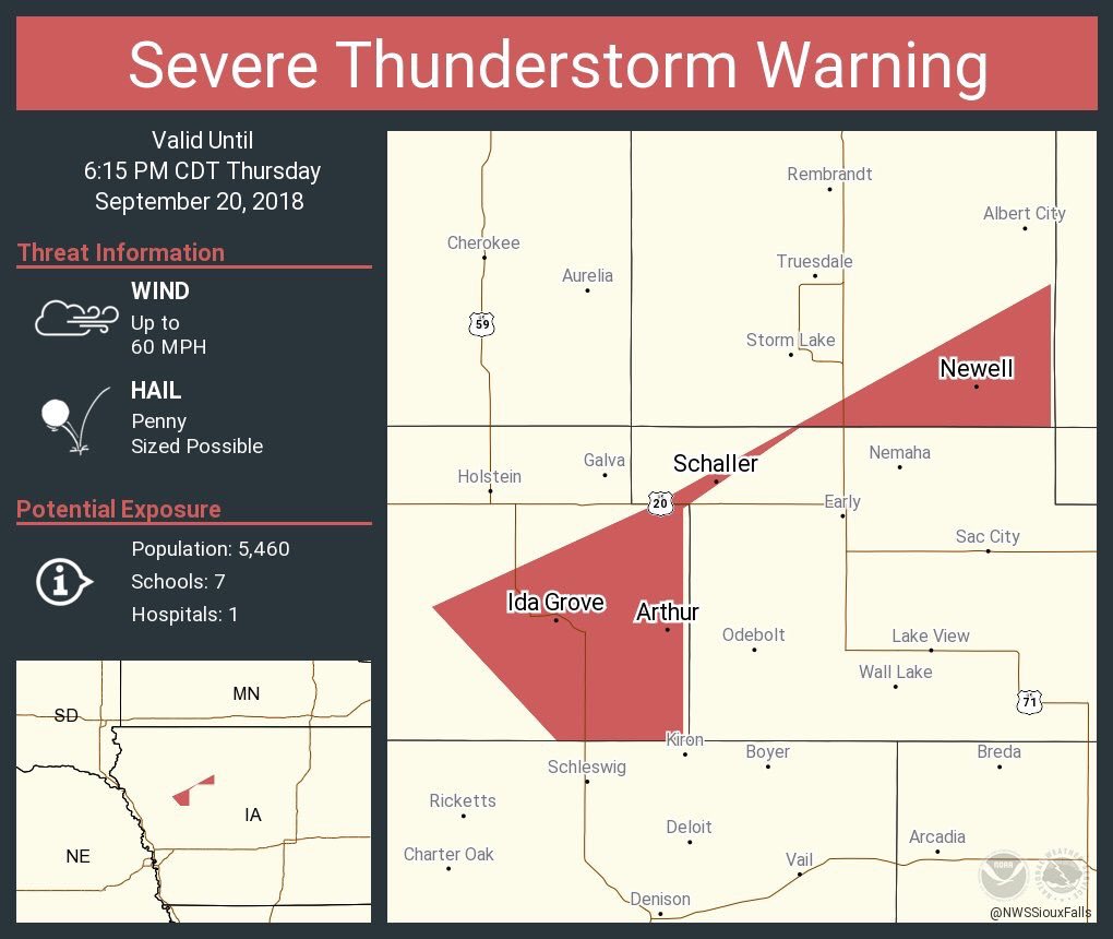
This has to be the weirdest warning polygon I've ever seen...
DnkopMiV4AA5T3E.jpg
 
Significant damage in the Ottawa-Gatineau (ON/QC) area. I can't find the exact picture but news coverage was showing what appeared to be EF3 or high-end EF2 damage. Straight line winds estimated at 100 kph (60 mph) and grape sized hail. Around 30 injuries total according to latest reports
 
Last edited:
Back
Top