Gail
Member
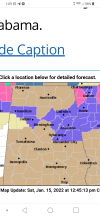
Dr. Wax is amazing. He taught all my favorite classes.They aren't forecasting any accumulation at Mom's I'm NE MS which means they'll get from 6 - 12 inches. I lived in Monroe county most of my life and Starkville for a while and forecasting snow there is nuts. I was friends with Dr. Wax at MSU and he said that forecasting snow in MS was harder than forecasting any other kind of weather.
Yeah, they’re saying basically nothing here in Lowndes County too. They’re keeping it all at the TN state line. I haven’t mentioned it to my 6 year old, and it’ll be a happy surprise if she wakes up to some snow on Sunday. If not, no lost excitement.