
Equus
Member
A lot more variables than Monday, but yeah if things pan out, things could be volatile. Of course the highest tornado risk is in an area where flooding has closed a ton of roads so this isn't an good setup for anyone.
Follow along with the video below to see how to install our site as a web app on your home screen.
Note: This feature may not be available in some browsers.
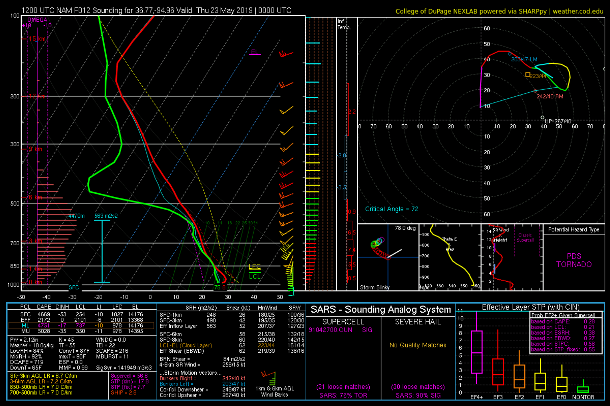
NAM 0000Z NE of Tulsa around the KS/MO/OK borders. Speaking of not being a good setup, looks to be a lot of HP supercells as well. Exactly what spotters don't need trying to do their jobs and exactly what Oklahoma doesn't need being flooded already.
That was my first thought actually, the biggest possible mitigating factors are a lack of low level shear and the cap. If the cap breaks we'll see some pretty explosive supercells, and if a storm is able to localize low level shear, some tornadoes as well.Low-level shear is adequate but a bit lacking in my opinion. Cap isn't super strong but it is there. Definitely wary of putting my marbles in the HRRR basket, but I don't like it developing supercells throughout the day - - especially those that look to impact Oklahoma City and Tulsa.

Just a hunch. Something big will happen in OK today.My meteorological reasoning will come later