• Welcome to TalkWeather!
    We see you lurking around TalkWeather! Take the extra step and join us today to view attachments, see less ads and maybe even join the discussion.
    CLICK TO JOIN TALKWEATHER
  • April 2024 Weather Video of the Month
    Post your nominations now!
Logo 468x120

Severe WX April 3rd-5th, 2023 (South, Southeast, Ohio Valley)

TH2002

Member
Sustaining Member
Messages
3,818
Reaction score
6,485
Location
California, United States
Special Affiliations
  1. SKYWARN® Volunteer
They uh, really backed off with their wording in the northern sector.
The southern sector however, it seems the SPC has actually doubled down and have increased confidence in violent nocturnal tornadoes.
The next hour or two is really going to tell a story regarding the northern sector. If substantial clearing occurs, watch out. If not we can safely assume not pulling the trigger on a high risk was the right call.
 

Jbop

Member
Messages
11
Reaction score
14
Location
Dallas
That was one of the best forecast discussions I’ve read in a very long time. Great job by the SPC. Got the feeling the really want to upgrade to HIGH once a few more details are resolved in the northern Moderate area.


Sent from my iPhone using Tapatalk

Didn't the last high-risk get updated around the 2nd to 3rd update for day 1? If I remember correctly
 

warneagle

Member
Messages
4,142
Reaction score
4,327
Location
Arlington, VA
Special Affiliations
  1. SKYWARN® Volunteer
Didn't the last high-risk get updated around the 2nd to 3rd update for day 1? If I remember correctly
They issued it at 1630 on Friday. We’re clearly not gonna see one for the northern threat but I guess they could still pull the trigger on one for the southern threat at 2000. Might be justified if obs/model trends converge toward an overnight violent tornado threat.
 

MattPetrulli

Member
Messages
431
Reaction score
501
Location
Pigeon Forge, TN
FWIW, 12z CAMs didn't have this thunderstorm complex over chicago. HRRR is the closest but none of them had a good grip of this. Something to keep in mind.
14250a08451ad2d58d79bd7940f08375.png

refcmp_uh001h.us_mw.png

refcmp_uh001h.us_mw.png

refcmp_uh001h.us_mw.png

refcmp_uh001h.us_mw.png
 

Taylor Campbell

Moderator
Moderator
PerryW Project Supporter
Messages
2,156
Reaction score
2,290
Location
Wedowee, AL
Special Affiliations
  1. SKYWARN® Volunteer
Satellite observations and newer high res model data shows the northern risk area is more likely to have big problems today. Very big population points under the gun in IA (Des Moines, Waterloo, Cedar Rapids, Davenport). Sadly, the time is closer for tornadoes to munch things.
 
Last edited:

WesL

"Bill, I'm talkin' imminent rueage"
Administrator
Moderator
Sustaining Member
Messages
3,420
Reaction score
2,767
Location
Fayetteville, AR
Special Affiliations
  1. SKYWARN® Volunteer
Meanwhile in Oklahoma, don’t fart it might start a fire.


andyhb

Member
Meteorologist
Messages
1,337
Reaction score
4,193
Location
Norman, OK
Fs5Dr_8akAAFy8V


Tornado watch coming for the northern MDT risk area. Got a couple of cells already going up SE of Kansas City.
 

cincywx

Member
Messages
645
Reaction score
1,311
Location
Cincinnati, OH
Special Affiliations
  1. SKYWARN® Volunteer
Fs5Dr_8akAAFy8V


Tornado watch coming for the northern MDT risk area. Got a couple of cells already going up SE of Kansas City.

accompanying disco is worth the read

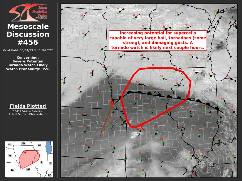
MESOSCALE DISCUSSION 0456
NWS STORM PREDICTION CENTER NORMAN OK
0149 PM CDT TUE APR 04 2023

AREAS AFFECTED...PORTIONS OF CENTRAL/SOUTHERN IA...NORTHWEST IL AND
NORTHERN MO

CONCERNING...SEVERE POTENTIAL...TORNADO WATCH LIKELY

VALID 041849Z - 042045Z

PROBABILITY OF WATCH ISSUANCE...95 PERCENT

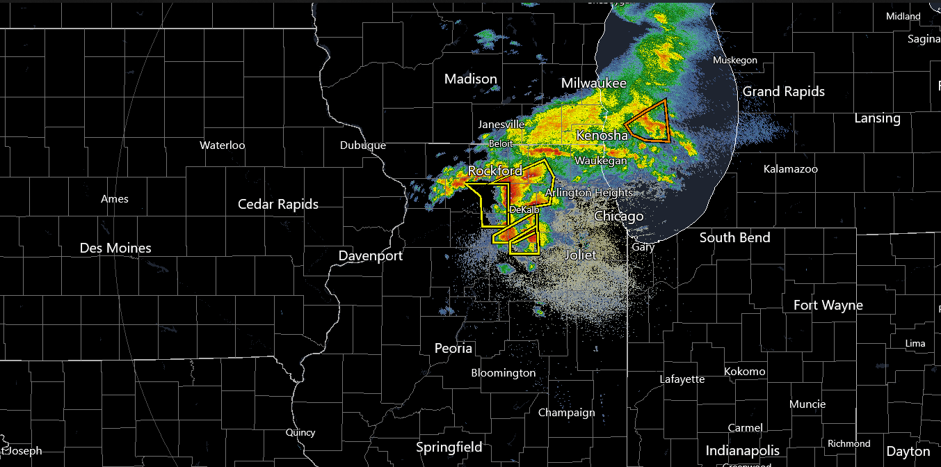
SUMMARY...SUPERCELL THUNDERSTORMS ARE EXPECTED TO DEVELOP BY 22Z/5
PM CDT AND SHIFT EAST ACROSS CENTRAL/SOUTHERN IOWA, NORTHERN
MISSOURI AND NORTHWEST ILLINOIS THROUGH THE EVENING. THESE STORMS
WILL BE CAPABLE OF PRODUCING VERY LARGE HAIL, TORNADOES (SOME
STRONG) AND DAMAGING GUSTS. A TORNADO WATCH WILL LIKELY BE ISSUED IN
THE NEXT COUPLE OF HOURS.

DISCUSSION...NORTHWARD TRANSPORT OF LOW-LEVEL MOISTURE CONTINUES
EARLY THIS AFTERNOON. DEWPOINTS ACROSS SOUTHERN IL/NORTHERN MO INTO
NORTHWEST IL HAVE INCREASED 8 DEGREES F OVER THE PAST 3 HOURS.
STRONG HEATING TO THE SOUTH OF A WARM FRONT HAS RESULTING IN
TEMPERATURES INTO THE LOW/MID 80S F AMID LOW/MID 60S F SURFACE
DEWPOINTS. SOME MIDLEVEL DRY AIR IS EVIDENT IN FORECAST AND OBSERVED
SOUNDINGS, AND MAY RESULT IN SOME MIXING OF BOUNDARY-LAYER MOISTURE.
FORECAST GUIDANCE SUGGEST AN INCREASING LOW-LEVEL JET WILL NOSE
INTO THE EASTERN IA/NORTHWEST IL LATER THIS AFTERNOON AND SUPPORT
OPEN WARM SECTOR STORMS NEAR THE WARM FRONT. ADDITIONAL STORMS ARE
EXPECTED TO DEVELOP NEAR THE SURFACE LOW, SOUTHWARD ALONG THE
EASTWARD-ADVANCING DRYLINE/COLD FRONT. WHILE MIXING MAY RESULT IN
SOMEWHAT HIGHER LCLS, VERY STEEP MIDLEVEL LAPSE RATES AND STRONG
VERTICAL SHEAR WILL SUPPORT SUPERCELLS CAPABLE OF VERY LARGE HAIL
(GREATER THAN 3 INCH IN DIAMETER) AND DAMAGING GUSTS. FURTHERMORE,
FORECAST SOUNDINGS INDICATED FAVORABLE LOW-LEVEL SHEAR AND 0-1 KM
SRH INCREASING TO AROUND 250 M2/S2, SUPPORTING TORNADO POTENTIAL.

INCREASING CUMULUS IS NOTED IN LATEST VISIBLE SATELLITE IMAGERY BOTH
ALONG THE WARM FRONT AND AHEAD OF THE DRYLINE AS OF 1830Z. A COUPLE
OF ELEVATED CELLS HAVE EVEN STARTED TO DEVELOP SOUTHWARD INTO
WEST-CENTRAL MO. WHILE CAPPING REMAINS OVER THE REGION, THIS MAY BE
AN INDICATION OF SOME INCREASED FORCING BEGINNING TO IMPINGE ON THE
AREA. CONTINUED LOW-LEVEL WARM/MOIST ADVECTION BENEATH THE CAP,
COUPLED WITH HEATING AND GRADUAL INCREASING ASCENT SHOULD RESULT IN
GREATER CONVECTIVE INITIATION/COVERAGE BY AROUND 22Z.
A TORNADO
WATCH WILL BE LIKELY IN THE NEXT COUPLE OF HOURS.

..LEITMAN/HART.. 04/04/2023
 

Muwx

Member
Messages
247
Reaction score
438
Location
Republic Mo
That Missouri cell may be off to the races….

Also, the dry line is trying to go in southern Oklahoma/north Texas.
 
Back
Top