Outlook for Tuesday. Seems a little more tame than what I was expecting
They cite moisture depth, possible capping issues, and absence of lift as caveats
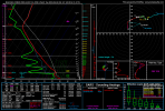
Storm Prediction Center Jul 15, 2026 1930 UTC Day 3 Severe Thunderstorm Outlook
Severe weather, tornado, thunderstorm, fire weather, storm report, tornado watch, severe thunderstorm watch, mesoscale discussion, convective outlook products from the Storm Prediction Center.
www.spc.noaa.gov
They cite moisture depth, possible capping issues, and absence of lift as caveats
Last edited: