
TCLwx
Member
Looks like the warm front is on the Wilcox/Dallas County line. TD 64F in Camden and 53F in Selma.
Follow along with the video below to see how to install our site as a web app on your home screen.
Note: This feature may not be available in some browsers.
Nothing tops the lightning from last weekend's tornadic storm here, but I just recently moved to a condo across town in Tuscaloosa and didn't have my curtains up. It was like someone kept flashing a flashlight in my windows at 4:30am.That storm at 5ish as it came through Trussville was absurdly loud. Probably the most frequent amount of close lightning strikes that I can remember occuring here in years.
Not sure much northward progress will happen in AL looking at the radar. More likely in MS.Looks like the warm front is on the Wilcox/Dallas County line. TD 64F in Camden and 53F in Selma.
Nothing tops the lightning from last weekend's tornadic storm here, but I just recently moved to a condo across town in Tuscaloosa and didn't have my curtains up. It was like someone kept flashing a flashlight in my windows at 4:30am.
It isn't just y'all's imagination. The surface inversion makes thunder louder as the sound waves reverberate between the inversion and the ground.


I agree, the overall threat areas has really shrunk, any storm that is able to ride the boundary could be significant. I am trying to remember if that boundary last year was moving or if it had become nearly stationary.I sort of wonder if an enhanced risk is all that is needed today, but like others have said, you just need one or two Beauregard like storms riding a boundary or something to make this a big event. 12z HRRR pick up on the idea of one or two potential long track storms/tornadoes.
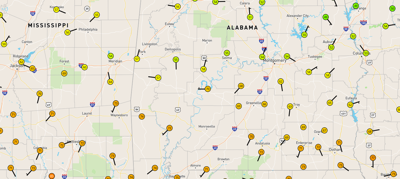
Where did you get that map?Very obvious where the warm front is located.
Very obvious where the warm front is located.
This is a very helpful site to add to one's weather link folder. Do you mind sharing the link for those of us who may be looking for a good mesonet graphic like this one? It is much easier to read than many I have seen (less crowded w/ other data)
Yes, it's the Wunderground map from Weather Underground. Make sure the Weather Stations option is checked with Temperature/Wind so you get the data from personal weather stations. https://www.wunderground.com/wunder...0Q&wxsn=0&svr=0&cams=0&sat=0&riv=0&mm=0&hur=0
Also notice the northward trend on radar west of SelmaYou can see the rain cooled boundary racing south of the complex over Central AL on radar. Will be interesting how the next complex of storms coming from MS interacts with the boundary as it’s wavers over south/central AL.
Also notice the northward trend on radar west of Selma