• Welcome to TalkWeather!
    We see you lurking around TalkWeather! Take the extra step and join us today to view attachments, see less ads and maybe even join the discussion.
    CLICK TO JOIN TALKWEATHER

Severe WX April 11-14th, 2022 Severe Weather Threat

I’m more concerned about the east AR/MS/TN corridor where there are significant breaks.

Edit…didn’t see your post OHWX97…but completely agree.
Same
 
Just to clarify, I'm not saying storms today won't be messy, I honestly expect it, but Texas yesterday is good example that despite a messy storm mode, you can still get at least a few strong tornadoes if conditions favor it.
QLCS tornadoes carry their own risks. Strong tornadoes are very possible today, I'm just skeptical of the long track wording that the SPC is using.
 
Messy mode semi linear convection seems to have started earlier and further east than I figured. Might really limit significant tornado risk for the western part of the risk area. We shall see?
 
Yeah I don’t see how this setup would really generate a significant amount of discrete convection and keep it alive long enough to generate any long-trackers, but as last night showed it only takes one to spawn something significant.
 
Messy mode semi linear convection seems to have started earlier and further east than I figured. Might really limit significant tornado risk for the western part of the risk area. We shall see?
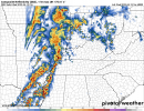
This is what the HRRR was saying. I'm not sure what is happening exactly in the upper levels but it's progressing a very fast moving MCS ahead of the front. That area was originally where the discrete convection was possible. If it's already linear, it's simply going to push its way through the warm sector. There's no forcing out ahead of this so the line is the only convection in play.
 
I went into my office at 10, and it was raining on me. I came out at 11:30, and it’s a breezy, beautiful day. From a quick trip to the store a few minutes ago, some think this morning was the bad weather we’re having today. I was in the checkout and heard others mention it. I told them there was more heading our way tonight so hopefully they at least look to see if what I said was true.

I’m near Columbus AFB and the old reliable Greenwood Springs radar.


DE3DC92E-EA75-4848-9438-214B98BD622E.jpeg
 
I've heard some people questioning the potential for supercells ahead of this developing MCS. Just want to explain what I'm seeing and why I believe the MCS is the only threat.

Where convection is initiating in a messy line is where moisture and mass convergence are happening. The blue, positive values indicate moisture/mass divergence, which will preclude any forcing in the area ahead of the line.

d.PNG

If I look at the same area where I have my cape and streamlines enabled, we see what the problem is. The instability is advecting in to the north through MS, but there is no forcing in that area, which precludes the formation of anything to the east of the currently developing MCS.


Capture.PNG


I'm sure a lot of people here already understand this but I had several on discord ask me about it and I've heard the question floating around, so just wanted to give a simple explanation.
 
Just saw this: gosh!

 
I'm sharing this from my Twitter and Facebook page. So many focus on individual supercells instead of squall lines for strong/long tracked tornadoes. While it's true that supercell storms produce more strong deadly tornadoes, squall lines can produce the same. Example: the April 27th 2011 early morning line. Produced strong EF3 tornadoes. I say that because we don't need to put so much focus on what type of storm structure will be the dominant one. Line of storms, multi-cell storms, and supercell storms can produce the SAME amount of damage.
 
Back
Top