
Kory
Member
Honestly it could be declared based on ASCAT.91L is starting to get its act together as well.
Follow along with the video below to see how to install our site as a web app on your home screen.
Note: This feature may not be available in some browsers.
Honestly it could be declared based on ASCAT.91L is starting to get its act together as well.

Might not be so brief. She's an organizing cat 1...might make a run for cat 2.Looks like Hanna will be able to reach minimal hurricane status briefly before it makes landfall.
Yeah she's moving slowly enough that she could probably manage it.Might not be so brief. She's an organizing cat 1...might make a run for cat 2.
Yeah she's moving slowly enough that she could probably manage it.
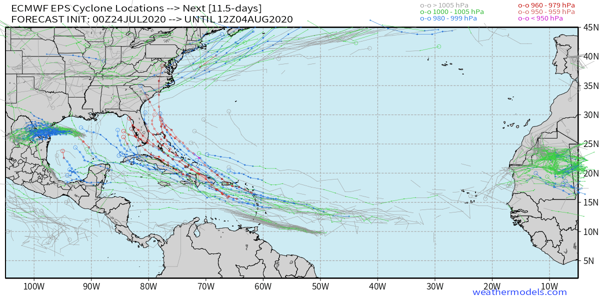
Euro says not so fast....MJO heading into phase 4-7 over the next couple weeks. Models not particularly bullish on development for that time period, no real surprise.
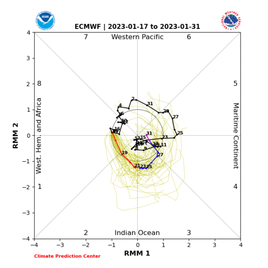
Yeah it's gonna be active regardless just thought the potential mjo swing deserved a mention. The euro could certainly be correct with the COD forecast. I'm far from versed in large scale tropical stuff just know there's a known coorelation between the mjo and tc development.Background state overwhelmingly favors the Atlantic...I'm not sure intraseasonal variability will matter much now that we're headed into the climatologically most favorable period on top of that.

