• Welcome to TalkWeather!
    We see you lurking around TalkWeather! Take the extra step and join us today to view attachments, see less ads and maybe even join the discussion.
    CLICK TO JOIN TALKWEATHER
Messages
2,159
Reaction score
2,716
Location
Missouri
So last year was the 30th anniversary of the March 13, 1990 Tornado Outbreak. While the Hesston and Goessel, KS F5s are well-known and documented many other tornadoes from that outbreak are not. This link had some pictures and articles of the long-track F4 that went through the area near Lawrence, Nebraska on that day. While officially this is the longest path in Nebraska state history at 124 miles, I'm sure it was actually a tornado family. A ton of newspaper articles I've never seen before on this thing are in the link below:


MNTornadoGuy

Member
Messages
1,615
Reaction score
2,570
Location
Apple Valley, MN
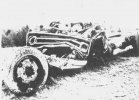
The 1969 Hazlehurst MS tornado was probably one of the strongest tornadoes to occur in January. A school bus was stripped from its frame and rolled a quarter-mile, 2,500,000 board feet of timber was destroyed in Bienville National Forest, cars and pickup trucks were rolled/thrown up to 400 yards, dozens of homes were leveled with some being completely swept away, debris from metal buildings was blown up to 7 miles, significant ground scouring occurred at some portions of the tornado's path and trees were debarked.
Screenshot_2021-01-22 30 Jan 1969, 1 - The Magee Courier at Newspapers com(1).jpgScreenshot_2021-01-22 30 Jan 1969, 7 - The Magee Courier at Newspapers com.jpg
Screenshot_2021-01-22 30 Jan 1969, 1 - The Magee Courier at Newspapers com.jpg
Screenshot_2021-01-22 30 Jan 1969, 7 - The Magee Courier at Newspapers com(1).jpgJHKPXHF5WRGMTK7EUUJD35XSGY.JPG
5JM6PXLDQVAPPD3M5QWOOKSSLI.JPG
Screenshot_2021-01-22 24 Jan 1969, Page 6 - Clarion-Ledger at Newspapers com.png
 

Attachments

  • Screenshot_2021-01-22 30 Jan 1969, 7 - The Magee Courier at Newspapers com.jpg
    Screenshot_2021-01-22 30 Jan 1969, 7 - The Magee Courier at Newspapers com.jpg
    125.8 KB · Views: 0

Marshal79344

Member
Messages
361
Reaction score
1,064
Location
Chicago, IL
The 1969 Hazlehurst MS tornado was probably one of the strongest tornadoes to occur in January. A school bus was stripped from its frame and rolled a quarter-mile, 2,500,000 board feet of timber was destroyed in Bienville National Forest, cars and pickup trucks were rolled/thrown up to 400 yards, dozens of homes were leveled with some being completely swept away, debris from metal buildings was blown up to 7 miles, significant ground scouring occurred at some portions of the tornado's path and trees were debarked.
View attachment 5728View attachment 5730
View attachment 5729
View attachment 5732View attachment 5733
View attachment 5734
View attachment 5735
That tornado really reminds me of Yazoo City a lot, spawned by a long-tracked, most definitely discrete supercell resulting in the tornado being able to maintain itself until the supercell likely got choked off by convection, or entered a more unfavorable environment.

ERA5 Analysis has a 999mb low over Central Missouri, with strong northwards advection, generating strong shear. Classic Dixie Alley setup.
us_reanalyse-en-087-0_modera5_196901231200_5749_149 (1).pngus_reanalyse-en-087-0_modera5_196901231200_5749_227.pngus_reanalyse-en-087-0_modera5_196901231200_5749_245 (1).pngus_reanalyse-en-087-0_modera5_196901231200_5749_654 (1).png
 
Messages
2,159
Reaction score
2,716
Location
Missouri
That tornado really reminds me of Yazoo City a lot, spawned by a long-tracked, most definitely discrete supercell resulting in the tornado being able to maintain itself until the supercell likely got choked off by convection, or entered a more unfavorable environment.

ERA5 Analysis has a 999mb low over Central Missouri, with strong northwards advection, generating strong shear. Classic Dixie Alley setup.
View attachment 5736View attachment 5737View attachment 5738View attachment 5739


Your quote: "That tornado really reminds me of Yazoo City a lot, spawned by a long-tracked, most definitely discrete supercell resulting in the tornado being able to maintain itself until the supercell likely got choked off by convection, or entered a more unfavorable environment."

Was this the kind of setup that spawned the Tri-State tornado (sorry if that seems like a silly question)?
 
Messages
2,159
Reaction score
2,716
Location
Missouri

MNTornadoGuy

Member
Messages
1,615
Reaction score
2,570
Location
Apple Valley, MN
Given how small and shallow those are I can't help but think they may have been done by large pieces of being bounced/slammed/dragged along the ground violently instead of sub-vortices. Or maybe both things played a role, not sure.
I don't think so as there is nothing nearby that would hint towards an object being responsible for the trenches. Also, it appears that dirt was sprayed out of the holes which is usually a sign of tornadic winds being responsible for digging the holes.
 
Messages
2,159
Reaction score
2,716
Location
Missouri
1. Found a Geological Survey Professional Paper from 1976 that discusses the Guin tornado (specifically it's track through William B. Bankhead National Forest). Not many pictures but some interesting tidbits about the tornado. Apparently the tornado leveled 20 million board feet of timber within the forest and destroyed a tower of a high-voltage transmission line (would love to find photographs of this). What's interesting is that the paper notes the tornado's track is wide on high ground and narrow in the valleys, but destruction was equal in both areas. The terrain seems to have affected the tornado's intensity and wind distribution in certain areas, and I think this also happened with Tuscaloosa when it was in between Tuscaloosa and Birmingham plowing through the 35 miles of forestland, the mountainous and craggy terrain made the tornado's damage path quite erratic.

Link: https://www.google.com/books/editio...r/hNlVyvXiLMcC?q=&gbpv=1&bsq=Bankhead#f=false


2. This is a Climatological Data National Summary book from 1974 that mentions Guin (and the 1974 outbreak on some of its pages, some interesting statistics I haven't been able to find anywhere else. It does mention that Guin destroyed 274 buildings and 50 mobile homes.

Link: https://www.google.com/books/editio...al_Summary/43YGGKW6U38C?hl=en&gbpv=1&bsq=guin


3. This last article is entitled 'Engineering Aspects of the Tornadoes of April 3-4, 1974'. Some damage photographs I haven't been able to find anywhere else and some interesting insight on building codes and tornadoes (at least for the day).

Link: https://www.nap.edu/catalog/20193/engineering-aspects-of-the-tornadoes-of-april-3-4-1974
 

Marshal79344

Member
Messages
361
Reaction score
1,064
Location
Chicago, IL
Your quote: "That tornado really reminds me of Yazoo City a lot, spawned by a long-tracked, most definitely discrete supercell resulting in the tornado being able to maintain itself until the supercell likely got choked off by convection, or entered a more unfavorable environment."

Was this the kind of setup that spawned the Tri-State tornado (sorry if that seems like a silly question)?
The Tri-State Tornado was spawned by a supercell that was located right along the surface low, riding at the intersection of the warm and cold fronts, also known as a "Triple Point." The supercell was able to form in an initially capped environment due to advanced forcing from the cold front, which allowed the supercell to form. The supercell's location at the Triple Point also gave it access to the best tornado-conducive conditions in the whole warm sector, where enhanced turning from the warm front enabled the Tri-State Supercell to produce a tornado, giving it access to the most favorable tornado-conducive wind profiles in the warm sector. Slightly southwesterly winds further south prevented other supercells, which eventually initiated to the south of the main Tri-State Supercell from dropping tornadoes while the main Tri-State Tornado was ongoing, although they likely would have exhibited some rotation aloft. The supercell's proximity to the surface low also gave it access to the highest shear values. The mid-latitude cyclone that spawned the Tri-State Tornado wasn't particularly intense while the Tri-State Tornado was ongoing (estimated at above 1000 mb), which would have allowed the Tri-State Supercell to interact with shear values high enough to generate a violent tornado, but not shear values too high, that would shear apart an updraft and kill storm potential. The supercell's proximity to the surface low also resulted in it having a very low base, which was most definitely not the case with the other supercells further south. From all available knowledge, the supercell appears to have immediately began rotating and producing the Tri-State Tornado right after it became supercellular.

The reason why other big tornadoes occurred along with the Tri-State Tornado (in Kentucky and Tennessee), despite the unfavorable conditions further down in the open warm sector while the main Tri-State Tornado was in progress was the fact that the mid-latitude cyclone began to move faster to the northwest as the day progressed, which increased shear values and wind profiles after the Tri-State Tornado dissipated. The Tri-State Tornado's dissipation was likely related to a convective merger, as all accounts have the tornado quickly weakening after striking Princeton. Another Tornado (which is unrated but I believe it was an EF3 or EF4) was most definitely generated by the same supercell further north in Indiana about an hour after the Tri-State Tornado dissipated, which most likely indicates that this tornado was a result of the supercell undergoing a cycling process. This is similar to the supercells of April 27, 2011. The Cullman Tornado dissipated as it's parent supercell had its inflow obstructed by nearby convection, resulting in it gradually weakening near the Arab, AL area before dissipating at the Guntersville Dam area. The supercell gradually developed a new mesocyclone, and eventually dropped a new tornado to the northeast near Pisgah, AL. Almost all of the dissipations of major tornadoes on April 27, 2011 were a result of convection obstructing the inflow notch, supercells merging with other convection (Philadelphia-Cordova Supercells), or the supercell simply moving into an environment that was no longer conducive for tornadoes. It's likely that the Tri-State Supercell's cycling process was like this as well, but there is no way to tell. The only tornadoes that had their parent supercells remain unobstructed for long periods of time on 4/27/2011 were the Enterprise, MS EF4, and the Hackleburg EF5. Both lasted over 100 miles.
 
Last edited:

MNTornadoGuy

Member
Messages
1,615
Reaction score
2,570
Location
Apple Valley, MN
One underrated tornado outbreak that isn't talked about much is the 5/20-21/1949 Plains-Central Mississippi Valley outbreak. On 5/20, one of the largest Plains tornado outbreaks occurred with 22 F2s, 10 F3s, and 2 F4s occurring. Many of these tornadoes were tornado families and many weak tornadoes occurred with at least 40 tornadoes occurring in Kansas alone. Grazulis in his book says there might have been as many as 100 tornadoes on 5/20. The next day a smaller but violent outbreak of tornadoes struck Missouri, Illinois, and Indiana with 6 F2s, 3 F3s, and 4 F4s.
 

andyhb

Member
Messages
1,035
Reaction score
2,697
Location
Norman, OK
One underrated tornado outbreak that isn't talked about much is the 5/20-21/1949 Plains-Central Mississippi Valley outbreak. On 5/20, one of the largest Plains tornado outbreaks occurred with 22 F2s, 10 F3s, and 2 F4s occurring. Many of these tornadoes were tornado families and many weak tornadoes occurred with at least 40 tornadoes occurring in Kansas alone. Grazulis in his book says there might have been as many as 100 tornadoes on 5/20. The next day a smaller but violent outbreak of tornadoes struck Missouri, Illinois, and Indiana with 6 F2s, 3 F3s, and 4 F4s.
May 20th would be an absolutely legendary chase day if it happened today, most of those tornadoes were out in the open in some of the best terrain for it in the country.
 

MNTornadoGuy

Member
Messages
1,615
Reaction score
2,570
Location
Apple Valley, MN
May 20th would be an absolutely legendary chase day if it happened today, most of those tornadoes were out in the open in some of the best terrain for it in the country.
It definitely would have been one of the best chasing days in Plains history. Also many of the F3s might have been violent but hit nothing. The two F4s occurred in OK and KS. The Kansas one struck near Gypsum and swept away a farmhouse and tossed a car 200 yards. The Oklahoma one struck near Etna and swept away a farmhouse.
 
Messages
2,159
Reaction score
2,716
Location
Missouri
Collection of lesser-known vids from 4/27/11:

Two videos of Smithville when it was in the Shottsville, AL area after crossing the state line. As can be seen, it narrowed quite a bit but was still fairly strong:

1.


2.


3.

Another video of Smithville when it was in the Hamilton, AL area (heads up for annoying music):


These next 2 are of Cullman:

These 2 videos of Cullman demonstrate how it had a shifting appearance when it was going through Cullman, by the time it got to Arab it was a more traditional Dixie wedge. The horizontal vortices and multiple vortices are clearly visible on this thing, a rarity for Dixie Alley. Also, it one of the videos it appears to lack a visible condensation funnel for a brief period, simialr to the DePauw, IN F5 of 1974 and the Henryville, IN EF4 of 2012.

1.


2.


Marshal79344

Member
Messages
361
Reaction score
1,064
Location
Chicago, IL
Some rare 4.27 photos I've found

End of the Cullman Tornado. The tornado dissipated immediately after it had finished crossing this river.
20110427CULLMANTORNADO14.jpg

The formation of the Flat Rock Tornado
20110427FLATROCKTORNADO4.jpg

The formation of the Rainsville Tornado
20110427RAINSVILLE17.jpg

The Ringgold Tornado at EF4 strength in the Apison, TN area
20110427RINGGOLDTORNADO.jpg

A view under the wall cloud of the Bridgeport, AL EF4
20110427BRIDGEPORT.jpg

The Hackleburg Tornado near the Carter Gin Subdivision (the final area of EF4+ damage along the path)
20110427HACKLEBURGTORNADO2.jpg

The Cordova Tornado's wall cloud structure
20110427CORDOVATORNADO4.jpg

The Shoal Creek Tornado approaching the Ohatchee area
20110427SHOALCREEKTORNADO2.jpg

A view of the Rainsville Tornado in its mature stage, as seen from Fort Payne, AL
20110427RAINSVILLETORNADO2.jpg

The horrific Tuscaloosa Tornado
20110427TUSCALOOSATORNADO2.jpg
 
Messages
2,159
Reaction score
2,716
Location
Missouri
Some rare 4.27 photos I've found

End of the Cullman Tornado. The tornado dissipated immediately after it had finished crossing this river.
View attachment 5815

The formation of the Flat Rock Tornado
View attachment 5816

The formation of the Rainsville Tornado
View attachment 5817

The Ringgold Tornado at EF4 strength in the Apison, TN area
View attachment 5818

A view under the wall cloud of the Bridgeport, AL EF4
View attachment 5819

The Hackleburg Tornado near the Carter Gin Subdivision (the final area of EF4+ damage along the path)
View attachment 5820

The Cordova Tornado's wall cloud structure
View attachment 5821

The Shoal Creek Tornado approaching the Ohatchee area
View attachment 5822

A view of the Rainsville Tornado in its mature stage, as seen from Fort Payne, AL
View attachment 5824

The horrific Tuscaloosa Tornado
View attachment 5825
Cordova had a gorgeous wall cloud, I think that picture could have been taken around the time this video was taking:


Do you know of any pictures of Hackleburg when it crossed into Tennessee? Also, do you know of any pictures of the tornado that went through the Great Smoky Mountains forest areas?
 

MNTornadoGuy

Member
Messages
1,615
Reaction score
2,570
Location
Apple Valley, MN
Cordova had a gorgeous wall cloud, I think that picture could have been taken around the time this video was taking:


Do you know of any pictures of Hackleburg when it crossed into Tennessee? Also, do you know of any pictures of the tornado that went through the Great Smoky Mountains forest areas?

I don't think there are any pictures of the Great Smoky Mountains tornado as it occurred at night and was rainwrapped.
 

Weatherphreak

Member
Messages
352
Reaction score
341
Location
Huntsville
I remember driving to Cloudland Canyon in Northwest Georgia about a month after the outbreak. The scar going up Lookout Mountain near Trenton Georgia was impressive. Quarter mile of down trees going up 2-2.5k feet.
 
Back
Top