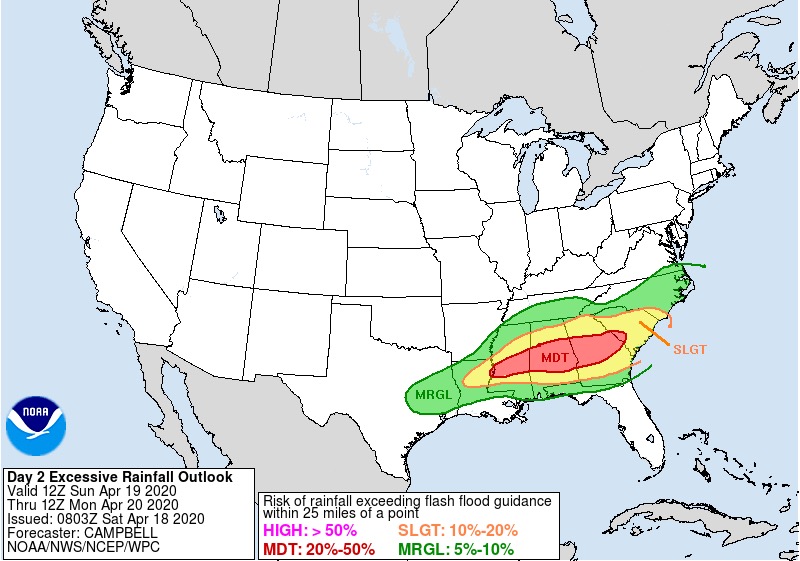
If you go by the nws graphic and you live in tuscaloosa co you can go from slight to enhanced to moderate all in 1 co! I think thats a great graphic to show how dramatic the cutoff is going to be from the haves and the have nots. This morning i noticed several models are dead set on montgomery area if you go by the uh streaks. Not sure if thats changed but you get the idea as of now the tornado threat remains s of 20/59 and id say from demopolis s. With the sharp cutoff there is going to be a surprise i feel. Further s or further n.