Brice
Member
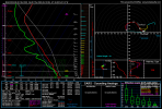
Expansive ENH today, and MDT forthcoming for parts of the Mid-Atlantic.
I’m in the MDT not too common at all.
Follow along with the video below to see how to install our site as a web app on your home screen.
Note: This feature may not be available in some browsers.
Expansive ENH today, and MDT forthcoming for parts of the Mid-Atlantic.
This might merit its own thread.
NWS Memphis seems a bit intrigued on Wednesday in their afternoon discussion:Wednesday starting to perk my interest more n more …. Look for a rather large enhanced risk coming in later updates , for august the shear isn’t bad for Ozarks over to the midsouth region….


We interrupt Summer to bring you Springtime In August
Or maybe upcoming fall severe season getting a earlier start lolWe interrupt Summer to bring you Springtime In August
Hopefully all 11 people got themAt least they are bothering to get TOR warnings out before there has been a TOG for 20 minutes. It's a start