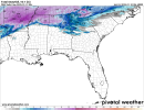
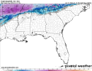
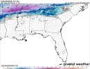
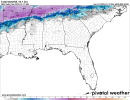
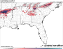
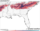
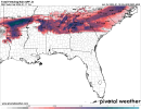
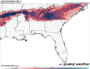
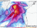
Let's see what happens with that heavier precip breaking out to the west and 850mb layer...if temps start running colder than modeled, we will know things may go differently. Models have been showing the temps crash a bit and then recover tomorrow....if the 850mb low winds up being weaker, the torch will not be as strong.
Navigation
Install the app
How to install the app on iOS
Follow along with the video below to see how to install our site as a web app on your home screen.
Note: This feature may not be available in some browsers.
More options
-
Welcome to TalkWeather! We see you lurking around TalkWeather! Take the extra step and join us today to view attachments, see less ads and maybe even join the discussion. CLICK TO JOIN TALKWEATHER -
Current Tropical Systems Melissa
You are using an out of date browser. It may not display this or other websites correctly.
You should upgrade or use an alternative browser.
You should upgrade or use an alternative browser.
Winter threat: 1/9-12/ 25
- Thread starter DetectiveWX
- Start date
The Colonel
Member
Great pointLet's see what happens with that heavier precip breaking out to the west and 850mb layer...if temps start running colder than modeled, we will know things may go differently. Models have been showing the temps crash a bit and then recover tomorrow....if the 850mb low winds up being weaker, the torch will not be as strong.
Last trend of the 850 level looks to be a little less amped, east of 65 and above I-20
Geno
Member
38 in the south end of Tuscaloosa. 40 at the airport.
brianc33710
Member
Gadsden rose 29-32, Pell City 30-36. BUT Haleyville & Muscle Scholes haven't increased ahead of incoming precip. They're the closest to what's ahead.
Still 33 here in remlap.
Gadsden rose 29-32, Pell City 30-36. BUT Haleyville & Muscle Scholes haven't increased ahead of incoming precip. They're the closest to what's ahead.
33 at Gadsden now, so they're back slightly above freezing.
MikeP
Member
Oddly enough, I'm up to 41 now in Bham. Wondering if my thermometer is off honestly....
brianc33710
Member
Airport is 39/12 as of 853, which is the official 9 pm observation.Oddly enough, I'm up to 41 now in Bham. Wondering if my thermometer is off honestly....
i have 35 at homeOddly enough, I'm up to 41 now in Bham. Wondering if my thermometer is off honestly....
Get you one of the old style thermostats, I set one right outside my window so I can look.Oddly enough, I'm up to 41 now in Bham. Wondering if my thermometer is off honestly....
*Woops I mean thermometer. Not thermostat. Gunna leave that goof uncorrected lol.
Geno
Member
37 in Tuscaloosa, dropped 1 degree in an hour.
Last edited:
brianc33710
Member
Well, when I said sometimes temps rise preceding these events, I didn't really want to be right. I had hoped the whole atmosphere would cool off so we'd all just have snow  . Obviously there's still time for evaporative cooling to turn things back around. Selma is the only site with an above 32 dp (34).
Flurry
Member
34 w/ DP 16 in Argo
Havaheart66
Member
Temp in Tallapoosa County was 40 two hours ago. Now it's 43.
Austin Dawg
Member
33° and it's been steadily raining or a few snow flurries all day long. It's about out of here headed east. Y'all have good evening.
lots of mixed precip and sleet reports in Miss. not seeing any snow reports

