What I sent to my county EMA and other officials this evening:
Good Evening!
What You Need To Know:
- Winter Storm Warning in effect for Monroe County and all of North MS from now until midnight Saturday.
- Total Snow/Sleet Accumulations: 2 inches
- Ice Accumulations: One tenth of an inch
- Timeframe: 10pm tonight thru 4pm tomorrow. (There is potential for a wintry mix and/or snow showers as early as 8pm)
- Impacts: Significant to Major travel issues, scattered to potentially widespread power outages (due to this being a heavy wet snow), and black ice issues (as what doesn't melt will refreeze)
IMPORTANT: I do NOT expect significant
ice accumulations!
I won't get into the meteorological details, but snow for Monroe County could be a literal on the fence type deal.
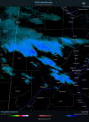
General Simple Meteorological Synopsis: A Gulf low is beginning to take shape off the coast of Texas. This is very similar to what occurred during the January 2011 snowstorm (6 inches for Northern Monroe) and the February 2015 snowstorm (8 inches for Northern Monroe). In both cases, you had a Gulf low in the same vicinity as this current one. All of Monroe County got snow in both 2011 and 2015. Northern areas of the county got more.
Scenario #1:
Gulf low tracks further south over the Gulf leading to more snow for Monroe County.
Scenario #2:
Gulf low tracks further north (just inland from the Gulf) leading to a wintry mess of snow, freezing rain, rain, and sleet. This would decrease our snow, but increase our risk of freezing rain/sleet.
I'm favoring the first scenario because it has more forecast models that have been very consistent with more snow for Monroe County and North MS in general. More on the snowfall expectations below.
How much snow?
That's the biggest question and one that I really don't know. However, I'm giving it my best shot.
The latest forecast models are hinting at the highest amounts (5+) across Northern Monroe County with lower amounts (4 or less) across Southern Monroe County.
Total Snow For Monroe County:
Low End Range: 1-3 inches
Mid Range: 4-6 inches
High End Range: 7-9 inches (locally 9+)
Again, I want to emphasize that towns/cities like Aberdeen could see 1 inch while Amory could see 5 inches while Smithville could see 8 inches. That's how wide ranging these totals could end up being and there's going to be a tight snow gradient.
Stay safe and aware everyone!
Meteorologist Johnny Parker