• Welcome to TalkWeather!
    We see you lurking around TalkWeather! Take the extra step and join us today to view attachments, see less ads and maybe even join the discussion.
    CLICK TO JOIN TALKWEATHER

Significant Tornado Events

This video shows that problem....at 2:25 or so the newscaster has a photo of Sawhill Tubular and identifies it as the Yourga Trucking Company....I guess it's easier to recognize so it gets more views?


Tornadotalk has some links to FB albums with F5 damage in Wheatland: https://www.tornadotalk.com/may-31-1985-tornado-outbreak/

This album has some incredible pictures: https://www.facebook.com/media/set/?set=a.10150209837408773&type=3

Yeah, I tracked down the person who owns those photos (most of them anyway) and asked them if they could make me higher-resolution scans, but it's been a couple of months now so I'm not terribly optimistic about them coming through. We'll see I guess. There's one guy who said he has lots of photos but will only show me in person and another guy who has a handful of pictures from around the area of peak intensity, but he's really weird about them and wouldn't give me permission to share. Pretty frustrating and I really can't say that I understand the rationale, but whatever.
 
Yeah, I tracked down the person who owns those photos (most of them anyway) and asked them if they could make me higher-resolution scans, but it's been a couple of months now so I'm not terribly optimistic about them coming through. We'll see I guess. There's one guy who said he has lots of photos but will only show me in person and another guy who has a handful of pictures from around the area of peak intensity, but he's really weird about them and wouldn't give me permission to share. Pretty frustrating and I really can't say that I understand the rationale, but whatever.
It's amazing how many people have access to information no one else does but don't want to share it for weird, personal reasons.
I'm sure when he dies some family member will upload all of them without his permission anyways lol. One can hope.
 
It's amazing how many people have access to information no one else does but don't want to share it for weird, personal reasons.
I'm sure when he dies some family member will upload all of them without his permission anyways lol. One can hope.
Yeah, it's weird. And then there are other people who've literally offered to mail me their physical photos, scrapbooks, etc.

The thing that really drives me crazy is thinking about all the people out there who have incredible, historically significant photos just like sitting in an old shoebox somewhere or something. They're usually willing to share but they often don't even realize anyone would be interested in seeing them, which means usually no one else even knows they have the photos. Makes it super, super hard to find them.
 
Considering its reputation, it has been rather difficult for me to find damage photos from the first Tanner tornado of 4/3/1974. What I have found, however (mostly from the NWS Huntsville page) indicates it was an incredibly violent tornado:
Tanner-F5-damage-bathtub.JPG
Probably the most iconic sight from the tornado was a bathtub embedded deeply into the ground.

Tanner-F5-damage-pump.JPG
A water pump pulled out of the ground.

All of the following photos are from the NWS Huntsville page and are photos of an aerial damage survey. Some of the homes are so obliterated it can be hard to tell there were homes there at first glance:
Tanner-F5-damage-aerial.JPG
Tanner-F5-damage-aerial2.JPG
Tanner-F5-damage-aerial3.JPG
Tanner-F5-damage-aerial4.JPG
Tanner-F5-damage-aerial5.JPG
Tanner-F5-damage-aerial-wide.JPG
 
Yeah, that is definitely a significant underestimate but those homes would probably be given a low-end EF4 rating or high-end EF3 today if the surveyors were more conservative today.
For sure. I can't imagine there were many homes struck by any of the tornadoes during the outbreak that could've supported an EF5 rating today, at least not without considering the surrounding context. Just really difficult to rate high-end tornadoes, especially in regions where building codes aren't as strong.
 
I feel like there should be some sort of crowdsourced driven website for these old tornado/damage pictures and videos that actively builds a network to go out and find these things.
That'd be fantastic. There's SO much out there but it can be pretty exhausting trying to track it down. Some sort of organized effort would make things much easier, especially if people could also upload their own photos & info to be indexed.
 
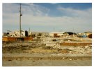
While looking at the Harvey County Historical Society's photo collection I found two photos from Hesston that caught my eye:
default.jpg

A heavily damaged building with what looks like intense ground scouring in the foreground; hard to say for sure though.

default.jpg

The heavily damaged King Construction office building
Speaking of Hesston, the Buller photos have to be one of my favorite series of tornado photos ever:


Edit: BTW, the Hesston Library has a gigantic amount of material for anyone who hasn't checked it out yet.

 
Last edited:
Here are some more Hesston photos, these I'm not sure what to make of:
Hesston-F5-damage-cleanup.JPG
Hesston-F5-damage-home2.JPG
Some homes possibly swept away; however I was unable to discern if these homes were swept away by the tornado, or by clean-up crews. You're free to decide.

This next photo I couldn't even guess what is going on here. A large building swept away or cleanup, I have no idea:
Hesston-F5-damage-groundlevel.JPG
 
Back
Top