It's hard to believe that a year has passed since the Bassfield Tornado's occurrence. The tornado was spawned by the first of two discrete supercells to interact with the extremely potent warm sector. A very dynamic system was moving very quickly across the area, providing very strong directional kinematics, and allowing for lots of wind shear and streamwise vorticity to manifest across the warm sector. Although the storm mode for the most part wasn't discrete, the first of the two cells to become discrete was the one responsible for the Bassfield Tornado.
Forecast HRRR sounding for the affected area about an hour prior to the tornado. At this time, clearing was occurring in that part of the warm sector, which enabled the cap, which had been present there for nearly the whole day, to finally erode to a level weak enough to support discrete convection. Note how much streamwise vorticity is present in the lowest 2 kilometers of the atmosphere, and how strong the winds remain until right before the ground. The winds from 6 kilometers to 2 kilometers above the ground, as evidenced by the SR Wind with Height Graph do not change, which supports a semi-high precipitation storm mode. The only saving factor would be the extreme shear values, which partially vented the updraft free of precipitation. This is a textbook violent tornado environment.
View attachment 8688
The supercell thunderstorm responsible started out as a bunch of weak convection moving in from the New Orleans vicinity, which quickly organized into a supercell thunderstorm once the capping inversion broke, at around 21:00 UTC. The supercell produced the first tornado, also rated EF4, at 21:39. That was a large wedge tornado that completely swept away an anchored guest home with such force that the anchors were bent significantly as the home was slabbed, cracking part of the foundation. Trees nearby were debarked and wrapped tightly with hay bales that had been thrown onto them by the tornado and may have contributed somewhat to the home's destruction. The tornado killed two here and killed two more in rural areas when a mobile home was obliterated before it finally died in a wooded area at 21:05.
The first EF4 Tornado at peak intensity on radar, at around 21:50 UTC. The tornado had just produced EF4 damage at this stage and was still likely of that intensity.
View attachment 8689
The first large EF4 Tornado caught on camera at peak intensity, while or just after EF4 Damage had been produced
View attachment 8690
The supercell cycled, as convective interference associated with the first tornado caused it to occlude. I'll post some damage pictures from the first tornado in a later post, which exhibit classic signs of violent tornado damage. The supercell, which had by this time fully matured and cleared its inflow notch from any convection, developed a massive area of inflow, and an extraordinarily violent mesocyclone. The mesocyclone was so strong that the radar began to glitch and miss some of the particles. The next and most violent tornado touched down at 21:12. It quickly grew large and killed a person in a mobile home. The intensity and width rapidly increased, and EF4 tree damage began to occur east of the town. Due to the parent supercell having strengthened considerably since producing the first tornado, evidenced by the Echo Tops increasing to over 50,000 feet during the tornadogenesis of the Bassfield Tornado, it's likely that the tornado would have been obscured by precipitation, and further hampered by low cloud bases. It would've been nearly impossible to see coming until later when the supercell gradually weakened near Soso and Moss. The tornado impacted a Cafe, with four people inside. The cafe was unanchored and had no shelter, and all four inside perished. Trees nearby were debarked, and a trailer was found wrapped tightly around a tree.
Remains of the cafe and debarked trees nearby
View attachment 8692
View attachment 8691
View attachment 8693
The intensity continued to increase as the violent tornado moved further to the northeast when it approached a well-anchored log cabin. A car from the farmstead was tossed over 200 yards, and little was ever recovered from the log cabin. It was completely swept away. I find the tree damage puzzling, as it wasn't really intense, however, the intensity of the damage here suggests a narrow sub-vortex may have been responsible.
View attachment 8694
The worst damage occurred at a grove of trees along Willie Fortenberry Road. The trees were completely stripped and debarked. Debarking is usually done by debris, not by the actual tornado itself. There was only one structure nearby, a home that sustained solid EF3 damage. Yet, these trees were completely stripped. It was at this location that the NWS in Jackson stated that it was "the worst tree damage we have ever seen."
View attachment 8695
View attachment 8696
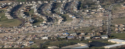
The monster widened significantly after this point and weakened a lot. However, the two-mile-wide monster was still easily strong enough to produce EF4 damage, which occurred to a few businesses along its track, and in the Moss area. The tornado finally weakened as the supercell began to interfere with nearby convection, and finally shrunk back into the clouds. However, the area was not out of danger yet, as a second supercell, trailing immediately northeast to the track of the first one, was able to drop an EF3 Tornado that lasted 84 miles, despite the effects of rain-cooled air in the wake of the first storm.