related to what we are all talking about for the Mets in here: which of these events would you consider to have been the “most optimal” environment ever for violent tornadoes? I would be curious if there are ways to simulate outcomes for events like this to see how many play out just like this or what elements could come into play to either reduce or, heaven forbid, even enhanced the threat further.
Just from my reading in the past, it’s felt like April 27, 2011 has become seen as the gold standard.
Not a met, but I’ll answer anyways.
At the end of the day, tornadoes care about shear above anything else.
All super outbreaks have the same general kinematics, (high shear/low to moderate cape), completed with a stout mid level inversion layer.
The requirement of high vertical instability (LLLR of 7+c/km and 1000+j/kg cape) ceases to matter once you have a LLJ velocity exceeding 45knots coinciding with environment SRH values of 400+. As long as you have it (warm air under cold air) LLLR can be under 5c/km and cape being sub 1000j/kg, it doesn’t matter.
Obviously though, you need a strong forcing mechanism superimposed over a diffuse enough front with a stout mid level inversion layer to get the ideal storm mode to take advantage of these kinematics.
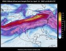
It’s extremely difficult to get a trough orientation that would get you a jet streak maximum over the OWS (which is what’s mainly responsible for having a strong LLJ) plus having all of the aforementioned elements come into play.
The vast majority “potential super outbreak” days, like March 15th, 2025 for example, have most of these kinematics in place, but it either ends up being a problem with the inversion layer, and the forcing mechanism; usually resulting in messy storm modes.
March 14th, 2025, really just needed a more expansive OWS and we easily would’ve had a super outbreak on our hands that night. It’s important to keep in mind that the Palm Sunday outbreak really didn’t have expansive storm coverage.
Unlike the 1974 or 2011 super outbreaks, that had confluence banding all throughout their much more expansive OWS which storms initiated on, Palm Sundays storms were limited to right along the dryline.
However, unlike the Pi day outbreak, Palm Sunday had a OWS that expanded out eastward far ahead of the storms; which gave them ample space to continuously cycle tornado after tornado, a luxury the Pi day outbreak didn’t have fortunately.


 www.tornadotalk.com