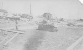
• Welcome to TalkWeather!
    We see you lurking around TalkWeather! Take the extra step and join us today to view attachments, see less ads and maybe even join the discussion.
    CLICK TO JOIN TALKWEATHER

Significant Tornado Events

I'm not sure about 222 miles but maybe 210 or so, I think the Shannon County, MO funnel was a separate tornado and the main tornado begins in Reynolds County, MO (right next door) a few minutes later. Either way, Tri-State's likely one of the few very long track events that is likely a single tornado for most of the path, pretty remarkable.
Shannon was the one that was 15 miles west of the beginning of the main path, right? That one was split off in Loco's map as well. He also split off the second brief tornado in Indiana.
 
More photos from the 5/31/85 Atlantic, PA F4, mostly around Cherrytree Rd & Rt 417 south of Cherrytree. There's a bunch of them so I stuck them in an album to avoid overwhelming the thread:


This particular photo shows a wider view of the intersection looking SW. Sadly, six of the victims I wrote about in my article (Charles, Judy & Brock Best, Viola McCormick, Beverly & Pamela Westfall) died in this short stretch:

wKiayMs.jpeg
 
I think not. There really is only one notable possible break point, in MO, and I am inclined to believe it was a single tornado due to the consistent heading. I'd also bump up the path length to 222 miles in accordance with @locomusic01's findings.

BTW, that article Juliett posted about the Tri-State Tornado reveals that the official death toll is over 100 people too low. The actual death toll, as shown in the article: 798.
Indeed, but I will say that when myself and the rest of our team researched the death toll, we decided to use the same standards that were used in 1925. So a large portion of the deaths (probably around a hundred) would be attributed as secondary causes or indirect deaths today. But it gets a bit too messy otherwise and in all honesty it drove me nuts going through literally thousands of names that we did haha. But yeah, we were generally very strict when looking into the deaths and we had to have written documentation of the cause of deaths and whether it was officially or unofficially attributed to the tornado. One thing in particular is that the regional death tallies when combined exceeded the red cross number of 689 (and the currently stated 695). So we had to try and be as precise as possible. What we found is that in many instances, people who were listed as deaths in x place were actually in another place so it got a bit messy but we managed!

I did wonder whether anyone saw that table since the article is so damn long lol.

1748102344449.png
 
Late but on topic because I decided to revisit Brandon today.

Second - I think the most suspicious long tracks are the ones with random jarring path changes. Brandon is one - it takes all these sharp angles and zigzags, and I have confirmed it was not a single tornado. In fact, not only did I split it into 7-9 tornadoes (there's 2 I'm unsure are tornadoes), but I concluded that the tornadoes from the Ethel area onward were likely produced by an entirely different supercell. Whoops.

When the track is basically straight arrow NE with little direction changes, then the likelihood of being legit increases. Hazelhurst 1969, the 1971 MS Delta tornadoes, Guin 1974 and Wilson 1992 are ones I'd bet on being continuous (or at least over 100 miles), though this doesn't always mean it was continuous (Albion 1990).

If I had to list some high confidence (IMO) VLTs, they would be:

Tri-State 1925 (for the full 200+ miles, not counting the weak tornadoes that bookended it)
Hazlehurst 1969
Delhi-Inverness 1971
Cary-Pugh City 1971 (the 114 mile track, not the 202.1 mile track)
Guin 1974 (I trust Tornado Talk for path lengths on old events such as this)
Jasper 1974
Wilson 1992 (Surveyors aren't always right but I trust them somewhat on an event this recent, coupled with no obvious discrepancies in the official track)
Every 100 miler after 2008

I'd like some input on other notable VLTs I'm unsure of like Primrose, btw.

IMO a path being fairly straight isn't necessarily reliable, families can be straight - Fujita even had a term, 'series mode' for them. Secondly it depends on how the tracks were plotted and we usually have little detail. The Storm Data entry for the Wilson tornado makes it sound like the path was not obvious and that they tried hard to make it join up. I don't have Grazulis' full entry on hand but the statement on Wiki that it was inexperienced surveyors tallies. The path in the NOAA is report is made of long segments and has enough changes in direction you could fit a family. The Ellettsville IN tornado was even more recent yet from its description and satellite imagery it was a family. There's no good imagery for the Wilson tornado and I could't find it on aerial imagery from March 1993. Given the history of spuriously long tracks, I'd want more evidence, and I say we won't know unless someone does a detailed study.

The Lawrence and Albion tornadoes from 1990 are two events whose courses are fairly straight with no major deviations, yet both are pretty much confirmed families by their descriptions - they are two events that I would like to see broken down by detailed research.

I'd add that we don't have the notes of surveys (I suppose they could still exist somewhere). We don't have Grazulis' working, nor do we often have the working of the various amateurs (whether here or on other websites) who try reconstructing past events. We can sometimes independently check (for example we can look at the aerials Tornado Talk used for the 1971 outbreak) but not always, at least without a lot of effort. Different people interpret data differently, so one researcher may come to a different conclusion to another about a given event.

(Moving on)
With the Jasper tornado, the path is easily visible on satellite (though not nearly as intense as Guin) from around the Sipsey River to Jasper. The earlier part isn't visible and the later part might have some faint suggestions that could be imagined. The storm data description says it was 'almost continuous' before Jasper and 'skipping' after, Fujita's map based on aerial survey lends an argument to its continuity. I wouldn't put it on the certain pile without further study.

For Yazoo City, south of French Camp, there appears to be another break. The path becomes indistinct around the Natchez Trace Parkway. Then a new one appears displaced to the north. This would make the Yazoo City tornado's path 83-84 miles long.

snapshot.png frenchcampyazootrack.jpg

Near Durant there's something a bit harder to interpret. The path narrows and swings on a curved course around the town. It appears to possibly end, then resumes from a clear area on the heading that it had before (unfortunately it goes from a cleared area). This could be another path break, a failed occlusion or even a merger. If it is a break, then it makes the Yazoo City path 56-57 miles long.

snapshot (1).png durentyazootrack.jpg
 
Near Durant there's something a bit harder to interpret. The path narrows and swings on a curved course around the town. It appears to possibly end, then resumes from a clear area on the heading that it had before (unfortunately it goes from a cleared area). This could be another path break, a failed occlusion or even a merger. If it is a break, then it makes the Yazoo City path 56-57 miles long.
I can very, very, VERY faintly make out the damage path in this one and it is continuous. French Camp is definitely a break though, and so Yazoo City becomes the latest "false VLT", and loses the title of Mississippi's longest reliably tracked tornado to Enterprise 2011 (130 miles according to TT).

EDIT:
Lawrence actually DOES have a major due eastward deviation around 100 miles into the path. It's obvious when you look at it in Tornado Archive. If Lawrence did cycle, it most likely did so there.
 
IMO a path being fairly straight isn't necessarily reliable, families can be straight - Fujita even had a term, 'series mode' for them. Secondly it depends on how the tracks were plotted and we usually have little detail. The Storm Data entry for the Wilson tornado makes it sound like the path was not obvious and that they tried hard to make it join up. I don't have Grazulis' full entry on hand but the statement on Wiki that it was inexperienced surveyors tallies. The path in the NOAA is report is made of long segments and has enough changes in direction you could fit a family. The Ellettsville IN tornado was even more recent yet from its description and satellite imagery it was a family. There's no good imagery for the Wilson tornado and I could't find it on aerial imagery from March 1993. Given the history of spuriously long tracks, I'd want more evidence, and I say we won't know unless someone does a detailed study.

The Lawrence and Albion tornadoes from 1990 are two events whose courses are fairly straight with no major deviations, yet both are pretty much confirmed families by their descriptions - they are two events that I would like to see broken down by detailed research.

I'd add that we don't have the notes of surveys (I suppose they could still exist somewhere). We don't have Grazulis' working, nor do we often have the working of the various amateurs (whether here or on other websites) who try reconstructing past events. We can sometimes independently check (for example we can look at the aerials Tornado Talk used for the 1971 outbreak) but not always, at least without a lot of effort. Different people interpret data differently, so one researcher may come to a different conclusion to another about a given event.

(Moving on)
With the Jasper tornado, the path is easily visible on satellite (though not nearly as intense as Guin) from around the Sipsey River to Jasper. The earlier part isn't visible and the later part might have some faint suggestions that could be imagined. The storm data description says it was 'almost continuous' before Jasper and 'skipping' after, Fujita's map based on aerial survey lends an argument to its continuity. I wouldn't put it on the certain pile without further study.

For Yazoo City, south of French Camp, there appears to be another break. The path becomes indistinct around the Natchez Trace Parkway. Then a new one appears displaced to the north. This would make the Yazoo City tornado's path 83-84 miles long.

View attachment 43305 View attachment 43306

Near Durant there's something a bit harder to interpret. The path narrows and swings on a curved course around the town. It appears to possibly end, then resumes from a clear area on the heading that it had before (unfortunately it goes from a cleared area). This could be another path break, a failed occlusion or even a merger. If it is a break, then it makes the Yazoo City path 56-57 miles long.

View attachment 43307 View attachment 43308
I always suspected Yazoo City of being a family, this finally confirms it.
 
I can very, very, VERY faintly make out the damage path in this one and it is continuous. French Camp is definitely a break though, and so Yazoo City becomes the latest "false VLT", and loses the title of Mississippi's longest reliably tracked tornado to Enterprise 2011 (130 miles according to TT).

EDIT:
Lawrence actually DOES have a major due eastward deviation around 100 miles into the path. It's obvious when you look at it in Tornado Archive. If Lawrence did cycle, it most likely did so there.

The tracks in TA are from the SPC/NCEI database and can't be taken at face value. They were constructed by converting text reports into (usually) county based segments with coordinates. The original reports aren't very precise, usually giving a locality, estimated distance (often only to the nearest mile and the centre or edge of town?), and rough direction. Many tornadoes weren't surveyed in the detail we're used to now - If Grazulis' comments in 1989 are true, the NWS didn't have the resources.

Aside from clerical errors, the conversion process introduced more inaccuracies, probably due to distances and directions not matching county lines, further rounding, misplaced localities and other causes. The result is that paths are often not where they're supposed to be, which can be found where other data exists.

This can introduce irregularities into a track that weren't originally recorded. For a mild example, here's the Albion path from the SPC data compared to the original map by Brian E Smith at the NSSFC. You can see it's much more jagged and incorrectly overlaps another track:
Screen Shot 2025-05-28 at 5.01.20 pm.png Screen Shot 2025-05-28 at 5.00.17 pm.png


The errors can be quite remarkable, like this example from 1993 remapped by Tornado Talk:
1748415503135.png

As a result I don't consider it good enough for fine details on where a tornado went, especially as the errors are very frequent.

The Lawrence description gives the tornado's entrance to a county by a rough distance and direction from a town in that county. The eastward jog is a very short section in Seward Co, with the entry being referenced to 11 m WNW of Staplehurst (the much closer town of Gresham in York Co isn't mentioned in the report). The Butler Co entry is supposed to be 6m SSW of Ulysses, but the SPC data segment starts well south of the county line (it ends too far N as well). Moving it to the county line straightens the jog. It doesn't remove it, but as it's only to the nearest quarter or half mile it could be straightened more. It's possible they had access to more detailed reports, but Edwards' paper on database errors makes me think that's unlikely. The rest is closer to the county lines. The start and end of the segment are exactly the same latitude. There's also much more obvious errors from the same outbreak. I think it's a database error and a fairly small one compared to others.

I'm belabouring the point to death, but I don't think one could say Wilson is less likely a family than Lawrence because the Lawrence's SPC path has a jog. Because the SPC paths themselves are often only approximate at best, missing the intricacies of a tornado's path, have errors, and are downright nonsense at worst. They aren't good enough quality so the apparent details often aren't relevant.

As a side note, I now officially concur with the assessment that Brent-Centreville was a family:


When Sentinel Hub was still free I fancied that I could see three tracks, the main one ending in the lower left corner, then a considerable gap, and two much shorter ones. A reporter, John Brasher, claims to have flown over it and that it 'never lifted from the ground' between Brent and Columbiana, against what the imagery shows. Even if true, that still leaves many miles unaccounted for.

Centreville1973 copy.png
 
Last edited:
I think people forget how truly violent the 2013 Moore/Newcastle EF5 really was. Out of the unbelievable 4253 objects considered damaged by the tornado, 4222 were surveyed for an EF-Scale assessment:

-50% were EF0 in rating
Excluding EF0 damage:
-38% were EF1 (825 DIs)
-24% EF2 (502 DIs)
-21% EF3 (462 DIs)
-17% were violent, EF4 DIs (363 DIs)
-0.4% EF5 (9 DIs)
17% of the 14-mile long, 1.05 mile wide surveyed area, was damage of EF4 intensity.

That is an unbelievably vast swath of violent damage, with 363 individual damage indicators of EF4 strength.

I dont think that's truly something we've seen since; sure, the lack of an EF5 rating in now 12 years is downright stupid: but I cannot deny that Moore 2013 really does stand out. Zones had to be made just for people to recognize their streets, it produced some of the worst vegetation damage from an EF5, plus mangled cars to the point of being unrecognizable.

Here are some rare views of the damage I've discovered on YouTube:
View attachment 42683
View attachment 42684
View attachment 42685
View attachment 42686

Combined with these; here are photos from the aerial survey of this EF5; this is what gave the surveyors the ability to determine many of the EF2-EF4 damage indicators; the (9) EF5 DIs were examined on the ground: these pics are by Dr. Roger Wakimoto
View attachment 42687
View attachment 42688
View attachment 42697
View attachment 42699
Just LOOK at how violent the core vortex scar is; you can visibly see how consistent, stable, and strong the end-wall, core vortex is.
Such a rare level of strength
It’s impressive for sure, but we have to remember that a major reason why we haven’t had a tornado produce this level of EF-4+ DIs since is that we haven’t had a violent tornado of this intensity impact a major metro like this since.

Yes, there have been several towns and smaller cities that suffered immense damage from likely EF-5s (saying likely based on what they were capable of at peak intensity, not necessarily the top-end DI they caused) like Mayfield, Rochelle, Rolling Fork, Greenfield, etc…However, Moore 2013 basically had structures in its path for almost its entire lifecycle because of where it hit.

If we end the EF-5 drought at some point soon without any reform to the scale, it’s probably going to take a tornado of this strength and intensity in a major metro, something that will have absolutely devastating consequences.
 
Something I’ve been thinking about for a while that I wanted to discuss here is how we should categorize and discuss outbreak intensity. While there are some metrics out there that do this, like the Outbreak Intensity Score, I’ve thought the way we think about these events should be adjusted based on a number of different factors.

For example: the Great Plains, generally speaking, have fewer structures and unconventional DIs like trees for tornadoes to impact. Therefore, even if we had or have had events that were capable of being a super outbreak in this region, you wouldn’t end up with an event grading out as that because it’s highly unlikely that you could ever have enough tornadoes earn an EF-3+ rating to put it anywhere near April 27, 2011 or April 3, 1974. Take April 14, 2012 as a good example. That event produced 113 confirmed tornadoes which is top-tier for a plains event. Yet, many potential intense/violent tornadoes that day impacted nothing, therefore knocking it down significantly in the OIS rankings.

You could also argue that events like the 1965 Palm Sunday outbreak, the 1984 Carolinas outbreak, or May 31, 1985 were “generational” or super outbreaks for their own regions of the country, even if their overall intensity of those events didn’t approach the 1974 or 2011 events (although Palm Sunday 1965 did produce a number of violent tornadoes basically on par with those events which is why some consider it to be a super outbreak).

Has there been an in-depth discussion of this on this thread before?
 
So this is random, but I just realized I have a handful of photos from the Mulhall F4 that I can't believe I somehow forgot to include in my article. Doesn't look like I've ever posted them here, either. Most unfortunately still aren't from the hardest-hit areas, but I figure anything new is worth sharing.

First one here is looking due E across town, roughly centered on Baty Ave/E0665 Rd:

nI0gOsm.jpeg


Very similar to one I'm pretty sure I did include in my article, which is just wider and from a higher angle (and obviously earlier in the cleanup process):

PYPsDSJ.jpeg


Another aerial view of Mulhall, this one looking N and centered around Lewis St:

5tSb6hM.jpeg


I believe this one is Hwy 77 on the southern edge of town, probably just slightly N of where the tornado crossed:

H6dnm4t.jpeg


Pretty sure the next three are all from around where the included aerial shot was taken (just S of N3080 Rd & E0720 Rd), which is ~9 mi SW of Mulhall and basically right where the Mulhall F4 and Crescent F3 paths crossed:

i4l5yEU.jpeg


Aj3ekZ9.jpeg


CJjX5eK.jpeg


ErBrOdY.jpeg


Last two I haven't had time to geolocate yet:

yxMlLgA.png


nZFLxne.jpeg
I can’t tell in the last pic, but that could be some slight scouring.
 
Not sure if I shared this but a recent image i was given by a descendant of a tri-state tornado survivor shows such gnarly vehicle damage that I thought I might just make a brief post showing a few other examples of pretty intense vehicle damage from the tornado. This is of course not a full list as there are close to 2,000 photos and many show cars in but here are some notable ones.
1748546546459.png
A pretty mangled car at the high school in murphysboro. There are much worse instances of vehicle damage in murphysboro, often taking a back seat to more general scenes of devastation, but you can squint in the aerials and bi-plane film to see the husks of mangled cars deposited many blocks away.

1748546806384.png
This crumpled ball of metal is also another vehicle from murphysboro, if you squint you can see the circular headlight.

Already mentioned this one but here is a completely stripped car near the Reliance Mill.

1748547167927.png

Crumpled car in De Soto1748547316292.png

Also De Soto, severe ground scouring and tree damage as well as a rolled vehicle.
1748547345111.png
De Soto again, this time a mangled car amongst fallen trees, might have to try and zoom in to the left to make it out fully.
1748547556356.jpeg

This one has been shared before and is somewhere between Plumfield and West Frankfort.
1748547588807.png

This one here was a car that was thrown about 500 yards from the car park at orient 2 into a field facing towards the C.E.I railyards.
1748548017952.jpeg

Vehicles at Caldwell having a bad day.
1748548115463.png
1748548178844.jpeg
At peabody 18.

Originally wanted this to be just one post but i got a few more lol.
 
Part 2. This has that new photo I was talking about. In fact here it is, taken near Parrish. The driver did in fact survive.
1748548247910.png
Mary Slider provided this photo.

Griffin had extreme vehicle damage so severe that some vehicles were just torn apart and their frames peppered the debris and was wrapped around trees. Here though is a more complete vehicle.
1748548449391.png

Perhaps the most famous image of a vehicle is Orley McClean's model t ford that was thrown a mile in Gibson County. He survived despite being carried the full journey with it.

1748548541006.png


More vehicle damage from that area.
1748548611753.jpeg
1748548632160.png
1748548644057.png
Not a car but a piece of farming machinery that was torn up.
1748548684333.png
More vehicles.
1748548696261.png
Extreme vehicle damage in princeton and scouring
1748548744170.png
Somewhat harder to spot is the pancaked model t thrown 500 feet here. Look at the center bottom on the foot of the rail road embankment.
1748548794932.png
 
Part 2. This has that new photo I was talking about. In fact here it is, taken near Parrish. The driver did in fact survive.
View attachment 43404
Mary Slider provided this photo.

Griffin had extreme vehicle damage so severe that some vehicles were just torn apart and their frames peppered the debris and was wrapped around trees. Here though is a more complete vehicle.
View attachment 43405

Perhaps the most famous image of a vehicle is Orley McClean's model t ford that was thrown a mile in Gibson County. He survived despite being carried the full journey with it.

View attachment 43406


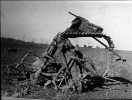
More vehicle damage from that area.
View attachment 43407
View attachment 43408
View attachment 43409
Not a car but a piece of farming machinery that was torn up.
View attachment 43410
More vehicles.
View attachment 43411
Extreme vehicle damage in princeton and scouring
View attachment 43412
Somewhat harder to spot is the pancaked model t thrown 500 feet here. Look at the center bottom on the foot of the rail road embankment.
View attachment 43413
It really seems like throughout the whole path, the Tri State was at an exceptional intensity.
 
It really seems like throughout the whole path, the Tri State was at an exceptional intensity.
Indeed, as the interactive damage map shows, it maintained its violent intensity (it had a red (devastating) damage indicator) for every mile in a continuous 165 or so mile stretch (that is of the confirmed continuous path of 174 miles) so besides a few miles at the start and end, it maintained its violent strength. Truly remarkable honestly.
 
Back
Top