• Welcome to TalkWeather!
    We see you lurking around TalkWeather! Take the extra step and join us today to view attachments, see less ads and maybe even join the discussion.
    CLICK TO JOIN TALKWEATHER

Significant Tornado Events

Indeed, as the interactive damage map shows, it maintained its violent intensity (it had a red (devastating) damage indicator) for every mile in a continuous 165 or so mile stretch (that is of the confirmed continuous path of 174 miles) so besides a few miles at the start and end, it maintained its violent strength. Truly remarkable honestly.
What town/area do you think the tornado peaked in? If I had to guess, it would’ve been from West Frankfort to Griffin.
 
What town/area do you think the tornado peaked in? If I had to guess, it would’ve been from West Frankfort to Griffin
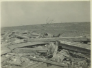
This question has been asked before to me elsewhere. My answer hasn't much changed lol...I don't know. I mean there are about 10 different locations where I can pick out and say it was exceptionally extreme, but there is not one single area I can definitely say it peaked here etc. West Frankfort and Griffin are both solid answers and definitely among the most extreme areas as is the caldwell-parrish area, Murphysboro-De Soto area, and the area between Gorham and Murphysboro. Even in Missouri there are areas that I would pick out, like Emily Shrum's place, Conrad School, the Fellows home to Biehle, Judge Claus Stueve's home etc. And of course the rural areas in Hamilton and White County. I mean this photo here shows what remains of an 18 acre densely populated forest. Almost all the hundreds of trees were obliterated.
1748550035814.png
1748550043171.png
A home in that area, once a beautiful and large farm.
1748550057206.png
Another


1748550070451.png


This was the Hubble Place (william or Norman) there is some uncertainty as to which one owned the property.
1748550287996.png


And of course even north of owensville and in rural Gibson County it produced extreme damage.

1748550213900.jpeg
1748550227776.png
1748550239107.png
1748550247848.png
 
Indeed, as the interactive damage map shows, it maintained its violent intensity (it had a red (devastating) damage indicator) for every mile in a continuous 165 or so mile stretch (that is of the confirmed continuous path of 174 miles) so besides a few miles at the start and end, it maintained its violent strength. Truly remarkable honestly.
There was also another exceptionally violent tornado from this outbreak that I see discussed very little. Is there any imagery from the tornado that formed north of Gallatin, TN on the same day and tracked for 60-ish miles? I've heard some extreme things about it, including intense ground scouring, slabbing homes and dismembering people violently. It's listed as an F4 but was very likely an F5 instead and I would be very interested to hear more about it.
 
Lick Creek Church (had a large portion of its concrete foundation torn up and thrown never to be found, the stairs were also blown over and the iron bridge to the south was ripped up and thrown 400 feet. In this photo you might note the two massive trees still standing, but all around them you can see the completely debarked and stripped trunks of other trees not as fortunate. This area (also where the persimmon trees were and this home of Raymond Van Winkle another photo from the area) had the highest ratio of deaths per how many were in the path. Only A couple people survived and they were severely injured in this area and 11 were killed. Raymond's daughter was actually thought to be dead since she was so terribly injured and unresponsive, but was later found to be alive.
1748550668362.png
1748550677982.png
1748550695896.png
1748550722244.jpeg
 
There was also another exceptionally violent tornado from this outbreak that I see discussed very little. Is there any imagery from the tornado that formed north of Gallatin, TN on the same day and tracked for 60-ish miles? I've heard some extreme things about it, including intense ground scouring, slabbing homes and dismembering people violently. It's listed as an F4 but was very likely an F5 instead and I would be very interested to hear more about it.
I disagree with the F4 and absolutely believe it to be F5 intensity. It killed nine people in one home, produced extreme scouring and tree damage, and ripped up the Liberty church whole leaving only the concrete steps to it. It also threw large stones from a quarry 30+ feet into trees.
1748550794744.jpeg
1748550803446.jpeg
1748550811937.jpeg
1748550820608.jpeg
1748550831253.jpeg
1748550839182.jpeg
1748550847834.jpeg
1748550859980.jpeg
1748550875759.jpeg
1748550886996.jpeg
Also the 60 mile track was likely two tornadoes, with the gallatin one ending shortly after entering KY.
 
There was also another exceptionally violent tornado from this outbreak that I see discussed very little. Is there any imagery from the tornado that formed north of Gallatin, TN on the same day and tracked for 60-ish miles? I've heard some extreme things about it, including intense ground scouring, slabbing homes and dismembering people violently. It's listed as an F4 but was very likely an F5 instead and I would be very interested to hear more about it.

Loco's Tri-State article discusses the Gallatin, TN tornado.


There was also another mile wide tornado that touched down in Harrison County, IN that swept away several farmsteads near Laconia and Elizabeth, Indiana. Grazulis ranks it F4 but it likely was F5.
This whole outbreak was a lot more impressive than we likely realize.
And there are likely many tornadoes we don't know about that happened on this day. Even for tornadoes like Gallatin the information is scarce as tri-state took center stage (understandably).
 
I disagree with the F4 and absolutely believe it to be F5 intensity. It killed nine people in one home, produced extreme scouring and tree damage, and ripped up the Liberty church whole leaving only the concrete steps to it. It also threw large stones from a quarry 30+ feet into trees.
View attachment 43429
View attachment 43430
View attachment 43432
View attachment 43433
View attachment 43434
View attachment 43435
View attachment 43436
View attachment 43437
View attachment 43438
View attachment 43439
Also the 60 mile track was likely two tornadoes, with the gallatin one ending shortly after entering KY.
What the hell was Grazulis doing in some of his ratings? It really was such an arbitrary process.
 
What the hell was Grazulis doing in some of his ratings? It really was such an arbitrary process.
He was compiling information on 12,000+ tornadoes; mistakes are going to be made.
Plus, he didn't have access to as much info as we do now. Again, mistakes are going to be made.
Really, he did many people a huge favor by retroactively rating so many historical events that happened before the development of the Fujita Scale.
 
Last edited:
He was compiling information on 12,000+ over decades; mistakes are going to be made.
Plus, he didn't have access to as much info as we do now. Again, mistakes are going to be made.
Really, he did many people a huge favor by retroactively rating so many historical events that happened before the development of the Fujita Scale.
Grazulis is an amazing archivist and his documentation of these events are unmatched, and as you noted are integral to tornado history. However, this doesn’t put him above criticism. He has quiet a few instances of head scratchers and inconsistencies in how he applied the ratings.
 
This isn’t necessarily Grazulis’ fault per se, but the retroactive ratings did add in a lot variability and skewing to the total historical record and database of tornado ratings. Many Tornados were either grossly overrated or underrated, and consistency was hard to establish. This leads to questions I have actually seen quite a few times on this forum which is “where are all the big outbreaks?” Because it seemed like the 20th century was full of them. When in reality, it’s an apples to oranges comparison between the retroactive historical Grazulis ratings, the F scale period, and now the EF scale

Anyways, don’t want to derail this thread with F scale talk. I had never seen photos of the Gallatin tornado before!
 
Last edited:
Grazulis is an amazing archivist and his documentation of these events are unmatched, and as you noted are integral to tornado history. However, this doesn’t put him above criticism. He has quiet a few instances of head scratchers and inconsistencies in how he applied the ratings.
If I could ever talk to him in person I'd love to pick his brain for his reasonings.
Also, I never said he was above criticism.
 
Loco's Tri-State article discusses the Gallatin, TN tornado.

It was actually at least two high-end tornadoes, which I mapped out a while back:


The Oak Grove, TN tornado was absolutely F5 IMO. The second tornado, which struck near Holland and Beaumont, KY, was probably F4 but there's not enough information to really say with confidence.

I never finished refining the Laconia, IN F4+ path but it should be reasonably accurate. The F3 that followed it through Pewee Valley was potentially violent, too:

bDfcJTS.png


I'm also of the opinion that the outbreak was probably larger than has been recorded, and probably much more violent overall.


It seems like Kentucky and Tennessee got raked that day. It wouldn't surprise me if there was 5-6 F5s in total and most weren't fully recorded. I wonder how many supercells there were. It seems like the Tri-State's was really isolated compared to all the others that day.
 
Could've sworn I'd posted this stuff before but it didn't turn up in a search. The late-May 1973 outbreak sequence is best known for the Union City F4 on May 24 and the Jonesboro and Brent F4s on May 27, but the F4 that struck Keefeton, OK on May 26 was also pretty impressive.

First one here is a pickup that was thrown three-quarters of a mile, killing four of the five family members inside. Second one is the engine of said pickup, which IIRC was found hundreds of yards away. If memory serves, they'd been trying to flee the tornado and their house ended up totally unscathed:

yOlgXOf.jpeg


RORZiyh.jpeg


This is a tractor.. or at least it was at one time:

PxtHnvy.jpeg


Couple of aerial views:

V42GVVJ.jpeg


fqEJHRo.jpeg


The general store (note the almost fully debarked branch in the foreground):

uyYwGRB.jpeg


Twisted mobile home frame:

ZOmkzwj.jpeg


SjJG6Wx.jpeg


ezfa0Ov.jpeg


I promise it's not a body lol:

u8MO8hF.jpeg
 
Yup, Huntsville does indeed confirm that DAT should be disregarded and CWA issues are to blame. Hackleburg now re-holds the record as "longest of the Super Outbreak".
 
  • Like
Reactions: AJS
Back
Top