• Welcome to TalkWeather!
    We see you lurking around TalkWeather! Take the extra step and join us today to view attachments, see less ads and maybe even join the discussion.
    CLICK TO JOIN TALKWEATHER
Messages
1,011
Reaction score
776
Location
texas
Nice finds! Here’s some more photos from damage south and north of town.
View attachment 17542
View attachment 17543
View attachment 17544
These 3 are all taken just south of the elementary school where the highest concentration of EF5 damage took place.

Here’s some rather extreme tree and vegetation damage near the lake:
View attachment 17545
View attachment 17546View attachment 17547View attachment 17548View attachment 17549View attachment 17550View attachment 17551
Greensburg seems to me like one of the most photographed aftermaths ever….
 

Western_KS_Wx

Member
Messages
210
Reaction score
592
Location
Garden City KS
Greensburg seems to me like one of the most photographed aftermaths ever….
There are quite a lot of photos from the tornado but most are within the downtown area or high school and big well. Finding photos of the most intense damage that occurred south of town, across the high school, along US-400 and in north Greensburg are incredibly hard to come by.
 
Messages
1,011
Reaction score
776
Location
texas
There are quite a lot of photos from the tornado but most are within the downtown area or high school and big well. Finding photos of the most intense damage that occurred south of town, across the high school, along US-400 and in north Greensburg are incredibly hard to come by.
Ahh.
 
Messages
2,232
Reaction score
2,823
Location
Missouri
Those Kane photos are incredible, I wouldn’t doubt in that rural area that it attained F5 intensity, honestly some of the most extreme forest/tree damage you’ll see. Tree damage lessened quite a bit as it entered the town itself but the tornado still caused F4 damage.
Yeah, Kane dodged a huge bullet; that the tornado had weakened to F4 and narrowed quite a bit by the time it reached the town. It probably would've done Smithville-type damage to the town if it had hit at full on intensity.
 

locomusic01

Member
Messages
1,355
Reaction score
3,776
Location
Pennsylvania
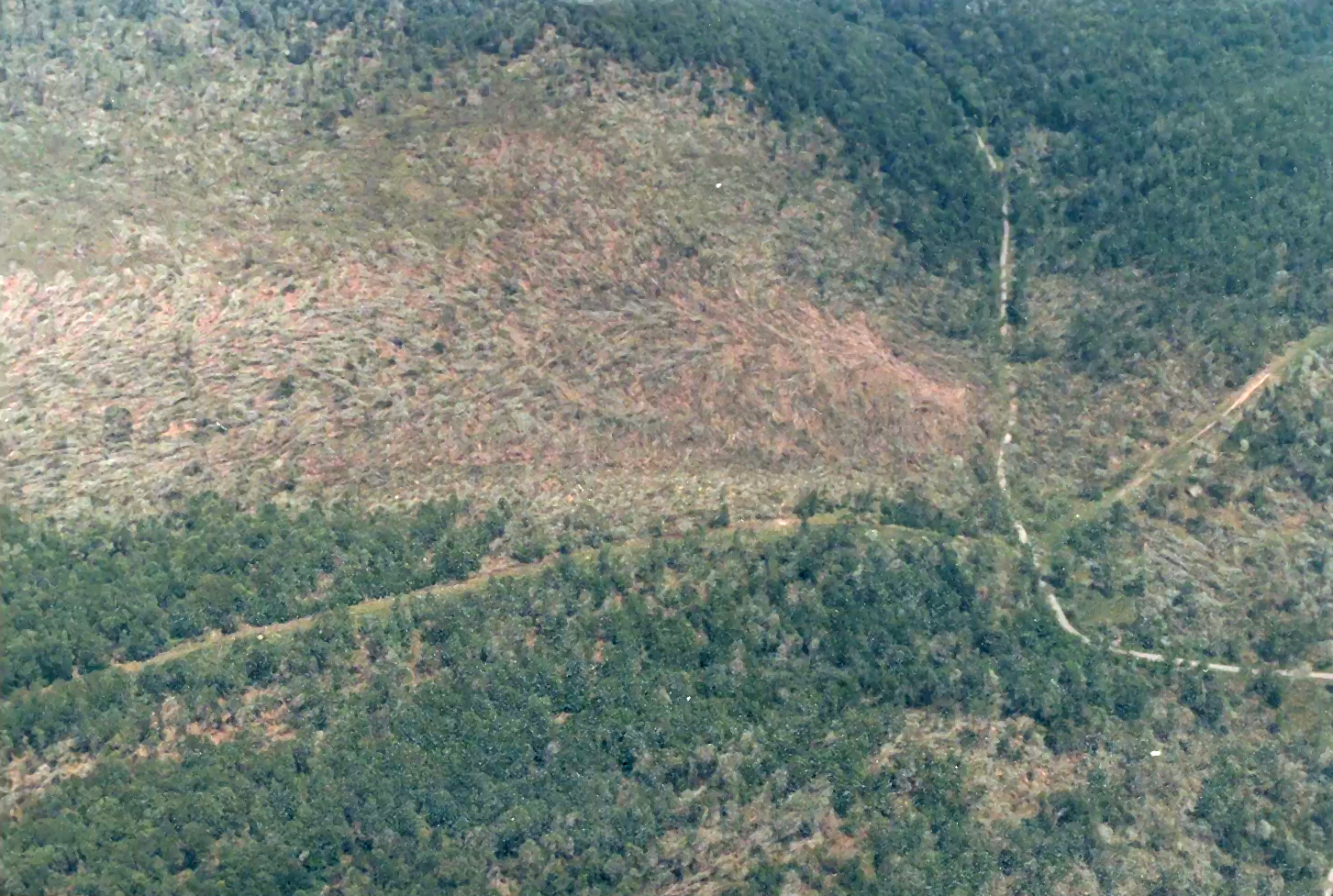
Since we're on the topic of 5/31/85 tree damage, I'm sure I've probably mentioned it before but the damage the Tionesta F4 did on German Hill is rather impressive. Not often you see virtually a whole swath of forest snapped within a few feet of the ground.

ross-run-rd-german-hill-area-marilyn-washburn-boyles.jpg


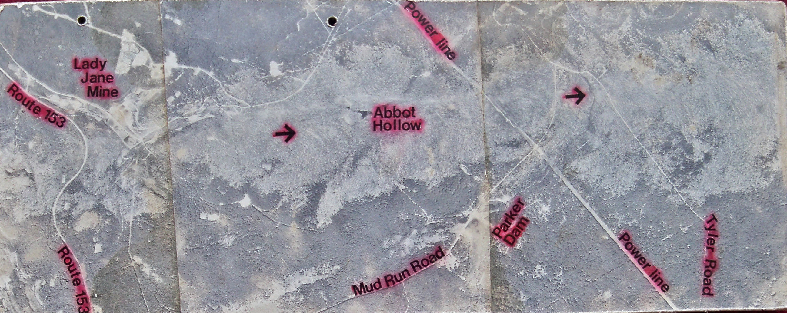
Also noteworthy is the pronounced convergence pattern Moshannon produced even despite the complex terrain (arrows & annotations aren't mine):

parker-dam-tornado-jesse-farrel.jpg


This spot east of Parker Dam State Park especially stands out.

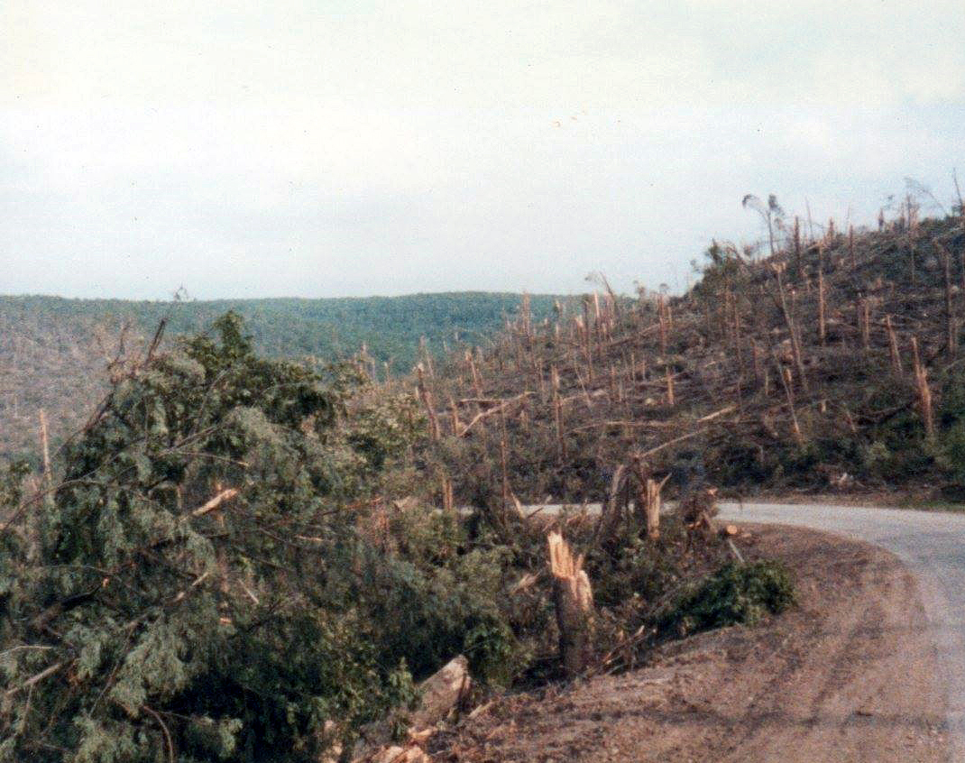
aerial-medix-rd-2-greg-forbes.jpg
 

SHA

Member
Messages
5
Reaction score
13
Location
Denmark
Years ago Greg Forbes emailed me a conference preprint I have never seen online, that included these low-quality scan aerials of Moshannon forest damage at Little Medix Run and Burns Run, FWIW. Posting these and the earlier Tionesta color aerial just in case people haven't already come across them. The attached preprint scan is in disarray as received from Forbes. It also includes tree damage aerials from the June 2, 1998 outbreak.
moshannontrack.png
 

Attachments

  • DOC.PDF
    481.6 KB · Views: 0

locomusic01

Member
Messages
1,355
Reaction score
3,776
Location
Pennsylvania
Years ago Greg Forbes emailed me a conference preprint I have never seen online, that included these low-quality scan aerials of Moshannon forest damage at Little Medix Run and Burns Run, FWIW. Posting these and the earlier Tionesta color aerial just in case people haven't already come across them. The attached preprint scan is in disarray as received from Forbes. It also includes tree damage aerials from the June 2, 1998 outbreak.
View attachment 17571
Nice, thanks! I tried reaching out to Dr. Forbes while I was researching my article (in part to see if I could get a copy of this paper) but never heard back from him. Anyway, the way the Moshannon tornado (and several of the others to a lesser extent) interacted with terrain throughout its path is endlessly fascinating. The effects are clearly evident both in aerial photos and in satellite imagery.

full-path-satellite.jpg
 

Steel Central

Member
Messages
34
Reaction score
51
Location
Grant County, MN
I though the scar was still visible on modern satellite (Google Maps), but as of recently its completely gone.


Makes me wonder how long the Tuscaloosa/Lake Martin/Louisville scars will last.
 

locomusic01

Member
Messages
1,355
Reaction score
3,776
Location
Pennsylvania
I wonder how old the Bing imagery is. Looking on Bing Maps right now, I can easily find the Moshannon path just like in that image, as well as several other 1985 paths in PA. But the 2011 paths and the 2008 Menominee path that are so easy to find on recent Google Maps imagery are no where to be seen.
It also matters when in the year the imagery was taken. I played around with this in LandsatLook a while back and IIRC I could just pick out parts of the path up to like 2009 or 2010, but only during certain months.
 
Messages
2,232
Reaction score
2,823
Location
Missouri
I wonder how old the Bing imagery is. Looking on Bing Maps right now, I can easily find the Moshannon path just like in that image, as well as several other 1985 paths in PA. But the 2011 paths and the 2008 Menominee path that are so easy to find on recent Google Maps imagery are no where to be seen.
The thing with the Bing imagery is if you zoom in for a closer view the scar is no longer visible. What's remarkable are the scars that are still visible, like High Uintas Wilderness Utah and (I think) portions of Smithville and Hackleburg after all these years. It goes to show how violent tornadoes can alter the landscape for years, if not decades.
 

TH2002

Member
Sustaining Member
Messages
3,172
Reaction score
4,815
Location
California, United States
Special Affiliations
  1. SKYWARN® Volunteer
Came across a previous post from @Marshal79344 regarding the Chapman tornado, and it included a better photo of this home:
20160525chapman36-jpg.9800

And this really confused me because the photo clearly shows this home did have straight nailed studs, so I'm trying to understand what Tim Marshall meant when he said there weren't any stud connections? Perhaps he meant there were no hurricane straps, but what home in the Midwest is going to have hurricane straps to begin with? Also, there were homes in Moore w/ straight nailed studs that were rated EF5, including some that were presumably surveyed by Marshall himself... but wait, there's more!

What about the other brick home that everyone knows about when they think of Chapman? The primary reason for the downgrade was the 'not a totally clean sweep' argument. But let's see about this home in Moore... not a totally clean sweep, straight nailed studs, rated EF5.
98853


Consistent application of the EF scale for sure... not expecting Grazulis to upgrade it based on how the discussion with Vilonia went, but hopefully at least one credible source will eventually give this tornado the EF5 rating it very much deserves.
 
Messages
2,232
Reaction score
2,823
Location
Missouri
Came across a previous post from @Marshal79344 regarding the Chapman tornado, and it included a better photo of this home:
20160525chapman36-jpg.9800

And this really confused me because the photo clearly shows this home did have straight nailed studs, so I'm trying to understand what Tim Marshall meant when he said there weren't any stud connections? Perhaps he meant there were no hurricane straps, but what home in the Midwest is going to have hurricane straps to begin with? Also, there were homes in Moore w/ straight nailed studs that were rated EF5, including some that were presumably surveyed by Marshall himself... but wait, there's more!

What about the other brick home that everyone knows about when they think of Chapman? The primary reason for the downgrade was the 'not a totally clean sweep' argument. But let's see about this home in Moore... not a totally clean sweep, straight nailed studs, rated EF5.
98853


Consistent application of the EF scale for sure... not expecting Grazulis to upgrade it based on how the discussion with Vilonia went, but hopefully at least one credible source will eventually give this tornado the EF5 rating it very much deserves.
Considering Grazulis backpedaled on Vilonia I'm not placing much hope with Chapman either (or Chickasha, Goldsby, Tuscaloosa, Mayfield, etc.).
 
Messages
2,232
Reaction score
2,823
Location
Missouri
Since we're on the topic of 5/31/85 tree damage, I'm sure I've probably mentioned it before but the damage the Tionesta F4 did on German Hill is rather impressive. Not often you see virtually a whole swath of forest snapped within a few feet of the ground.

ross-run-rd-german-hill-area-marilyn-washburn-boyles.jpg


Also noteworthy is the pronounced convergence pattern Moshannon produced even despite the complex terrain (arrows & annotations aren't mine):

parker-dam-tornado-jesse-farrel.jpg


This spot east of Parker Dam State Park especially stands out.

aerial-medix-rd-2-greg-forbes.jpg
Yeah, so many tornadoes from this day levelled immense amounts of forest. I think the only other outbreaks with as much widespread forest damage are the 1974 and 2011 Super Outbreaks.
I've no doubt that Kane, Tionesta & Moshannon achieved F5 intensity, just didn't hit any DIs capable of registering it (which is good, obviously).
 

Marshal79344

Member
Messages
361
Reaction score
1,066
Location
Chicago, IL
I was peering through the NETR Historic Aerials archives and found the scar left behind of an "F2" that killed a few people when it swept away log cabins near the town of Wilbur, Michigan on June 8th, 1953. This is the oldest tornado scar I have in my archives so I thought it'd be cool to share.

image.png
 
Back
Top