• Welcome to TalkWeather!
    We see you lurking around TalkWeather! Take the extra step and join us today to view attachments, see less ads and maybe even join the discussion.
    CLICK TO JOIN TALKWEATHER
  • April 2024 Weather Video of the Month
    Post your nominations now!
Logo 468x120

Tennie

Member
Messages
1,010
Reaction score
868
Location
Tennessee
I don't know if this has been brought up yet in this thread or its global equivalent, but here's a pretty good website that can be quite useful for looking up historical tornadoes:


It has a data explorer (click the link labeled "Data Explorer" near the upper right side of the page to access it) that displays the tracks of various historical tornadoes, and can be searchable by time periods, (E)F-scale ratings, etc.

Here's a couple videos that explain how to use the site. The first video introduces the site and how to use it:


The second video shows off a bunch of new features that were implemented after the first video was made (including the ability to plot certain data based off the ERA5 reanalysis):


I hope you can find this stuff useful!
 
Messages
1,091
Reaction score
858
Location
texas
I don't know if this has been brought up yet in this thread or its global equivalent, but here's a pretty good website that can be quite useful for looking up historical tornadoes:


It has a data explorer (click the link labeled "Data Explorer" near the upper right side of the page to access it) that displays the tracks of various historical tornadoes, and can be searchable by time periods, (E)F-scale ratings, etc.

Here's a couple videos that explain how to use the site. The first video introduces the site and how to use it:


The second video shows off a bunch of new features that were implemented after the first video was made (including the ability to plot certain data based off the ERA5 reanalysis):


I hope you can find this stuff useful!

ive been using that for a while now
 
Last edited:

locomusic01

Member
Messages
1,376
Reaction score
3,833
Location
Pennsylvania
Think I might've posted this before, but here's an aerial video of the damage from the Corry, PA F4.


Around the 2:30 mark is the famous Wiggers Canoe Shop (and the owner's home next door) where some of the customers' vehicles went for pretty long rides.

sam-hamilton-truck-shopping-at-wiggers-canoe-sales-north-of-corry.jpg


corry-daniel-wolfe.jpg


The tree damage on the hill behind the property is pretty fascinating; not sure if it was caused by multiple vortices or just the terrain, but it looks almost like a lava flow or landslide or something.

wiggers-place-rt-426-crosscut-rd.jpg


I've heard from a bunch of sources (the Wiggers family, customers who were there, people who lived near the lake, newspaper reports, etc) that at least one canoe from the shop was found wrapped around a tree - or sitting in/against a tree, depending on the source - on the shore of Chautauqua Lake, which is ~23 miles away in New York. I honestly have no idea if that's even possible, although canoes seem like the right combination of lightweight and large surface area to be carried pretty far under the right circumstances.
 

buckeye05

Member
Messages
3,354
Reaction score
5,215
Location
Colorado
As we are on Hackleburg topic
Here's some Incredible debarking to even hardwood outside of Hackleburg
View attachment 14425View attachment 14426View attachment 14427
Vehicles were mangled into unrecoginizable fashion near this place.
View attachment 14431
View attachment 14432
Incredible damage inside the town
View attachment 14430View attachment 14429View attachment 14428
Before and after view of Mount Hope EF5 rating Restaurant
View attachment 14433
View attachment 14434
That Hackleburg area debarking is some of the worst I’ve seen photographed. I knew it was bad, but not that bad. That’s well into Bridge Creek/Moore/Joplin territory.
 

buckeye05

Member
Messages
3,354
Reaction score
5,215
Location
Colorado
I know I haven't been able to shut up about Hackleburg lately, but I found some new stuff people might find interesting.

First of all, I am aware that this photo has been posted before, but to compliment the scouring, this is apparently the brick home along Hwy 237 that allegedly had its basement walls caved in and carport dislodged. No way to tell for sure without an extreme close up, but no doubt this home experienced some extremely violent winds. If so, this is likely some Brandenburg-esque damage.
View attachment 14419

Remains of the Phil Campbell Church of God; the church itself was reduced to its slab, and extensive ground scouring occurred.
View attachment 14420
View attachment 14421

Large home that was reduced to its foundation between Hackleburg and Phil Campbell
View attachment 14422

General destruction in Phil Campbell; note what looks like a slabbed home in the background.
View attachment 14424

Yet another swept away home in Phil Campbell, interesting how this one got an EF4 rating attached to it considering some of the DI's that got EF5.
15892


Finally, a return label from Phil Campbell that reportedly traveled over 100 miles:
Phil-Campbell-address-labels_0931-410x307.jpg

Phil-Campbell-address-labels_0932.jpg
Regardless of construction (I think it was CMU), that first Phil Campbell photo has always impressed the hell out of me, especially the hillside that appears to have been scoured down to bare soil. The comparison to Brandenburg is spot on.
 

buckeye05

Member
Messages
3,354
Reaction score
5,215
Location
Colorado
Here's some more Hackleburg stuff. I can't remember if I've shared these yet. Most were taken just minutes after the tornado hit, so no cleanup here.

Shredded trees and car. I actually didn't even notice the car the first time I looked at this photo.
5674897108_cdd1391e5f_k.jpg


Completely bizarre damage to a series of metal fence posts in town. How does this even happen?
5687299702_44c144aebe_z.jpg


Total destruction and plowed up earth in Hackleburg, possibly from trees getting ripped out of the ground imo.
5686739489_5d6d3104fd_c.jpg


Debris granulation
5686737269_85b52ca61f_c.jpg


Wooded ravine completely decimated
5686735937_8f0b3b7dee_c.jpg


Poured concrete torn up. I can't exactly tell what this was, but I strongly suspect that its a driveway or garage slab.
I6vSn4U.png


What I believe to be a piece of concrete stemwall thrown into the base of a tree and shattered
2mt7VXv.jpg


And just for posterity, here's some awesome Oak Grove before and after pics. I'm particularly intrigued by the second one, as it looks like a small piece of concrete was ripped from the driveway in the "after" photo. It could also be a piece of debris on the concrete though. I can't tell definitively, but we already know this tornado did crazy things to poured concrete in multiple areas along its path. What do you guys think it is?
5H5ZMrB.gif

MSMIV9z.gif
 

TH2002

Member
Sustaining Member
Messages
3,490
Reaction score
5,617
Location
California, United States
Special Affiliations
  1. SKYWARN® Volunteer
Regardless of construction (I think it was CMU), that first Phil Campbell photo has always impressed the hell out of me, especially the hillside that appears to have been scoured down to bare soil. The comparison to Brandenburg is spot on.
Closest view I could find does show evidence that the foundation was likely CMU, you can see some cinder blocks. However the same comment on extremeplanet also mentioned that the carport slab was dislodged, and if that's what this photo actually shows, damn:
Hackleburg-damage-dislodged-foundation.JPG

Finally found a ground level view of one of the slabbed homes in Hackleburg. If you look closely it does at least appear to have sill plates, so it was probably well built.
Hackleburg-damage-home-aerial.JPG
5666646472_04a2a07183_o.jpg

Aerial of additional homes/buildings swept away near the Wrangler plant, some pretty incredible wind rowing here:
Hackleburg-EF5-damage-windrowing2.jpg
 
Messages
2,256
Reaction score
2,856
Location
Missouri
Here's some more Hackleburg stuff. I can't remember if I've shared these yet. Most were taken just minutes after the tornado hit, so no cleanup here.

Shredded trees and car. I actually didn't even notice the car the first time I looked at this photo.
5674897108_cdd1391e5f_k.jpg


Completely bizarre damage to a series of metal fence posts in town. How does this even happen?
5687299702_44c144aebe_z.jpg


Total destruction and plowed up earth in Hackleburg, possibly from trees getting ripped out of the ground imo.
5686739489_5d6d3104fd_c.jpg


Debris granulation
5686737269_85b52ca61f_c.jpg


Wooded ravine completely decimated
5686735937_8f0b3b7dee_c.jpg


Poured concrete torn up. I can't exactly tell what this was, but I strongly suspect that its a driveway or garage slab.
I6vSn4U.png


What I believe to be a piece of concrete stemwall thrown into the base of a tree and shattered
2mt7VXv.jpg


And just for posterity, here's some awesome Oak Grove before and after pics. I'm particularly intrigued by the second one, as it looks like a small piece of concrete was ripped from the driveway in the "after" photo. It could also be a piece of debris on the concrete though. I can't tell definitively, but we already know this tornado did crazy things to poured concrete in multiple areas along its path. What do you guys think it is?
5H5ZMrB.gif

MSMIV9z.gif
That stuff with the poles reminds me of stuff in other events:

Jarrell:

25.jpg

Tri-State Tornado:


West Frankfort 13.jpg

Apparently something similar happened in Joplin (steel fence posts around the high school were bent in opposite directions) but I can't find a picture of it.
 

Sawmaster

Member
Messages
518
Reaction score
663
Location
Pickens SC
Special Affiliations
  1. SKYWARN® Volunteer
Yep- the pics don't lie. How you can get this kind of destruction with maximum winds of 210 MPH affecting any particular homesite for maybe 3-4 seconds is beyond belief- for a reason. This damage is equal to or greater than that of Bridge Creek and El Reno where winds were measured at about 50% higher, so clearly the "official" wind speeds listed for Hackleburg are very very wrong. But the NWS doesn't think so...

Phil
 

locomusic01

Member
Messages
1,376
Reaction score
3,833
Location
Pennsylvania
Completely bizarre damage to a series of metal fence posts in town. How does this even happen?
5687299702_44c144aebe_z.jpg
Man, that really is odd. I've seen plenty of instances where the posts are flattened in opposite directions on either side of the tornado's centerline, but not alternating back and forth like that. Curious whether some kind of local topographical feature might've affected the flow there. Pretty neat.
 

MNTornadoGuy

Member
Messages
1,625
Reaction score
2,601
Location
Apple Valley, MN
Yep- the pics don't lie. How you can get this kind of destruction with maximum winds of 210 MPH affecting any particular homesite for maybe 3-4 seconds is beyond belief- for a reason. This damage is equal to or greater than that of Bridge Creek and El Reno where winds were measured at about 50% higher, so clearly the "official" wind speeds listed for Hackleburg are very very wrong. But the NWS doesn't think so...

Phil
That’s because that is how the current EF-scale works. Keep in mind the EF-scale is a damage scale not a wind scale.
 

buckeye05

Member
Messages
3,354
Reaction score
5,215
Location
Colorado
Closest view I could find does show evidence that the foundation was likely CMU, you can see some cinder blocks. However the same comment on extremeplanet also mentioned that the carport slab was dislodged, and if that's what this photo actually shows, damn:
View attachment 14442

Finally found a ground level view of one of the slabbed homes in Hackleburg. If you look closely it does at least appear to have sill plates, so it was probably well built.
View attachment 14444
View attachment 14445

Aerial of additional homes/buildings swept away near the Wrangler plant, some pretty incredible wind rowing here:
View attachment 14449
That photo with the red oval. Damn. I think that shows exactly what we think it shows. That's incredible.
 

TH2002

Member
Sustaining Member
Messages
3,490
Reaction score
5,617
Location
California, United States
Special Affiliations
  1. SKYWARN® Volunteer
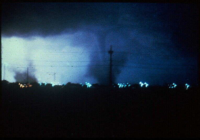
42 years ago today, one of the most unusual tornado events in history took the lives of five people when seven separate tornadoes hit the Grand Island, Nebraska area in the span of just 2 hours and 45 minutes.

R.I.P. to Robin Larson, 17, Charles Peterson, 66, Ronnie Leece, 30, Denise Behring, 19, and Danny Davenport, 25.

gitornadopic2.jpg

Arguably one of the most iconic tornado photos of all time, taken by Rod Gartner. The smaller "gustnado-looking" tornado on the left is the second tornado (rated F1) and the larger tornado on the right is the third tornado (rated F3).

These tornadoes took very unusual paths, often twisting and even looping over themselves. In some cases this doubled the tornado path lengths; three of the tornadoes were also anticyclonic.

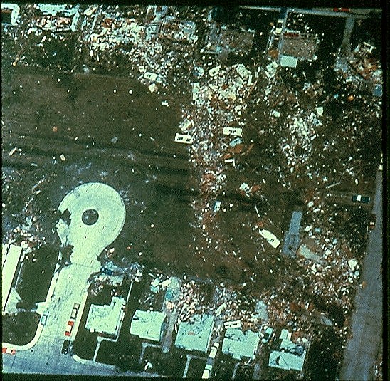
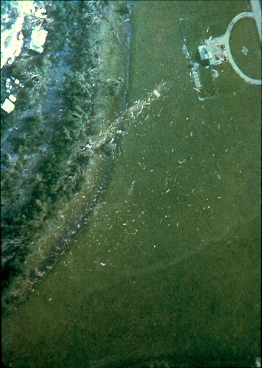
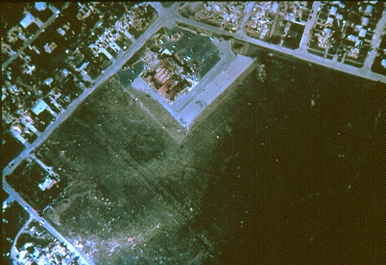
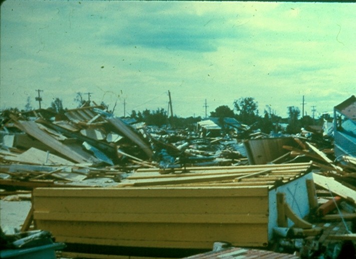
Damage from the first tornado (F3). Homes (though likely poorly constructed) were swept away in northwestern Grand Island.
gioverhead3.jpg

gioverhead6.jpg

gioverhead4.jpg


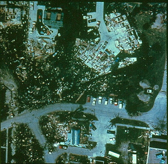
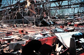
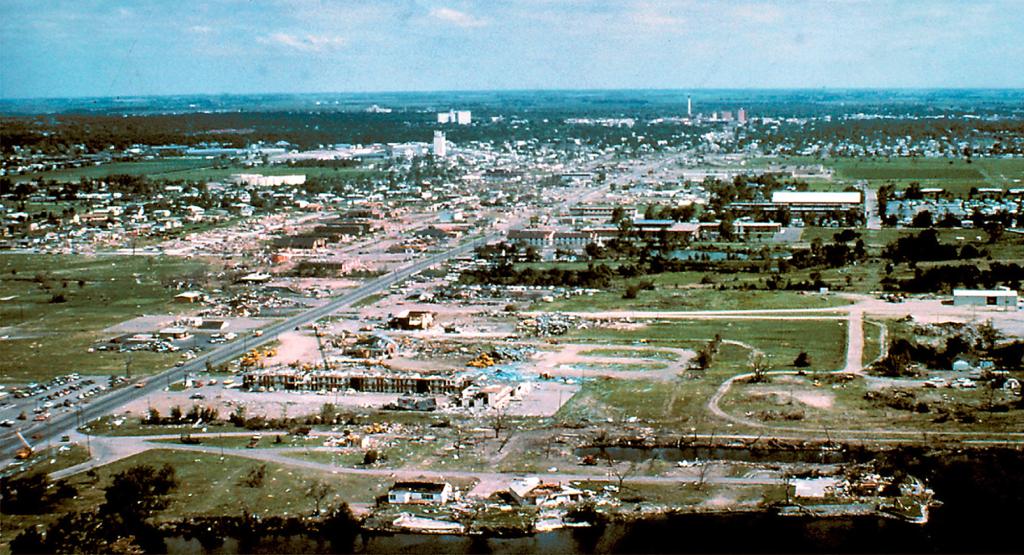
The fifth tornado caused F4 damage as it tracked along Locust St in Grand Island.
gioverhead23.jpg

Aerial-view-of-Meves-Bowling-Alley-looking-toward-the-southwest-illustrating-windward-and.png

MeavesBowl2.jpg

5ed04ffe1b237.image.jpg

gidamage.jpg

SLocustSt1.jpg

5ed04b97c8b46.image.jpg
 
Messages
2,256
Reaction score
2,856
Location
Missouri
Man, that really is odd. I've seen plenty of instances where the posts are flattened in opposite directions on either side of the tornado's centerline, but not alternating back and forth like that. Curious whether some kind of local topographical feature might've affected the flow there. Pretty neat.
Something similar happened at Joplin but for the life of me I can't find the pic of it.
 
Messages
681
Reaction score
1,036
Location
Oakland, Tennessee
42 years ago today, one of the most unusual tornado events in history took the lives of five people when seven separate tornadoes hit the Grand Island, Nebraska area in the span of just 2 hours and 45 minutes.

R.I.P. to Robin Larson, 17, Charles Peterson, 66, Ronnie Leece, 30, Denise Behring, 19, and Danny Davenport, 25.

gitornadopic2.jpg

Arguably one of the most iconic tornado photos of all time, taken by Rod Gartner. The smaller "gustnado-looking" tornado on the left is the second tornado (rated F1) and the larger tornado on the right is the third tornado (rated F3).

These tornadoes took very unusual paths, often twisting and even looping over themselves. In some cases this doubled the tornado path lengths; three of the tornadoes were also anticyclonic.

Damage from the first tornado (F3). Homes (though likely poorly constructed) were swept away in northwestern Grand Island.
gioverhead3.jpg

gioverhead6.jpg

gioverhead4.jpg


The fifth tornado caused F4 damage as it tracked along Locust St in Grand Island.
gioverhead23.jpg

Aerial-view-of-Meves-Bowling-Alley-looking-toward-the-southwest-illustrating-windward-and.png

MeavesBowl2.jpg

5ed04ffe1b237.image.jpg

gidamage.jpg

SLocustSt1.jpg

5ed04b97c8b46.image.jpg
The track map was also something else.
God.png
 

locomusic01

Member
Messages
1,376
Reaction score
3,833
Location
Pennsylvania
So here's something. I wasn't aware of any photos having been taken of the Barrie tornado (aside from the wide shot of the storm that may or may not show the rain-wrapped funnel), but I got a call this morning from a man who lived in Allandale Heights, which is the neighborhood overlooking the Hwy 400/Essa Rd interchange where some of the worst vegetation damage happened.

Anyway, someone I'd talked to a few weeks ago told him I was asking around about the tornado and he called to tell me that his girlfriend at the time was in their front yard snapping photos as the tornado came through. Apparently they broke up a while after and didn't keep in touch, so it may be tricky finding her if she's married and changed her name now. She may not even have the photos anymore, or they may not show much (cloud bases were rather low and there was quite a bit of precip). Who knows. The guy did say you could see the funnel and clouds of debris though.

Either way, at least it's a potential lead. I'm not gonna let it hold up my article since I can always add it later, but it's pretty exciting.
 

locomusic01

Member
Messages
1,376
Reaction score
3,833
Location
Pennsylvania
Oh, one other thing. In Wheatland, the roof of R&J Trucking was torn off almost entirely in one massive piece, thrown over a quarter-mile and dumped in the front yard of a home in a big crumpled ball. I think that may be what the big piece of debris is next to the funnel in this photo. I can't say for sure since there was an insane amount of debris being kicked up from a bunch of buildings, but it looks like it's in roughly the right place.

wheatland-tornado-2-mike-sisic.jpg
 
Messages
681
Reaction score
1,036
Location
Oakland, Tennessee
Oh, one other thing. In Wheatland, the roof of R&J Trucking was torn off almost entirely in one massive piece, thrown over a quarter-mile and dumped in the front yard of a home in a big crumpled ball. I think that may be what the big piece of debris is next to the funnel in this photo. I can't say for sure since there was an insane amount of debris being kicked up from a bunch of buildings, but it looks like it's in roughly the right place.

wheatland-tornado-2-mike-sisic.jpg
You posted this before and you said this was Yourga Trucking then. Of course you might have gotten them mixed up as there were a whole bunch of trucking places that got hit lol

EDIT: Or maybe Yourga and R&J are the same thing? Idk
 

locomusic01

Member
Messages
1,376
Reaction score
3,833
Location
Pennsylvania
You posted this before and you said this was Yourga Trucking then. Of course you might have gotten them mixed up as there were a whole bunch of trucking places that got hit lol

EDIT: Or maybe Yourga and R&J are the same thing? Idk
It was probably this one that I posted. Several of the terminals were pretty close together (along with some of the industrial plants and whatnot) so there's probably no way to know for sure, but I'm basing my speculations on the apparent locations + the fact that R&J Trucking had its roof torn off mostly in one piece while Yourga's was shredded, which is what it looks like is happening here.

(Edit: Or it might've been the same one, I dunno. I don't remember when I learned about the R&J roof.)

YU8ytKO.jpg


I believe this is probably about the time the tornado was moving into the more residential area around the railroad tracks.

W7ZBxw9.jpg
 
Top