
Navigation
Install the app
How to install the app on iOS
Follow along with the video below to see how to install our site as a web app on your home screen.
Note: This feature may not be available in some browsers.
More options
-
Welcome to TalkWeather! We see you lurking around TalkWeather! Take the extra step and join us today to view attachments, see less ads and maybe even join the discussion. CLICK TO JOIN TALKWEATHER
You are using an out of date browser. It may not display this or other websites correctly.
You should upgrade or use an alternative browser.
You should upgrade or use an alternative browser.
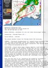
Severe Weather Threat November 24-25, 2025
- Thread starter MichelleH
- Start date
Kds86z
Member
AJS
Member
Oh my god. I think I actually just blew out my eardrums.
A lightning strike just happened right out on my street in front of my house.
A lightning strike just happened right out on my street in front of my house.
AJS
Member
Right on the left edge of that.
Kds86z
Member
Kds86z
Member
What is it with you and lightningOh my god. I think I actually just blew out my eardrums.
A lightning strike just happened right out on my street in front of my house.

AJS
Member
My street is a lightning hot spot! I swear, my house nearly gets struck at least twice a year. It’s outrageous.What is it with you and lightning
Kds86z
Member
zachary browm
Member
New Tornado Watch
WeathermanLeprechaun
Member
Things remain tame for now, i guess. Still a fairly conditional nighttime tor threat in TX here. Convection really struggling. This conditional prefrontal/WAA event will continue for the rest of the night, but beginning to doubt any CF will be notable. It seems like my expectations of this event have verified so far at least. Nighttime round still to go.
Kds86z
Member
THE NATIONAL WEATHER SERVICE IN SHREVEPORT HAS ISSUED A
* SEVERE THUNDERSTORM WARNING FOR...
NORTH CENTRAL ANGELINA COUNTY IN EASTERN TEXAS...
SOUTHEASTERN NACOGDOCHES COUNTY IN EASTERN TEXAS...
WEST CENTRAL SAN AUGUSTINE COUNTY IN EASTERN TEXAS...
* UNTIL 800 PM CST.
* AT 715 PM CST, A SEVERE THUNDERSTORM WAS LOCATED NEAR LUFKIN,
MOVING NORTHEAST AT 30 MPH.
HAZARD...60 MPH WIND GUSTS.
SOURCE...RADAR INDICATED.
IMPACT...EXPECT DAMAGE TO ROOFS, SIDING, AND TREES.
* LOCATIONS IMPACTED INCLUDE...
LUFKIN, WODEN, ETOILE, CHIRENO AND REDLAND.
PRECAUTIONARY/PREPAREDNESS ACTIONS...
SEEK SHELTER INSIDE A WELL-BUILT STRUCTURE AND STAY AWAY FROM
WINDOWS. THIS STORM IS CAPABLE OF PRODUCING DAMAGING WINDS.
TORNADOES CAN DEVELOP QUICKLY FROM SEVERE THUNDERSTORMS. SEEK
SHELTER IMMEDIATELY IN AN INTERIOR ROOM ON THE LOWEST FLOOR OF A
WELL-BUILT STRUCTURE.
A TORNADO WATCH REMAINS IN EFFECT UNTIL 100 AM CST TUESDAY FOR A
PORTION OF NORTHEAST TEXAS.
LAT...LON 3131 9471 3142 9477 3159 9441 3140 9423
TIME...MOT...LOC 0115Z 246DEG 25KT 3138 9468
TORNADO...POSSIBLE
HAIL THREAT...RADAR IND
WeathermanLeprechaun
Member
00z HRRR tones down tomorrow's event rather significantly, with no "prefrontal band" or a already semi discrete pearl of cells. Some models hint at a scenario like that being possible, so we will watch. Regardless, few tornadoes is still what the 00z HRRR depicts so not much of a downtrend but in terms of spatial coverage and robust storms, doesn't fire many in Alabama.
Kds86z
Member
Kds86z
Member
WeathermanLeprechaun
Member
On the warm front most likely
CheeselandSkies
Member
I'd watch that storm down near Bay City headed in the general direction of Angleton, TX. Severe warned for a while now, core up to 65 dbz. Looks to be a bit of a right-mover, as well.
Reflectivity, UH streaks, MUCAPE and SRH off the 00Z HRRR. Two (and a half?) things to note here. 1) compared to 18Z, HRRR has made the second round of activity more discrete and less of a messy cluster appearance - you can make out individual cells within the reflectivity. A mode like this might have less total areal coverage, but the risks would increase. 2) This run shows more robust early-day convection, which moves over the northern portions of Alabama and parts of NW GA before tapering off. This could hamper severe risk across northern Alabama later in the day. However, 2 1/2) if this scenario were to pan out, it may well set up a boundary around or north of I-20 for instability to build back in on and encourage more aggressive convection. Kinematic situation remains unchanged, it will be more than enough if other conditions allow for it. Tomorrow will likely mostly hinge on convective evolution - it's definitely an "iffy" setup, but it also has the potential to be significantly more productive than is immediately apparent. Very low floor but a ceiling that would certainly be a way to wake up to the winter tornado season here in the Southeast. Taken verbatim, the most favorable areas for tornadoes would be in a relatively small zone in east-central AL and west-central GA from roughly 18Z-00Z.


Kds86z
Member
KevinH
Member
Damnit @Clancy you just HAD to mention my area at the end of your post huh? LOL!!!!! So far this feels like it could be a “typical” winter severe event. We will see how the D1s evolve tomorrow.Reflectivity, UH streaks, MUCAPE and SRH off the 00Z HRRR. Two (and a half?) things to note here. 1) compared to 18Z, HRRR has made the second round of activity more discrete and less of a messy cluster appearance - you can make out individual cells within the reflectivity. A mode like this might have less total areal coverage, but the risks would increase. 2) This run shows more robust early-day convection, which moves over the northern portions of Alabama and parts of NW GA before tapering off. This could hamper severe risk across northern Alabama later in the day. However, 2 1/2) if this scenario were to pan out, it may well set up a boundary around or north of I-20 for instability to build back in on and encourage more aggressive convection. Kinematic situation remains unchanged, it will be more than enough if other conditions allow for it. Tomorrow will likely mostly hinge on convective evolution - it's definitely an "iffy" setup, but it also has the potential to be significantly more productive than is immediately apparent. Very low floor but a ceiling that would certainly be a way to wake up to the winter tornado season here in the Southeast. Taken verbatim, the most favorable areas for tornadoes would be in a relatively small zone in east-central AL and west-central GA from roughly 18Z-00Z.
View attachment 48904View attachment 48905View attachment 48906View attachment 48907View attachment 48908
Keep up the good posts!!!!
AJS
Member
That storm approaching Angleton, TX is really starting to get it’s act together.