
ashtonlemleywx
Member
Its not showing tornado probs for that day yet. It is showing some severe probs on Sunday that just caught my eye.What are the TOR probs for this same hour?
Follow along with the video below to see how to install our site as a web app on your home screen.
Note: This feature may not be available in some browsers.
Its not showing tornado probs for that day yet. It is showing some severe probs on Sunday that just caught my eye.What are the TOR probs for this same hour?


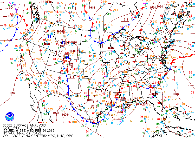


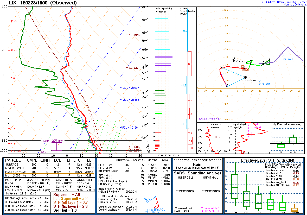
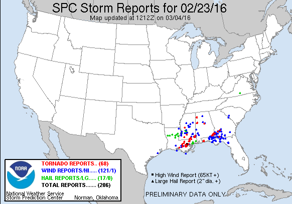
Good analog, I almost think the parameters support a even higher event than this, I'll have to sit down and look at this one. Always good to compare similar events and see how they evolve12z GFS setup is very similar to 2/23/16

Been a while since our synoptic scale severe wx whisperer, @Fred Gossage , chimed on one of these upcoming setups. I'm sure he's busy with TN Valley Weather and any other projects he's got going on, but we'd all value his opinion. If he does take the time to write up a detailed dissertation for this forum, you know he's concerned and chances are it's going to end up pretty rough (case in point, 12/10/21 when he almost singlehandedly filled out the entire first page or two of the thread). Like Spann when the coat and tie come off (or on 4/27/11 when I don't think he ever got around to putting them on in the first place).
“Severe Wx whisperer”. That is perfect for Fred.
I will remember one of his post before 4/27/11 for the rest of my life.
Sent from my iPhone using Tapatalk
I want to note something to you.. I had to think about it, but with the position of the convection initiator the cold front. It shoots out ahead and almost goes north south from the bottom of the low to the Gulf. Most of our fronts lag behind and cause issues with storm mode. This setup supports isolated due to the conditions of initiation. I'd like it to be more westerly but that'd require a more broader 500mb base. But still18z continues the more severe trend. Would possible be some more issues with storm mode etc but all of that is still a bit far away. The more concerning thing is the trend to a now more properly developed warm sector and surface low. In previous runs the isobars were fairly weak in the warm sector, which was probably contributing a bit to the moisture issues, but latest GFS run has that 'proper warm sector wind field' look, if you know what I mean. 70kt LLJ with 65F dews is never a good thing in Dixie Alley, even at 130 hours on the GFS. Needs more close watching, especially if the trend continues.
18z continues the more severe trend. Would possible be some more issues with storm mode etc but all of that is still a bit far away. The more concerning thing is the trend to a now more properly developed warm sector and surface low. In previous runs the isobars were fairly weak in the warm sector, which was probably contributing a bit to the moisture issues, but latest GFS run has that 'proper warm sector wind field' look, if you know what I mean. 70kt LLJ with 65F dews is never a good thing in Dixie Alley, even at 130 hours on the GFS. Needs more close watching, especially if the trend continues.


Those values Favor long tracked supercells.You know it's a bad sign when the 500mb height wind speed is nearly the same as the bulk shear wind speed.
View attachment 16995View attachment 16996
