• Welcome to TalkWeather!
    We see you lurking around TalkWeather! Take the extra step and join us today to view attachments, see less ads and maybe even join the discussion.
    CLICK TO JOIN TALKWEATHER

Severe Weather Threat 5/19-5/22/2024

I think the enhanced risk for tomorrow needs to be brought south into northwest Oklahoma with a 10% hatched tornado threat.
Tornado threat still conditional in those areas due to high LCL's, stronger capping, and weaker shear being more removed from upper level shortwave. However, llj does increase towards 0z and moisture is better south so helps to decease T-Td spreads. But not sure a storm will be able to sustain itself long if it moves off dryline. Cap might choke it out. Better llj and moisture is a little displaced east of DL.
 
H O T H E L I C I T Y
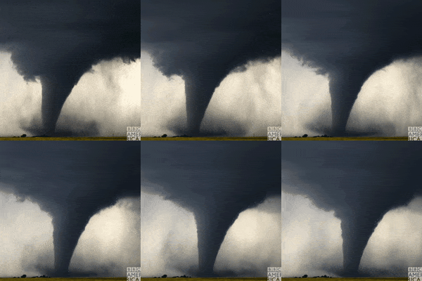
North America Weather GIF by BBC America
SRH 0 TO 1 KM....2,000 M2S2
SRH 0 TO 3 KM....2,500 M2S2
SRH 0 TO 6KM....3,000 M2S2
 
WHY DOES THE FV3 KEEP SHOWING A SUPERCELL WITH A LOW PRESSURE SYSTEM IN NORTHERN OKLAHOMA

Like I posted earlier in the thread, appears it's actually resolving the supercell's mesocyclone as a small mesolow (which it technically is, it's just only relatively recently we've had models with high enough resolution to show this).
 
Like I posted earlier in the thread, appears it's actually resolving the supercell's mesocyclone as a small mesolow (which it technically is, it's just only relatively recently we've had models with high enough resolution to show this).
Crazy thing is, pretty much every single model is agreeing with the placement and strength of that supercell, along with another one with a deep mesolow the next day in southwest Nebraska. I don't remember seeing this much consistency on a supercell, let alone how strong it may be.
 
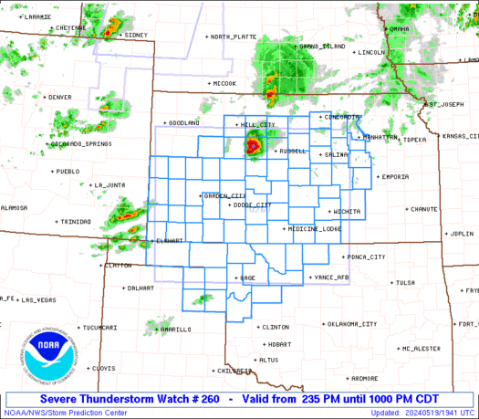
SUMMARY...Numerous severe thunderstorms are expected to develop and track rapidly eastward across the watch area through the afternoon and evening. Supercells capable of giant hail, damaging winds, and isolated tornadoes will be the main threat early. Storms willo rganize into multiple fast-moving bowing lines through the evening with a risk of widespread damaging winds.
 
SUMMARY...Numerous severe thunderstorms are expected to develop and track rapidly eastward across the watch area through the afternoon and evening. Supercells capable of giant hail, damaging winds, and isolated tornadoes will be the main threat early. Storms willo rganize into multiple fast-moving bowing lines through the evening with a risk of widespread damaging winds.
Isolated tornadoes mentioned in pds svr watch? I’ve tracked weather for 20 years, but seems odd?
 
Back
Top