
Bama Ravens
Member
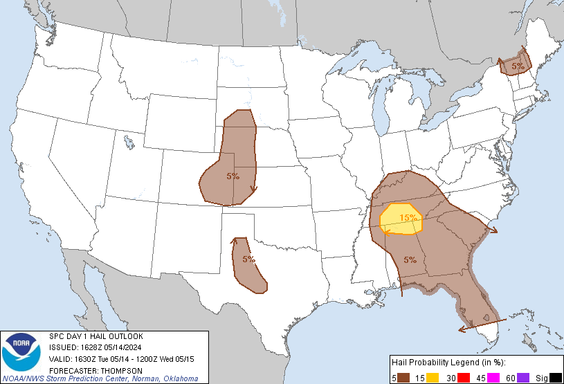
30% hatched area for hail
Follow along with the video below to see how to install our site as a web app on your home screen.
Note: This feature may not be available in some browsers.
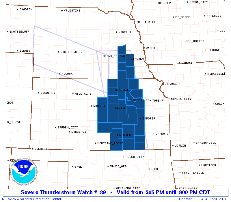
URGENT - IMMEDIATE BROADCAST REQUESTED
Severe Thunderstorm Watch Number 89
NWS Storm Prediction Center Norman OK
1205 PM CDT Mon Mar 27 2017
The NWS Storm Prediction Center has issued a
* Severe Thunderstorm Watch for portions of
Eastern Arkansas
Western Kentucky
Missouri Bootheel
Northern Mississippi
Western Tennessee
* Effective this Monday afternoon and evening from 1205 PM until
800 PM CDT.
* Primary threats include...
Scattered large hail and isolated very large hail events to 2.5
inches in diameter possible
Scattered damaging wind gusts to 70 mph possible
A tornado or two possible

Good call. It's warned now.Watch that supercell in North MS. It's rotating nicely.
This storm has had a strong mid level meso for a few scans. Still rotating nicely.Tor warning McNairy Co. TN until 2:15
Both of MEG's tornado warnings have this wording for some reason. Although, both are only radar indicated according to the Tornado tag at the bottom of the text.Apparently there is a confirmed tornado with it, unless there is a typo in the warning. It says a "storm producing a tornado".
Sent from my iPhone using TalkWeather

I think it has to be a mistake, and was meant to say capable of producing a tornado. There was nothing on the correlation coefficient to confirm a tornado.Both of MEG's tornado warnings have this wording for some reason. Although, both are only radar indicated according to the Tornado tag at the bottom of the text.
I completely agree. I don't know what was up with that.I think it has to be a mistake, and was meant to say capable of producing a tornado. There was nothing on the correlation coefficient to confirm a tornado.