- Admin
- #41
- Messages
- 3,618
- Reaction score
- 3,431
- Location
- Fayetteville, AR
- Special Affiliations
- SKYWARN® Volunteer
FB Live video from near Dallas, TX of Golfball size hail -
Courtesy Jake Hudson
Courtesy Jake Hudson
Follow along with the video below to see how to install our site as a web app on your home screen.
Note: This feature may not be available in some browsers.
That one did produce.Tornado warning just to the south of Ada, OK.
Watch out later. We've got capping currently keeping any convection from going off, which will help build instability through the day. Very steep lapse rates per the JAN sounding (7.8 C/KM) are advecting into AL. When that cap breaks, we will likely have isolated supercells capable of producing some hail...potentially large.
Any thoughts on any potential tornado threat? Seems very unlikely to me, but you guys know more than I do.Watch out later. We've got capping currently keeping any convection from going off, which will help build instability through the day. Very steep lapse rates per the JAN sounding (7.8 C/KM) are advecting into AL. When that cap breaks, we will likely have isolated supercells capable of producing some hail...potentially large.
Low level winds are way too weak. I just don't see it....Any thoughts on any potential tornado threat? Seems very unlikely to me, but you guys know more than I do.

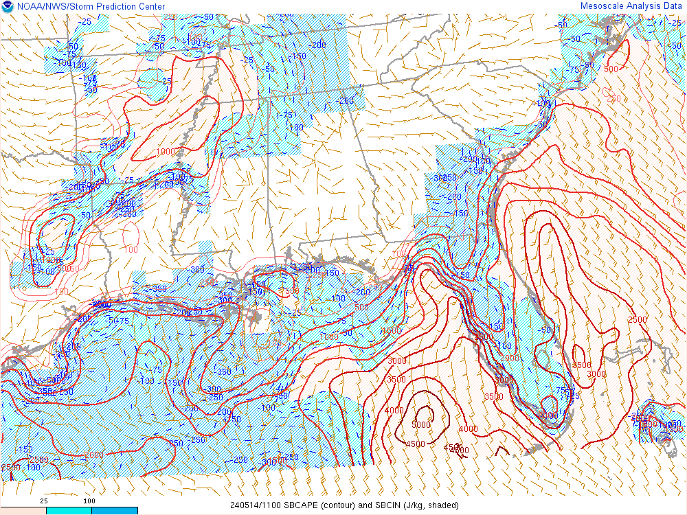
That's what happens when you have temps popping into the mid to upper 70s and dews in the mid 60s. Not to mention 500mb temps of -16C.RAP has SBcape 2000-2500 over a good chunk of AL and all of MS right now.