slenker
Member
Great forecast video by Trey. Sounds somewhat bearish on today’s threat
Follow along with the video below to see how to install our site as a web app on your home screen.
Note: This feature may not be available in some browsers.


I was chatting real time with my mother in Smithville. My brother was in Fulton at his home. It caught me by a surprise too, and I didn't really watch it until it was hitting Amory. We are so lucky that weren't more people killed.Yes. My nerves were through the roof that night. I had trouble sleeping late that night/early morning of the 25th just thinking about what Amory would look like and having flashbacks to 2011. Plus wondering if I had done my best.

O yes. Nothing like a late night severe weather/tornado threat for MS. LOL! Pour me more coffee sir
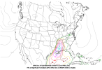
The severe weather threat for Tornado Watch 715 continues.
SUMMARY...The severe threat continues across much of southeast Texas
as storms intensify across the region.
DISCUSSION...Storm intensification across southeast TX has been
gradual over the past several hours with most storms struggling to
maintain intensity, possibly owing to numerous destructive storm
interactions/colliding outflows. Despite this, the overall trend has
been towards more intense updrafts as evidence by colder cloud-top
temperatures in GOES IR imagery with the stronger pulses.
Additionally, KHGX velocity data has shown a few weak, but
persistent, low/mid-level mesocyclones with some of the stronger
storms. Environmentally, temperatures continue to warm into the
upper 60s to mid 70s ahead of a broken line of storms (delineating
the primary surface trough) along the TX coast, and KHGX VWP
observations have sampled strengthening winds through the 1-3 km
layer over the past 2 hours with 0-1 km SRH between 150-200 m2/s2.
Further east into far southeast TX, cooler temperatures are yielding
less buoyancy compared to areas further southwest along the coast,
but southeasterly winds are supporting effective SRH on the order of
200-250 m2/s2 based on latest RAP mesoanalysis estimates. Latest
high-res guidance suggests that the environment will continue to
become more favorable for well-organized convection as the surface
low deepens to the north, and given the aforementioned convective
trends, further intensification appears probable through late
afternoon. In the short term, the greatest severe/tornado risk will
likely be associated with the stronger cells within the line
approaching the Houston area and in far southeast TX where low-level
mesocyclones associated with persistent supercells have been noted.
..Moore.. 12/26/2024


Dang!NAM 3km shows a rather unpleasant-looking scenario at the end of its 12Z run: a broken-up QLCS sporting multiple embedded supercells with additional, discrete development in AL. If an appreciable warm sector were to be realized, would present a serious overnight threat for strong tornadoes. Sounding attached from MS/AL line, west of Demopolis-Tuscaloosa region. Want to see continued consistency on this outcome, but worrying if you're living in MS or western AL.
View attachment 31964View attachment 31965View attachment 31966View attachment 31967
Oh god…..This storm near Sunny Side, TX has a persistent mesocyclone. Could be a troublemaker as it moves into Houston's northern suburbs.
View attachment 31968
Within the enhanced risk corridor, forecast soundings show 45 to 50
knots of effective shear and instability ranging from 1000 to 2000
J/kg MLCAPE. This will support supercells with all severe weather
hazards across much of the warm sector from northern Louisiana to
western Alabama as early as late morning. The tornado threat remains
more uncertain based on the final evolution of the mid-level trough.
A slower trough ejection (such as is shown by the ECMWF) may cause
more issues with destabilization and less favorable low-level
hodographs as the low-level jet ramp up is delayed.
This storm really has me concerned. I live in the Cypress suburb of Houston. Home alone too and parents are out.This storm near Sunny Side, TX has a persistent mesocyclone. Could be a troublemaker as it moves into Houston's northern suburbs.
View attachment 31968
Would be taking shelter if I were you just to play it safe.This storm really has me concerned. I live in the Cypress suburb of Houston. Home alone too and parents are out.

How come they haven’t issued a tornado warning?Would be taking shelter if I were you just to play it safe.
View attachment 31970
Yep.Would be taking shelter if I were you just to play it safe.
View attachment 31970