Severe Weather Statement
National Weather Service Peachtree City GA
744 PM EDT Sat Aug 1 2026
GAC295-012354-
/O.CAN.KFFC.SV.W.0247.000000T0000Z-260802T0015Z/
Walker GA-
744 PM EDT Sat Aug 1 2026
...THE SEVERE THUNDERSTORM WARNING FOR NORTH CENTRAL WALKER COUNTY IS
CANCELLED...
The severe thunderstorm which prompted the warning has moved out of
the warned area. Therefore, the warning has been cancelled.
&&
LAT...LON 3499 8499 3491 8501 3491 8502 3489 8502
3489 8501 3488 8501 3486 8503 3486 8506
3484 8506 3486 8526 3498 8527 3499 8526
TIME...MOT...LOC 2344Z 259DEG 19KT 3492 8522
$$
GAC047-020015-
/O.CON.KFFC.SV.W.0247.000000T0000Z-260802T0015Z/
Catoosa GA-
744 PM EDT Sat Aug 1 2026
...A SEVERE THUNDERSTORM WARNING REMAINS IN EFFECT UNTIL 815 PM EDT
FOR CATOOSA COUNTY...
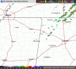
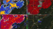
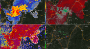
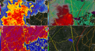
At 744 PM EDT, a severe thunderstorm was located over Fort
Oglethorpe, or near Ringgold, moving east at 20 mph.
HAZARD...60 mph wind gusts and penny size hail.
SOURCE...Radar indicated.
IMPACT...Expect damage to roofs, siding, and trees.
Locations impacted include...
Ringgold, Fort Oglethorpe, Boynton, Lakeview, Indian Springs,
Graysville, Blue Spring, East Ridge, and Apison.
PRECAUTIONARY/PREPAREDNESS ACTIONS...
For your protection move to an interior room on the lowest floor of a
building.
&&
LAT...LON 3499 8499 3491 8501 3491 8502 3489 8502
3489 8501 3488 8501 3486 8503 3486 8506
3484 8506 3486 8526 3498 8527 3499 8526
TIME...MOT...LOC 2344Z 259DEG 19KT 3492 8522
TORNADO...POSSIBLE
HAIL THREAT...RADAR INDICATED
MAX HAIL SIZE...0.75 IN
WIND THREAT...RADAR INDICATED
MAX WIND GUST...60 MPH