• Welcome to TalkWeather!
    We see you lurking around TalkWeather! Take the extra step and join us today to view attachments, see less ads and maybe even join the discussion.
    CLICK TO JOIN TALKWEATHER

Severe Weather 2026

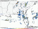
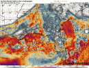
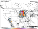
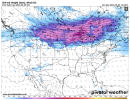
00Z model forecasts for tomorrow afternoon. All show convective activity across parts of Alabama moving eastward at this time frame, overlapping significant instability and generally small, slightly-curved hodographs. While it might be tempting to eye the potentially semi-discrete activity as it initiates near the MS/AL state line, in setups like these, most tornadoes tend to come from the mesoscale chaos once things grow upscale into a messy MCS, so would watch for that as the activity moves across northern and central Alabama, possibly into western Georgia.
models-2026080100-f021.refcmp_uh001h.us_se.gifmodels-2026080100-f021.sbcape_hodo.us_se.gif
 
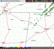
Initiation beginning in NW AL, pretty much in-line with modelling. Should blossom into an MCS over the next few hours before fizzling later this evening.
KGWX_loop.gif
 
WW being considered for parts of AL/GA/TN.
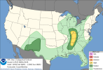
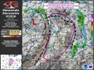
Mesoscale Discussion 1818
NWS Storm Prediction Center Norman OK
0300 PM CDT Sat Aug 01 2026

Areas affected...northern and central Alabama into northwest Georgia

Concerning...Severe potential...Watch possible

Valid 012000Z - 012200Z

Probability of Watch Issuance...40 percent

SUMMARY...Scattered thunderstorms are forecast to develop along a
trailing cold front late this afternoon and evening. Damaging wind
gusts may occur and a WW is possible.

DISCUSSION...As of 20 UTC, visible imagery showed a band of
deepening cumulus and initial showers along a trailing cold
front/surface trough stretching from southern Middle TN into
northern AL/MS. South of the primary upper low over the Midwest,
synoptic ascent is rather modest, as is confluence with veered
low-level flow along the lagging surface front. Regardless,
continued heating approaching convective temperatures should erode
the very weak lingering inhibition, with the modest frontal forcing
supporting storm development late this afternoon. Despite poor
mid-level lapse rates, the very warm temperatures and dewpoints in
the mid to upper 70s F are supporting large buoyancy sufficient for
severe storms, with MLCAPE of 2000-3000 J/kg.

Most CAM guidance depicts one or more bands of storms developing
along the front, with 20-30 kt of effective shear supporting a few
organized lines/clusters. This would favor some risk for damaging
gusts given high PWATs and water loading of downdrafts. Severe risk
is expected to be focused with the more robust clusters across
north-central AL and eventually into GA and southeast TN this
evening. Given the potential for damaging gusts with these storms a
WW is possible this afternoon.

..Lyons/Mosier.. 08/01/2026
 
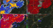
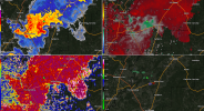
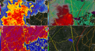
Something fishy northeast of Talladega, but can't quite make heads or tails of it. Also pretty interesting storm structure near Winterboro, southwest of Talladega.
1785627373776.png1785627386737.png
 
Tornado possible SVR currently for Ringgold, GA. Transient rotation continues in storms across central/eastern AL.
Severe Weather Statement
National Weather Service Peachtree City GA
744 PM EDT Sat Aug 1 2026

GAC295-012354-
/O.CAN.KFFC.SV.W.0247.000000T0000Z-260802T0015Z/
Walker GA-
744 PM EDT Sat Aug 1 2026

...THE SEVERE THUNDERSTORM WARNING FOR NORTH CENTRAL WALKER COUNTY IS
CANCELLED...

The severe thunderstorm which prompted the warning has moved out of
the warned area. Therefore, the warning has been cancelled.

&&

LAT...LON 3499 8499 3491 8501 3491 8502 3489 8502
3489 8501 3488 8501 3486 8503 3486 8506
3484 8506 3486 8526 3498 8527 3499 8526
TIME...MOT...LOC 2344Z 259DEG 19KT 3492 8522

$$

GAC047-020015-
/O.CON.KFFC.SV.W.0247.000000T0000Z-260802T0015Z/
Catoosa GA-
744 PM EDT Sat Aug 1 2026

...A SEVERE THUNDERSTORM WARNING REMAINS IN EFFECT UNTIL 815 PM EDT
FOR CATOOSA COUNTY...

At 744 PM EDT, a severe thunderstorm was located over Fort
Oglethorpe, or near Ringgold, moving east at 20 mph.

HAZARD...60 mph wind gusts and penny size hail.

SOURCE...Radar indicated.

IMPACT...Expect damage to roofs, siding, and trees.

Locations impacted include...
Ringgold, Fort Oglethorpe, Boynton, Lakeview, Indian Springs,
Graysville, Blue Spring, East Ridge, and Apison.

PRECAUTIONARY/PREPAREDNESS ACTIONS...

For your protection move to an interior room on the lowest floor of a
building.

&&

LAT...LON 3499 8499 3491 8501 3491 8502 3489 8502
3489 8501 3488 8501 3486 8503 3486 8506
3484 8506 3486 8526 3498 8527 3499 8526
TIME...MOT...LOC 2344Z 259DEG 19KT 3492 8522

TORNADO...POSSIBLE
HAIL THREAT...RADAR INDICATED
MAX HAIL SIZE...0.75 IN
WIND THREAT...RADAR INDICATED
MAX WIND GUST...60 MPH
 
Back
Top