- Thread starter
- #7,481
KevinH
Member
Ah yes! I forgot about Enderlin.Note he said "F/EF4 plus"
Enderlin!
Going to read about it now!
Follow along with the video below to see how to install our site as a web app on your home screen.
Note: This feature may not be available in some browsers.
Ah yes! I forgot about Enderlin.Note he said "F/EF4 plus"
Enderlin!
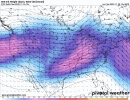
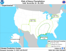
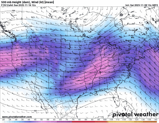
I smell a thread coming lol18z Operational GFS 500 mb map, from hour ~120 to hour ~170. The kinematics are absolutely incredible, but as is usual with autumn/winter severe events, moisture remains the big question mark.
View attachment 48511


Tonights Euro is nasty for Dixie. Time will reveal
View attachment 48544
View attachment 48543
View attachment 48542


It's definitely worth keeping an eye on. It could end up being a pretty robust system (it reminds me a bit of 11/4/2022), but the last few have downtrended pretty quickly so I guess I'll believe it when I see it lol.View attachment 48625
18z Euro one week out is quite something, and this has been showing up for a while now between the other models too. It is still a while out, but this is believable considering the fact that there’s a little primer wave that precedes this. I worry about anything being able to potentially take full advantage this moisture, seems like a powder keg.