• Welcome to TalkWeather!
    We see you lurking around TalkWeather! Take the extra step and join us today to view attachments, see less ads and maybe even join the discussion.
    CLICK TO JOIN TALKWEATHER

Severe Weather 2025

They don't seem impressed with my neck of the woods. Which is fine with me since November will be here soon enough.

...Sunday/Day 5 and Monday/Day 6...
The mid-level trough is forecast to move through the Ohio and
Tennessee Valleys on Sunday, and to the Atlantic Seaboard on Monday.
Ahead of the trough, scattered thunderstorms with an isolated severe
threat will be possible Sunday and Sunday night, with much of the
convection moving offshore into the Atlantic relatively early on
Monday. An isolated severe threat would still be possible closer to
the mid-level low in parts of the Mid-Atlantic Monday afternoon.
Really not sure what think bout this threat , it’s the first threat of the fall season.. ingot
Knock the rust off for it being quiet period all summer . But think we are mainly got watch for damaging wind threat vs the tornado .Just hope the storms don’t knock out my power during the Vols bama game Saturday night . Lol
 
Off topic again but giving an update -

Our mail usually doesn't run until well past dark. Last night when my son got home, he poked his head into my room and said, "Guess what?" "What?" "Your book came."

Which was followed by my squealing and running into the kitchen to follow him as he opened it for me. The outside cover has wear and a little bit of staining, but I don't care. The inside text is perfect - no stains, no marks, no highlighting, just perfect. And I still can't believe I finally own my "holy grail" after all these years.

IMG_2420.jpg
 
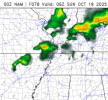
Yo, am I crazy or are the short term models showing a pretty gnarly tornado threat tomorrow afternoon/evening in New Mexico and Colorado?

View attachment 47310View attachment 47311
View attachment 47312

The Nam

View attachment 47313View attachment 47314
View attachment 47318


The RAP
View attachment 47315
View attachment 47316

View attachment 47319
Seems like my comment a few days ago about today paid off! Stuff definitely a bit better to support tornadoes, but still a few limiting factors to a couple/several. Probably one or two at the least
 
pivotal-weather-gfs-500wh-conus.gif
18z GFS just rolled in. As far as Saturday goes this doesn't look like a good severe setup. Sunday may be better but the timing isn't the best for when the trough fully matures, seems like it's got a great negative tilt to it at one point though (it would be 7AM EST by the time this happens). If the warm sector becomes more expansive to the northeast and this general shape holds, I wouldn't be surprised to see a low end threat added for Sunday. I'm not sure if storm mode will cooperate either though.

Euro continues to show a weirdly sheared-out looking trough. Honestly I trust the Euro much more than the GFS because it isn't flip-flopping nearly as hard, but I thought this run was interesting enough to bring up. We aren't that far out anymore.
 
Well, I see we are now at number 3 on the Here's How It Will Go List leading up to the severe weather threat
 
Trying to get back into posting more here.

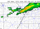
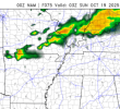
Currently not expecting much this weekend. Looks like it'll be a sloppy setup, certainly not an event to chase. I think Ark-La-Tex has the highest ceiling for tornadoes Saturday night, but the trough isn't at it's highest intensity until Sunday morning (on the latest GFS run). Early NAM runs are more bullish on an overnight tornado threat than the GFS is, but I'll check the NAM again tomorrow morning.

It'll bring some good rain here, and we really need it in NE Mississippi. Pretty much the entire north part of the state has been under drought conditions for a while.

Unrelated, but the Pivotal Weather Beta sucks. Maybe I just need to get used to it.
 
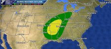
The risk on the 18th is trending towards being pretty low-end

I’ve seen improvement- the GFS has markedly changed towards the EURO and UK that have shown a greater risk. Looks like the same song and dance for MO into AR that we’ve seen so many times this year.
 
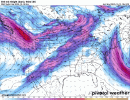
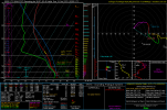
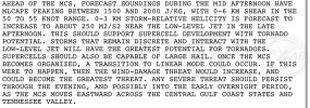
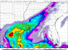
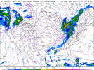
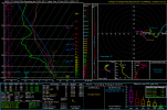
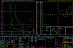
Some severe threat could continue into Sunday. NAM forecasts some actually decent instability over AL/GA Sunday afternoon - but wind fields aren't favorable for tornadoes. GFS, on the other hand, has a healthier wind field for tornadoes and damaging winds. The main issue I see is how far-removed this axis of instability will be from the parent system, and the possibility of winds going parallel due to the sagging/trailing nature of the southern end of activity. Worth watching if you're in Alabama or Georgia and have plans on Sunday, though.

Edit: I should've mentioned the soundings are from the AL/GA border and North Georgia.
...DISCUSSION...
...Sunday/Day 4 and Monday/Day 5...
A large-scale mid-level trough and an associated cold front are
forecast to move through the Ohio and Tennessee Valleys on Sunday.
Thunderstorms will likely be ongoing across the central Gulf Coast
states and Tennessee Valley at the start of the period. This
convection should have a negative impact on instability across the
much of the moist sector during the day. In areas that are not
impacted, weak instability is forecast to develop ahead of the front
from Georgia and the Carolinas into the central Appalachians. The
instability combined with strong large-scale ascent and moderate to
strong deep-layer shear will likely result in a severe threat. A
potential for wind damage and a few tornadoes will be possible. At
this time, uncertainty is substantial as to exactly where the
greatest severe potential will occur. As new runs come in, an
upgrade to Slight may be needed.
1760613838923.png1760613847728.png1760613853488.png1760613908401.png
 
Last edited:
Back
Top