• Welcome to TalkWeather!
    We see you lurking around TalkWeather! Take the extra step and join us today to view attachments, see less ads and maybe even join the discussion.
    CLICK TO JOIN TALKWEATHER

Severe Weather 2023

JPWX

Member
Messages
1,507
Reaction score
4,075
Location
Smithville MS
So I always do a long range analysis the day after we have severe weather. I always want to know what is next. Just finished today's analysis.
Too far out to see true severe potential, but it looks like we have rain/storm chances on the following dates:

Around January 7-8
Around January 12-13
Around January 16-18

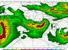
All of these date ranges are supported by GFS and ECMWF.
We are almost in the NAM range for January 7-8....and at the moment it appears to mostly be a rain event with a marginal risk.

Way too far out to know how January 12-18 will play out but it appears there will be a few rounds of activity.
Very Interesting. Looking at the latest 32 to 35 day precipitation anomalies off the GFS Ensemble Extended, CMC Weeklies, and the Euro Weeklies, it definitely looks wet. Wet meaning a battle zone between winter weather and severe weather.

cmc-weeklies-all-avg-conus-qpf_anom_32day-5036800.pngecmwf-weeklies-avg-conus-qpf_anom_32day-5382400.png gfs-ensemble-extended-all-c00-conus-qpf_anom_35day-5728000.png
 

Taylor Campbell

Moderator
Moderator
PerryW Project Supporter
Messages
2,121
Reaction score
2,222
Location
Wedowee, AL
Special Affiliations
  1. SKYWARN® Volunteer
The past few operational GFS runs and the trend on the GEFS favor a potentially higher caliber type severe weather event around the 16th-17th. This is a nasty look right now so let’s keep an eye on the newer data.

D4D2D588-D52F-4507-9530-84407A882C0A.gif

D24CBAAA-8A37-41E2-BD8A-CE6EB5E6DE36.gif

287A8414-1B43-4F5C-826D-688FCA7A9F65.gif

CB147017-9630-4997-919E-B5FE0EF1D2CA.gif
 
Messages
1,071
Reaction score
1,313
Location
jackson tennessee
Special Affiliations
  1. SKYWARN® Volunteer
I agree that Jan 16th-17th has highest potential on GFS runs the past 24hrs......but it is still 250+ hours out. Winter storm season will find a way to surprise us with something between now and then.
Yeah and it won’t to hard to get a good severe event way the pacific jet is roaring ….
 

JPWX

Member
Messages
1,507
Reaction score
4,075
Location
Smithville MS
18z GFS as well as the 12z Euro have the look that late next week will need to be monitored for at least a low end severe weather threat. @ashtonlemleywx was the first to mention a threat around the 12th. For now, there's model support. Then the 18z GFS too is showing further potential around the 16th which both @ashtonlemleywx
and @Taylor Campbell have mentioned as well.
gfs-deterministic-conus-z500_speed-3892000.png


gfs-deterministic-conus-z500_speed-3546400.pngecmwf-deterministic-conus-z500_speed-3546400.png
 

KevinH

Member
Messages
1,816
Reaction score
2,888
Location
West Central GA
18z GFS as well as the 12z Euro have the look that late next week will need to be monitored for at least a low end severe weather threat. @ashtonlemleywx was the first to mention a threat around the 12th. For now, there's model support. Then the 18z GFS too is showing further potential around the 16th which both @ashtonlemleywx
and @Taylor Campbell have mentioned as well.
View attachment 16540


View attachment 16538View attachment 16539
I may not be reading these maps correctly, but this looks to be an MS/AL/GA threat? I renamed the thread I THOUGHT was going to be for today to the potential event on the 16th.
 

Taylor Campbell

Moderator
Moderator
PerryW Project Supporter
Messages
2,121
Reaction score
2,222
Location
Wedowee, AL
Special Affiliations
  1. SKYWARN® Volunteer
The system passage late next week looks to scathe much of the moisture through the Gulf into the western Caribbean. This would help dampen the severity of a system coming the following week.
 

UncleJuJu98

Member
100,000th Post
Messages
3,921
Reaction score
5,097
Location
Birmingham
Sounding from north Mississippi 3oclock Thursday. Check out the directional shear looking at some isolated convection with those almost near westerlies at 500.

Position of the Low on the GFS is almost your prototypical severe/tornado setup location for a bad day in Mississippi and Alabama. (Belly button of Missouri to around the Memphis area for a low pressure system)

This threat bears watching mesoscale features and details will be ironed out but the general picture here supports a decent severe episode for the deep south.
2023010706_GFS_135_33.44,-89.41_severe_ml.png
 
Last edited:
Back
Top