• Welcome to TalkWeather!
    We see you lurking around TalkWeather! Take the extra step and join us today to view attachments, see less ads and maybe even join the discussion.
    CLICK TO JOIN TALKWEATHER

This severe weather season will be?

  • Above Average

    Votes: 7 31.8%
  • Average

    Votes: 13 59.1%
  • Below Average

    Votes: 2 9.1%

  • Total voters
    22
  • Poll closed .

Kory

Member
Messages
4,928
Reaction score
2,119
Location
Tuscaloosa, Alabama
Next Thursday looks rough with recent model trends. Large scale troughing in the Western U.S. into the Plains with quality moisture return and high shear.
 

amp1998

Member
Messages
57
Reaction score
41
Location
Alabama
Next Thursday looks rough with recent model trends. Large scale troughing in the Western U.S. into the Plains with quality moisture return and high shear.
Next Thursday/Friday looks interesting to me too. Problem with Thursday at first glance is substantial warm sector contamination. If the current EURO is right, Friday morning looks potent for Dixie Alley.
 

Brinkster28

Member
Messages
1
Reaction score
0
Location
Southeast KS
SPC pulled the trigger on a slight risk for Wednesday in Texas. They also put a marginal up into the Texas Panhandle/Western Oklahoma. Still staying pretty ambiguous on Thursday/Friday though.
 

Kory

Member
Messages
4,928
Reaction score
2,119
Location
Tuscaloosa, Alabama
The Euro rainfall is pretty crazy through the end of the run. Widespread 8-10 inches from LA/MS into AL/TN with isolated 12” locations. Heavy subtropical jet influence with a cut off trough over the Western/Central US will keep a boundary stalled over the region with widespread rainfall.
 

Austin Dawg

Member
Sustaining Member
Messages
852
Reaction score
1,299
Location
Leander, Texas
The Euro rainfall is pretty crazy through the end of the run. Widespread 8-10 inches from LA/MS into AL/TN with isolated 12” locations. Heavy subtropical jet influence with a cut off trough over the Western/Central US will keep a boundary stalled over the region with widespread rainfall.

They keep bouncing back and forth from a squall line with embedded severe storms with straight-line winds and hail to possibly some rotating tornadic storms here in Texas. They also switch from here in central Texas to a more northerly risk of severe weather. The local discussion said there was not going to be enough heating tomorrow to support supercells.

My worry is the models seem off already. We are getting showers already that were not supposed to be here until late tonight or tomorrow and we had an extremely foggy morning here, so the air is very, very saturated.

What do you guys think and what are you seeing when this system rolls east towards the mid-south. As I said before, I have family in Mississippi and Alabama that depend on me warning them ahead of time since I am the family weather nut.
 

warneagle

Member
Messages
3,729
Reaction score
3,208
Location
Arlington, VA
Special Affiliations
  1. SKYWARN® Volunteer
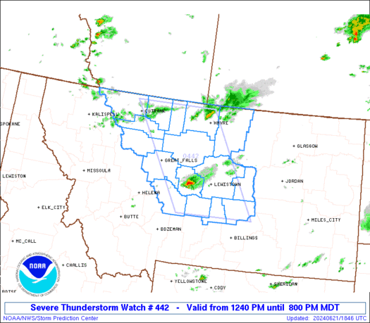
Watch is up in central Texas. 50/20.

ww0442_radar.gif
 

JayF

Technical Administrator
Staff member
Administrator
Moderator
Sustaining Member
Technical Admin
Messages
1,624
Reaction score
878
Location
Hartselle, al
HAM Callsign
KB4JCS
Several Tornado Warnings have been issued this morning in Louisiana. Those storms are moving into Southern Mississippi soon.
 

JayF

Technical Administrator
Staff member
Administrator
Moderator
Sustaining Member
Technical Admin
Messages
1,624
Reaction score
878
Location
Hartselle, al
HAM Callsign
KB4JCS
Early Morning Tornado warnings were issued in Texas and Arkansas.
 

Kory

Member
Messages
4,928
Reaction score
2,119
Location
Tuscaloosa, Alabama
The biggest problem will be excessive rainfall. High res models nail the I-20/59 corridor from the MS/AL line to Birmingham. Isolated 6-8 inches as the squall line stalls. This could be a serious flood problem.
 

Kory

Member
Messages
4,928
Reaction score
2,119
Location
Tuscaloosa, Alabama
The squall line is beginning to come to a halt from South Louisiana into Southern MS and Western AL. Get prepared for flash flooding...potentially significant.
 

Kory

Member
Messages
4,928
Reaction score
2,119
Location
Tuscaloosa, Alabama
Lots of creeks and streams are overflowing banks this morning. Widespread 4-6" of rain have fallen in the past 12-18 hours across Central and Southern AL. Don't look now...another rainy stretch into the New Year. El Nino is making its presence known...

High water rescues in parts of Louisiana and Mississippi which have gotten near a foot of rain....
 

rolltide_130

Member
Messages
828
Reaction score
378
Location
Harvest, Alabama
Special Affiliations
Lots of creeks and streams are overflowing banks this morning. Widespread 4-6" of rain have fallen in the past 12-18 hours across Central and Southern AL. Don't look now...another rainy stretch into the New Year. El Nino is making its presence known...

High water rescues in parts of Louisiana and Mississippi which have gotten near a foot of rain....

It seems to me like the storm track this year has been significantly more active than the 2015 Nino, which was busy in it's own right.

I've seen sun less than 5 times the whole month of December.. this may be record.
 

JayF

Technical Administrator
Staff member
Administrator
Moderator
Sustaining Member
Technical Admin
Messages
1,624
Reaction score
878
Location
Hartselle, al
HAM Callsign
KB4JCS
They just issued a Tornado warning off of that storm.

THE NATIONAL WEATHER SERVICE IN TALLAHASSEE HAS ISSUED A

* TORNADO WARNING FOR...
SOUTHEASTERN HENRY COUNTY IN SOUTHEASTERN ALABAMA...
NORTHEASTERN HOUSTON COUNTY IN SOUTHEASTERN ALABAMA...
WEST CENTRAL EARLY COUNTY IN SOUTHWESTERN GEORGIA...

* UNTIL 1230 PM EST/1130 AM CST/.
 

Kory

Member
Messages
4,928
Reaction score
2,119
Location
Tuscaloosa, Alabama
In all my years of living in Tuscaloosa, I don't think I've ever seen Jack Warner Parkway flooded from the river. Last crest over 140 feet...4/4/2000.


Logo 468x120
Back
Top